- Niles Township, Cook County, Illinois
-
Niles Township — Township — Location in Cook County Cook County's location in Illinois
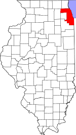
Coordinates: 42°01′56″N 87°45′30″W / 42.03222°N 87.75833°WCoordinates: 42°01′56″N 87°45′30″W / 42.03222°N 87.75833°W Country United States State Illinois County Cook Area - Total 21.25 sq mi (55.05 km2) - Land 21.25 sq mi (55.05 km2) - Water 0 sq mi (0 km2) 0% Elevation 623 ft (190 m) Population (2000) - Total 102,638 - Density 4,830/sq mi (1,864.5/km2) Time zone CST (UTC-6) - Summer (DST) CDT (UTC-5) ZIP codes 60025, 60029, 60053, 60076, 60077, 60091, 60201, 60202, 60203, 60645, 60712, 60714 GNIS feature ID 0429447 Niles Township is one of thirty townships in Cook County, Illinois, USA. As of the 2000 census, its population was 102,638[1].
Contents
Geography
According to the United States Census Bureau, Niles Township covers an area of 21.25 square miles (55.0 km2).
Cities, towns, villages
- Glenview
- Golf
- Lincolnwood
- Morton Grove (east three-quarters)
- Niles (southeast half)
- Skokie
Adjacent townships
- New Trier Township (north)
- Evanston Township (east)
- Maine Township (west)
- Northfield Township (northwest)
Cemeteries
The township contains these eight cemeteries: Beth Jacob, Dewes, Memorial, New Light, Saint Adelbert, Saint Matthews, Saint Pauls Lutheran and Saint Peters Catholic.
Major highways
Airports and landing strips
- Lincolnwood Town Center Heliport
Education
Political districts
- Illinois' 9th congressional district
- State House District 15
- State House District 16
- State House District 17
- State House District 18
- State House District 20
- State Senate District 08
- State Senate District 09
- State Senate District 10
References
- "Niles Township, Cook County, Illinois". Geographic Names Information System, U.S. Geological Survey. http://geonames.usgs.gov/pls/gnispublic/f?p=gnispq:3:::NO::P3_FID:0429447. Retrieved 2010-01-10.
- United States Census Bureau 2007 TIGER/Line Shapefiles
- United States National Atlas
External links
Categories:- Townships in Cook County, Illinois


Wikimedia Foundation. 2010.