- Chapple, Ontario
-
Chapple — Township — 
 Chapple
Coordinates: 48°45′N 93°59′W / 48.75°N 93.983°WCoordinates: 48°45′N 93°59′W / 48.75°N 93.983°W Country  Canada
Province  Ontario
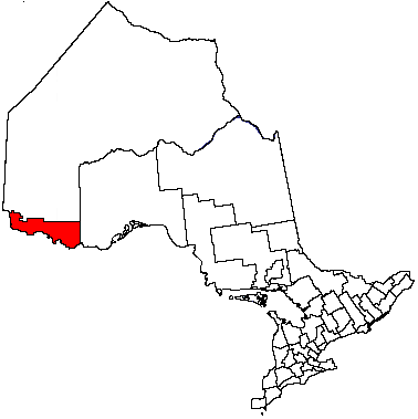
District Rainy River Settled Incorporated 1899 Government - Reeve Peter Van Heyst - Federal riding Thunder Bay—Rainy River - Prov. riding Kenora—Rainy River Area[1] - Land 529.02 km2 (204.3 sq mi) Population (2006)[1] - Total 856 - Density 1.6/km2 (4.1/sq mi) Time zone CST (UTC-6) - Summer (DST) CDT (UTC-5) Postal Code FSA P0W 1A0 Area code(s) 807 Website www.chapple.on.ca Chapple is a township in the Canadian province of Ontario, located in the Rainy River District. The main communities in the township are Barwick, located along Ontario Highway 11 and Black Hawk, located along Secondary Highway 600.
Contents
History
It was named after Thomas William Chapple, a former Ontario MPP, who served as judge for the Rainy River District.
Demographics
Canada census – Chapple Community Profile 2006 2001 Population:
Land area:
Population density:
Median age:
Total private dwellings:
Mean household income:856 (-5.9% from 2001)
529.02 km2 (204.26 sq mi)
1.6 /km2 (4.1 /sq mi)
35.7 (males: 35.7, females: 35.8)
345
$39,593910 (0.1% from 1996)
529.02 km2 (204.26 sq mi)
1.7 /km2 (4.4 /sq mi)
33.1 (males: 30.3, females: 35.3)
347
$43,062References: 2006[2] 2001[3] Population trend:[4]
- Population in 2006: 856
- Population in 2001: 910
- Population in 1996: 909
- Population in 1991: 948
Climate
Climate data for Chapple Month Jan Feb Mar Apr May Jun Jul Aug Sep Oct Nov Dec Year Record high °C (°F) 9
(48)14
(57)19.5
(67.1)31
(88)32
(90)36.5
(97.7)35.5
(95.9)35
(95)34
(93)28.5
(83.3)21
(70)9
(48)36.5
(97.7)Average high °C (°F) −9.9
(14.2)−5.4
(22.3)1.4
(34.5)10.5
(50.9)18.5
(65.3)22.5
(72.5)24.8
(76.6)24
(75)17.7
(63.9)10.4
(50.7)0.1
(32.2)−7.7
(18.1)8.9 Daily mean °C (°F) −15.9
(3.4)−11.6
(11.1)−4.4
(24.1)4.2
(39.6)11.7
(53.1)16.2
(61.2)18.8
(65.8)17.8
(64.0)12.1
(53.8)5.5
(41.9)−3.8
(25.2)−12.7
(9.1)3.2 Average low °C (°F) −22
(−8)−17.8
(0.0)−10.2
(13.6)−2.1
(28.2)4.9
(40.8)10
(50)12.6
(54.7)11.6
(52.9)6.5
(43.7)0.7
(33.3)−7.7
(18.1)−17.7
(0.1)−2.6 Record low °C (°F) −45.5
(−49.9)−49
(−56)−38
(−36)−25
(−13)−7.5
(18.5)−2
(28)2.5
(36.5)−1
(30)−5.5
(22.1)−17
(1)−39
(−38)−44
(−47)−49
(−56)Precipitation mm (inches) 28.3
(1.114)24.1
(0.949)29.7
(1.169)40
(1.57)68.3
(2.689)113.8
(4.48)99
(3.9)84
(3.31)80
(3.15)56.2
(2.213)41.7
(1.642)29.7
(1.169)694.7
(27.35)Source: Environment Canada[5] References
- ^ a b "Chapple community profile". 2006 Census data. Statistics Canada. http://www12.statcan.gc.ca/census-recensement/2006/dp-pd/prof/92-591/details/page.cfm?Lang=E&Geo1=CSD&Code1=3559024&Geo2=PR&Code2=35&Data=Count&SearchText=Chapple&SearchType=Begins&SearchPR=01&B1=All&Custom=. Retrieved 2011-05-04.
- ^ "2006 Community Profiles". Statistics Canada. Government of Canada. 2009-02-24. http://www12.statcan.ca/census-recensement/2006/dp-pd/prof/92-591/index.cfm?Lang=E. Retrieved 2011-05-04.
- ^ "2001 Community Profiles". Statistics Canada. Government of Canada. 2007-02-01. http://www12.statcan.ca/english/profil01/CP01/Index.cfm?Lang=E. Retrieved 2011-05-04.
- ^ Statistics Canada: 1996, 2001, 2006 census
- ^ Environment Canada — Canadian Climate Normals 1971–2000. Retrieved 29 April 2010.
External links

Unorganized Rainy River Morley 
Unorganized Rainy River  Chapple

Long Sault 12 IR Koochiching Cty. (USA), Manitou Rapids 11 IR Emo Towns 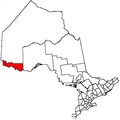
Townships Indian reserves Agency 1 • Big Grassy River 35G • Big Island Mainland 93 • Couchiching 16A • Long Sault 12 • Manitou Rapids 11 • Neguaguon Lake 25D • Rainy Lake • Sabaskong Bay 35C • Saug-a-Gaw-Sing 1 • Seine RiverUnorganized areas See also: Communities in Rainy River District • Census divisions of Ontario Categories:- Township municipalities in Ontario
- Municipalities in Rainy River District, Ontario
- Northern Ontario geography stubs

Wikimedia Foundation. 2010.