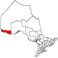
- La Vallee, Ontario
-
La Vallee — Township — Coordinates: 48°37′N 93°39′W / 48.617°N 93.65°WCoordinates: 48°37′N 93°39′W / 48.617°N 93.65°W Country  Canada
Province  Ontario
District Rainy River Settled Incorporated Government - Reeve Ross Donaldson - Federal riding Thunder Bay—Rainy River - Prov. riding Kenora—Rainy River Area[1] - Land 237.26 km2 (91.6 sq mi) Population (2006)[1] - Total 1,067 - Density 4.5/km2 (11.7/sq mi) Time zone CST (UTC-6) - Summer (DST) CDT (UTC-5) Postal Code P0W 1C0 Area code(s) 807 Website www.lavallee.ca La Vallee is a township in the Canadian province of Ontario, located within the Rainy River District. It stretches for 6 miles (9.7 km) along the north side of the Rainy River, with a depth of 15 miles (24 km), and consists of the geographic townships of Devlin, Burriss and Woodyatt. The township had a population of 1,067 in the Canada 2006 Census.
Demographics
Canada census – La Vallee, Ontario Community Profile 2006 2001 Population:
Land area:
Population density:
Median age:
Total private dwellings:
Mean household income:1067 (-0.6% from 2001)
237.26 km2 (91.61 sq mi)
4.5 /km2 (12 /sq mi)
39.4 (males: 39.7, females: 39.2)
392
$76,8111073 (-5.0% from 1996)
237.26 km2 (91.61 sq mi)
4.5 /km2 (12 /sq mi)
36.9 (males: 38.3, females: 35.4)
374
$57,680Population trend:[4]
- Population in 2006: 1067
- Population in 2001: 1073
- Population in 1996: 1130
- Population in 1991: 1081
References
- ^ a b Vallee&SearchType=Begins&SearchPR=01&B1=All&Custom= "La Vallee community profile". 2006 Census data. Statistics Canada. http://www12.statcan.gc.ca/census-recensement/2006/dp-pd/prof/92-591/details/page.cfm?Lang=E&Geo1=CSD&Code1=3559016&Geo2=PR&Code2=35&Data=Count&SearchText=La Vallee&SearchType=Begins&SearchPR=01&B1=All&Custom=. Retrieved 2011-05-03.
- ^ "2006 Community Profiles". Statistics Canada. Government of Canada. 2009-02-24. http://www12.statcan.ca/census-recensement/2006/dp-pd/prof/92-591/index.cfm?Lang=E. Retrieved 2011-05-03.
- ^ "2001 Community Profiles". Statistics Canada. Government of Canada. 2007-02-01. http://www12.statcan.ca/english/profil01/CP01/Index.cfm?Lang=E. Retrieved 2011-05-03.
- ^ Statistics Canada: 1996, 2001, 2006 census

Unorganized Rainy River 
Emo 
Unorganized Rainy River
Alberton La Vallee

Rainy River
Koochiching County, MinnesotaTowns 
Townships Indian reserves Agency 1 • Big Grassy River 35G • Big Island Mainland 93 • Couchiching 16A • Long Sault 12 • Manitou Rapids 11 • Neguaguon Lake 25D • Rainy Lake • Sabaskong Bay 35C • Saug-a-Gaw-Sing 1 • Seine RiverUnorganized areas See also: Communities in Rainy River District • Census divisions of OntarioCategories:- Township municipalities in Ontario
- Municipalities in Rainy River District, Ontario
- Northern Ontario geography stubs
Wikimedia Foundation. 2010.

