- Dawson, Ontario
-
For the unincorporated township in Manitoulin District, see Manitoulin, Unorganized, West Part, Ontario.
Dawson — Township — 
 Dawson
Coordinates: 48°45′N 94°29′W / 48.75°N 94.483°WCoordinates: 48°45′N 94°29′W / 48.75°N 94.483°W Country  Canada
Province  Ontario
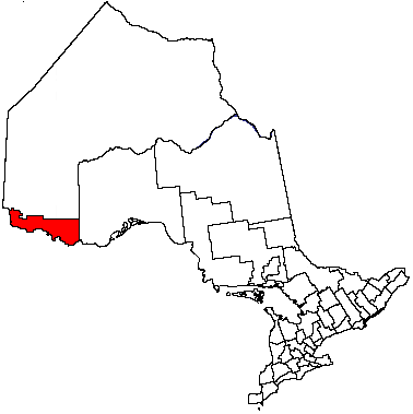
District Rainy River Settled Formed January 1, 1997 Government - Mayor - Federal riding Thunder Bay—Rainy River - Prov. riding Kenora—Rainy River Area[1] - Land 338.35 km2 (130.6 sq mi) Elevation[2] 335 m (1,099 ft) Population (2006)[1] - Total 620 - Density 1.8/km2 (4.7/sq mi) Time zone CST (UTC-6) - Summer (DST) CDT (UTC-5) Postal Code FSA P0W 1L0 Area code(s) 807 Dawson is a township located in Rainy River District in Northwestern Ontario, Canada. The township is located at the mouth of the Rainy River where it flows into Lake of the Woods.
The township was formed on January 1, 1997, when the former incorporated townships of Atwood, Blue, Dilke, and Worthington were amalgamated.
Contents
Communities
The primary communities in the township are Blue, McGinnis Creek, Pinewood and Sleeman.
Demographics
Canada census – Dawson Community Profile 2006 2001 Population:
Land area:
Population density:
Median age:
Total private dwellings:
Mean household income:620 (1.1% from 2001)
338.35 km2 (130.64 sq mi)
1.8 /km2 (4.7 /sq mi)
44.2 (males: 43.3, females: 44.8)
323
$47,175613 (−2.9% from 1996)
338.32 km2 (130.63 sq mi)
1.8 /km2 (4.7 /sq mi)
42.6 (males: 42.7, females: 42.6)
300
$44,449References: 2006[3] 2001[4] Population trend:[5]
- Population in 2006: 620
- Population in 2001: 613
- Population in 1996: 631
- Atwood (township): 273
- Blue (township): 100
- Dilke (township): 153
- Worthington (township): 105
- Population in 1991:
- Atwood (township): 294
- Blue (township): 95
- Dilke (township): 163
- Worthington (township): 110
Climate
Climate data for Sleeman Month Jan Feb Mar Apr May Jun Jul Aug Sep Oct Nov Dec Year Record high °C (°F) 7
(45)11
(52)16.5
(61.7)31.5
(88.7)32.5
(90.5)33.5
(92.3)35
(95)34.5
(94.1)34.4
(93.9)26.7
(80.1)22.2
(72.0)9
(48)35
(95)Average high °C (°F) −11.4
(11.5)−7
(19)0.3
(32.5)10.5
(50.9)18.8
(65.8)22.3
(72.1)25
(77)23.4
(74.1)17.3
(63.1)10.5
(50.9)−0.2
(31.6)−8.9
(16.0)8.4 Daily mean °C (°F) −17.2
(1.0)−13.2
(8.2)−5.6
(21.9)4.1
(39.4)11.8
(53.2)16.2
(61.2)19
(66)17.4
(63.3)11.8
(53.2)5.7
(42.3)−4.1
(24.6)−14
(7)2.7 Average low °C (°F) −22.9
(−9.2)−19.3
(−2.7)−11.4
(11.5)−2.2
(28.0)4.8
(40.6)9.9
(49.8)12.9
(55.2)11.4
(52.5)6.3
(43.3)0.8
(33.4)−8
(18)−19.1
(−2.4)−3.1 Record low °C (°F) −44
(−47)−41
(−42)−37.5
(−35.5)−27.8
(−18.0)−8
(18)−2
(28)1.1
(34.0)−1.7
(28.9)−6
(21)−17
(1)−39
(−38)−43
(−45)−44
(−47)Precipitation mm (inches) 27.9
(1.098)21.6
(0.85)30.1
(1.185)37.9
(1.492)60.4
(2.378)107.5
(4.232)86.4
(3.402)90.5
(3.563)69.3
(2.728)57.7
(2.272)37.2
(1.465)23.5
(0.925)650
(25.59)Source: Environment Canada[2] References
- ^ a b "Dawson community profile". 2006 Census data. Statistics Canada. http://www12.statcan.gc.ca/census-recensement/2006/dp-pd/prof/92-591/details/page.cfm?Lang=E&Geo1=CSD&Code1=3559040&Geo2=PR&Code2=35&Data=Count&SearchText=Dawson&SearchType=Begins&SearchPR=01&B1=All&Custom=. Retrieved 2011-05-05.
- ^ a b Environment Canada - Canadian Climate Normals 1971–2000, accessed 2011-05-05
- ^ "2006 Community Profiles". Statistics Canada. Government of Canada. 2009-02-24. http://www12.statcan.ca/census-recensement/2006/dp-pd/prof/92-591/index.cfm?Lang=E. Retrieved 2011-05-05.
- ^ "2001 Community Profiles". Statistics Canada. Government of Canada. 2007-02-01. http://www12.statcan.ca/english/profil01/CP01/Index.cfm?Lang=E. Retrieved 2011-05-05.
- ^ Statistics Canada: 1996, 2001, 2006 census

Lake of the Woods Unorganized Rainy River Wheeler Twp. (USA)
Wabanica Twp. (USA)
Morley  Dawson

Baudette Twp. (USA) Baudette (USA), Rainy River, Gudrid Twp. (USA) Koochiching Cty. (USA) Towns 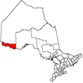
Townships Indian reserves Agency 1 • Big Grassy River 35G • Big Island Mainland 93 • Couchiching 16A • Long Sault 12 • Manitou Rapids 11 • Neguaguon Lake 25D • Rainy Lake • Sabaskong Bay 35C • Saug-a-Gaw-Sing 1 • Seine RiverUnorganized areas See also: Communities in Rainy River District • Census divisions of Ontario Categories:- Township municipalities in Ontario
- Municipalities in Rainy River District, Ontario
- Northern Ontario geography stubs

Wikimedia Foundation. 2010.