- Morley, Ontario
-
Morley — Township — 
 Morley
Coordinates: 48°50′N 94°10′W / 48.833°N 94.167°WCoordinates: 48°50′N 94°10′W / 48.833°N 94.167°W Country  Canada
Province  Ontario
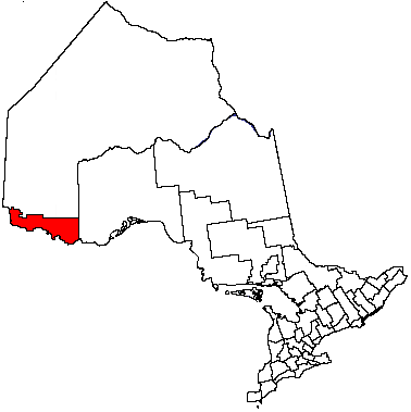
District Rainy River Settled 1880s Incorporated 1903 Government - Reeve Gary Gamsby - Federal riding Thunder Bay—Rainy River - Prov. riding Kenora—Rainy River Area[1] - Land 375.61 km2 (145 sq mi) Population (2006)[1] - Total 492 - Density 1.3/km2 (3.4/sq mi) Time zone CST (UTC-6) - Summer (DST) CDT (UTC-5) Postal Code FSA P0W 1N0 Area code(s) 807 Website www.townshipofmorley.ca Morley is a township in the Canadian province of Ontario, located within the Rainy River District. The township had a population of 492 in the Canada 2006 Census. Named after John Morley, it was formed in 1903 when the townships of Morley and Pattullo, as well as the village of Stratton, were amalgamated.[2]
In 2004, the Township of Morley was expanded through the addition of the geographic townships of Sifton and Dewart, that were previously within Unorganized Rainy River.[2]
Demographics
Canada census – Morley Community Profile 2006 2001 Population:
Land area:
Population density:
Median age:
Total private dwellings:
Mean household income:492 (-6.5% from 2001)
375.61 km2 (145.02 sq mi)
1.3 /km2 (3.4 /sq mi)
39.6 (males: 38.6, females: 41.1)
214
$54,849447 (-6.5% from 1996)
185.08 km2 (71.46 sq mi)
2.4 /km2 (6.2 /sq mi)
32.7 (males: 29.3, females: 36.1)
152
$41,429References: 2006[3] 2001[4] Population trend:[5]
- Population in 2006: 492
- Population in 2001: 447 (or 526 when adjusted to 2006 boundaries)
- Population in 1996: 478
- Population in 1991: 435
References
- ^ a b "Morley community profile". 2006 Census data. Statistics Canada. http://www12.statcan.gc.ca/census-recensement/2006/dp-pd/prof/92-591/details/page.cfm?Lang=E&Geo1=CSD&Code1=3559031&Geo2=PR&Code2=35&Data=Count&SearchText=Morley&SearchType=Begins&SearchPR=01&B1=All&Custom=. Retrieved 2011-05-04.
- ^ a b "The Full History". The Corporation of the Township of Morley. http://www.townshipofmorley.ca/fullhistory.html. Retrieved 2011-05-04.
- ^ "2006 Community Profiles". Statistics Canada. Government of Canada. 2009-02-24. http://www12.statcan.ca/census-recensement/2006/dp-pd/prof/92-591/index.cfm?Lang=E. Retrieved 2011-05-04.
- ^ "2001 Community Profiles". Statistics Canada. Government of Canada. 2007-02-01. http://www12.statcan.ca/english/profil01/CP01/Index.cfm?Lang=E. Retrieved 2011-05-04.
- ^ Statistics Canada: 1996, 2001, 2006 census

Lake of the Woods Sioux Narrows-Nestor Falls Unorganized Rainy River Unorganized Rainy River 
Chapple  Morley

Dawson Koochiching County, Minnesota Long Sault 12 IR Towns 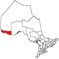
Townships Indian reserves Agency 1 • Big Grassy River 35G • Big Island Mainland 93 • Couchiching 16A • Long Sault 12 • Manitou Rapids 11 • Neguaguon Lake 25D • Rainy Lake • Sabaskong Bay 35C • Saug-a-Gaw-Sing 1 • Seine RiverUnorganized areas See also: Communities in Rainy River District • Census divisions of Ontario Categories:- Township municipalities in Ontario
- Municipalities in Rainy River District, Ontario
- Northern Ontario geography stubs

Wikimedia Foundation. 2010.