- Devon and Somerset Railway
-
Devon and Somerset Railway 
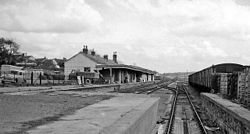
Barnstaple Victoria Road stationDates of operation 1871–1966 Successor Great Western Railway, 1876 Track gauge 4 ft 8 1⁄2 in (1,435 mm) (standard gauge),
7 ft 0 1⁄4 in (2,140 mm) until 1881Devon and Somerset Railway Legend

Bristol and Exeter Railway to Bristol 

0.00 Taunton 

2.00 Norton Fitzwarren 


West Somerset Railway 

Bristol and Exeter Railway to Exeter 

6.50 Milverton 

9.50 Wiveliscombe 

Bathealton Tunnel 

Venn Cross Viaduct 

Venn Cross Tunnel 

14.25 Venn Cross 

17.75 Morebath 

Exe Valley Railway 

19.25 Morebath Junction 

21.00 Dulverton 

Nightcote Tunnel 

24.75 East Anstey 

26.50 Yeo Mill 

30.00 Bishops Nympton and Molland 

34.25 South Molton 

Castle Hill Tunnel 

Castle Hill Viaduct 

37.50 Filleigh 

40.75 Swimbridge 


44.75 Barnstaple Victoria Road 


Tarka Line 

45.75 Barnstaple Junction 


North Devon Railway to Bideford 

Ilfracombe Branch Line 

Ilfracombe The Devon and Somerset Railway was a branch line from near Norton Fitzwarren in Somerset to Barnstaple in North Devon. It was operated from the outset by the Bristol and Exeter Railway which became part of the Great Western Railway on 1 January 1876.
Contents
History
The Act of Parliament that authorised the Devon and Somerset Railway received assent on 29 July 1864. Engineered by Eugenius Birch, the first small 7.25 miles (11.67 km) section of the branch was opened on 8 June 1871, from Watchet Junction at Norton Fitzwarren to Wiveliscombe on the edge of Exmoor. (The line later diverged from the main Bristol and Exeter Railway rather than the West Somerset Railway.) The 35.75 miles (57.53 km) extension to Barnstaple was not completed until 1 November 1873. Between Norton Fitzwarren and Milverton the line was double track. West of Milverton it was single track with passing loops at most stations, which were reduced in the years before closure. It featured steep gradients of up to 1 in 60, two large viaducts, over the River Tone and the River Exe whch were restricted to very slow speed when crossing, and three tunnels.
The line was originally 7 ft 0 1⁄4 in (2,140 mm) broad gauge. After the last broad gauge train ran on 14 May 1881 the line was converted to 4 ft 8 1⁄2 in (1,435 mm) gauge and reopened on 18 May.
In 1884 the Tiverton and North Devon Railway to Tiverton opened, creating a junction with the Devon and Somerset Railway at Morebath Junction. T&NDR services ran over the D&SR between the junction and Dulverton, where they terminated. In 1885 the T&NDR was extended to Stoke Canon on the Bristol and Exeter Railway, giving the D&SR a direct link with Exeter St Davids.
In 1890 the GWR appointed a Mrs Towns as signalwoman to operate Morebath Junction.[1] She is the only recorded example of a signalwoman on any railway in Britain in 19th century.[1] In October 1913 the Railway Magazine reported that she was "very proud" of her job after 23 years' service and hoped to continue indefinitely.[1]
Conversion to broad gauge enabled a connection to the London and South Western Railway at Barnstaple. This was was opened on 1 June 1887, after which Great Western trains ran through to Ilfracombe along that company's Ilfracombe Branch Line. The D&SR station was named Barnstaple Victoria Road from 1949 to distinguish it from Barnstaple Junction and Barnstaple Town railway stations, both originally built by the LSWR.
The GWR bought the Devon and Somerset Railway in 1901. With the increase in people taking holidays during the 1930s the line carried heavy weekend traffic, including through expresses to Ilfracombe.
Declining passenger numbers after the Second World War, attributed to an increase in motor traffic, made the line uneconomical. Following The Reshaping of British Railways report, in 1963 BR decided to route most trains via Exeter St Davids. Steam locomotives from the depot at Taunton worked the line until the end of 1964. Diesel multiple units then took over for the final two years until BR closed the line on 1 October 1966. The section between Barnstaple Victoria Road and Barnstaple Junction remained open until 30 May 1970 for freight.
In 1989 the A361 North Devon Link Road was built on sections of the former trackbed between the sites of Barnstaple Victoria Road station and the South Molton station road junction. However much of the former trackbed remains intact with most of the station buildings now converted for use as private homes. Many relics still exist, for instance, a Filleigh station sign is now in the village hall car park, and at the former Venn Cross station is a set of semaphore signals. At Barnstaple Victoria Road, remains of the station platforms survive and the goods shed has been converted into an Evangelical church.
Engineering
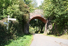
 A bridge carrying the railway over a road near Bathealton.
- Tone Viaduct, Venn Cross, a wrought iron viaduct 162 yards (148 m) long and 101 feet (31 m) above the valley floor
- Castle Hill (or Filleigh) Viaduct, Filleigh, a stone-pillared cast-iron viaduct 232 yards long and 94 feet (29 m) high
- Bathealton Tunnel, 440 yards (400 m) long
- Venn Cross Tunnel, 246 yards (225 m) long
- Nightcote Tunnel, 44 yards (40 m) long, near Dulverton
- Castle Hill Tunnel, 317 yards (290 m) long
An Ordnance Survey map from 1884 calls Nightcote Tunnel "Knackershole Tunnel".[2] after the adjacent toponym "Knacker's Hole". East and West Nightcott are on the diagonally opposite (north-east) side of the railway line.[3]
References
- ^ a b c Wojtczak, 2005, page 11
- ^ Ordnance Survey. 1:10560 County Series (Map) (1st edition (ca. 1884-87) ed.). Section Sheet 67 Subsheet 06. http://www.somerset.gov.uk/archives/Maps/os61htm/6706.htm. (Scroll down to bottom-left of map page.)
- ^ Note: The 1905 1:10560 map (accessible through this link - takes a while to find) has "Knacker's Hole" replaced by "West Knowle", but the tunnel is still "Knackershole". The 1925 1:25000 OS map of the area (find it here) does not name the tunnel at all (adjacent names are West Knowle and Northcott, respectively). Officially, the tunnel appears to be named Nightcote [1], although some references alternatively name it Nightcott.
- Connolly, W. Philip (1976). British Railways Pre-Grouping Atlas and Gazetteer. Shepperton: Ian Allan Publishing. maps seven and eight. ISBN 0 7110 0320 3.
- Cooke, R.A. (1979). Track Layout Diagrams of the GWR and BR WR, Section 15: North Devon. Harwell: R.A. Cooke.
- Dewick, Tony (2002). Complete Atlas of Railway Station Names. Hersham: Ian Allan Publishing. maps seven and eight. ISBN 0 7110 2798 6.
- MacDermot, E.T. (1931). History of the Great Western Railway. II, 1863-1921. London: Great Western Railway.
- Oakley, Mike (2002). Somerset Railway Stations. Wimbourne: The Dovecote Press. ISBN 1-90434-909-9.
- Wojtczak, Helena (2005). Railwaywomen: Exploitation, Betrayal and Triumph in the Workplace. Hastings: Hastings Press. p. 11. ISBN 1-904-109-047.
External links
Categories:- Rail transport in Somerset
- Rail transport in Devon
- Great Western Railway constituents
- 7ft gauge railways
- Railway lines opened in 1873
Wikimedia Foundation. 2010.
