- Jesmond Metro station
-
Jesmond 
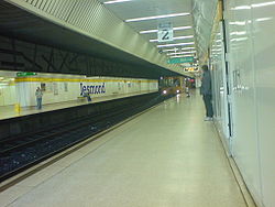
Jesmond Metro station viewed from platform 2 in March 2007 Location Place Jesmond Local authority Newcastle upon Tyne Fare zone information Network One zone 1 Metro zone A Original (1979) zone 26 Station code JES Operations Platforms 2 Escalators none History Opened 1980-08-11 Tyne and Wear Metro
List of Tyne and Wear Metro stationsJesmond Metro station serves Jesmond in Newcastle upon Tyne, England. The station opened in August 1980 and was purpose built as part of Tyne and Wear Metro. The station lies off the former North Tyneside Loop just north of the original Jesmond railway station. The station was used by over 1 million passengers in the period 2008-9. [1]
Contents
Jesmond railway station
Jesmond railway station 54°58′55″N 1°36′18″W / 54.9820°N 1.6049°W was built as part of the Blyth and Tyne Railway which ran from Blyth in Northumberland to New Bridge Street railway station in Newcastle City Centre. The station at New Bridge Street was later linked via the Manors curve to Newcastle Central and became part of the North Tyneside Loop. The platforms and signal box of the old station still remain intact although the former southbound platform is now used as a car park. The signal box forms part of a restaurant, along with an old railway carriage. One line still runs through the station linking the Metro line just north of Jesmond Metro station with the line west of Manors Metro station.
Station art
The station features an installation called Abstract Murals [2] created by Simon Butler. It consists of vitreous enamel panels with brightly coloured geometric shapes.
References
- ^ NEXUS Business Intelligence Report. http://www.nexus.org.uk/wps/wcm/resources/file/eba01f018731343/Business%20Intelligence%20Annual%20Report%20200809.pdf
- ^ "Abstract Murals, Jesmond". Art on Transport. Nexus. Archived from the original on 2007-09-29. http://web.archive.org/web/20070929102856/http://www.nexus.org.uk/wps/wcm/connect/Nexus/Art+on+Transport/Commissions/Art+-+Abstract+Murals+(Jesmond). Retrieved 2007-04-17.
External links
- Train times and station information for Jesmond Metro station from Nexus
Coordinates: 54°58′58″N 1°36′20″W / 54.9828°N 1.6056°W
Preceding station Tyne and Wear Metro Following station towards St James via the CoastYellow line towards South Shieldstowards AirportGreen line towards South HyltonEast Coast Main Line (London Kings Cross) → → Birtley (closed) • Lamesley (closed) • Low Fell (closed) • Bensham (closed) • Newcastle Central • Manors • Heaton (closed) • Forest Hall (closed) • Killingworth (closed) • Annitsford (closed) → →(Edinburgh Waverley)Durham Coast Line Tyne Valley Line Former railway linesBlyth and Tyne Railway Backworth • Benton • Cullercoats • Gosforth • Holywell • Jesmond • Moor Edge • New Bridge Street • North Shields • Percy Main • Prospect Hill • Tynemouth • Whitley BayDerwent Valley Railway Swalwell • Rowlands Gill → → (Blackhill)Newcastle and Carlisle Railway
(Original route)North Wylam loop Lemington • Newburn • Heddon on the Wall • North WylamPonteland Light Railway Gosforth • West Gosforth • Coxlodge • Kenton • Callerton → → (Ponteland)Riverside branch Byker • St Peter's (Tyneside) • St Anthony's • Walker • Carville • Point Pleasant • Willington QuayTanfield Railway Sunniside → → (East Tanfield)Metro (converted stations) Benton • Brockley Whins • Cullercoats • East Boldon • Felling • Hebburn • Howdon • Jarrow • Longbenton • Monkseaton • North Shields • Percy Main • Seaburn • South Gosforth • Sunderland • Tynemouth • Walkergate • Wallsend • West Jesmond • West Monkseaton • Whitley Bay •Metro (purpose built stations) Airport • Bank Foot • Bede • Byker • Callerton Parkway • Central Station • Chichester • Chillingham Road • Fawdon • Fellgate • Four Lane Ends • Gateshead • Gateshead Stadium • Hadrian Road • Haymarket • Heworth • Ilford Road • Jesmond Metro station • Kingston Park • Manors • Meadow Well • Millfield • Monument • Northumberland Park • Pallion • Palmersville • Park Lane • Pelaw • Regent Centre • Simonside • St James • St Peter's (Wearside) • Shiremoor • South Hylton • South Shields • Stadium of Light • Tyne Dock • University (Sunderland) • Wansbeck Road •Transport in Tyne and Wear • Nexus • Tyne and Wear Metro 
This United Kingdom rapid transit article is a stub. You can help Wikipedia by expanding it.
