- New York State Route 310
-
This article is about the current alignment of NY 310. For the former alignment of NY 310 in Albany County, see New York State Route 310 (1930s–1960s).
NYS Route 310
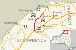
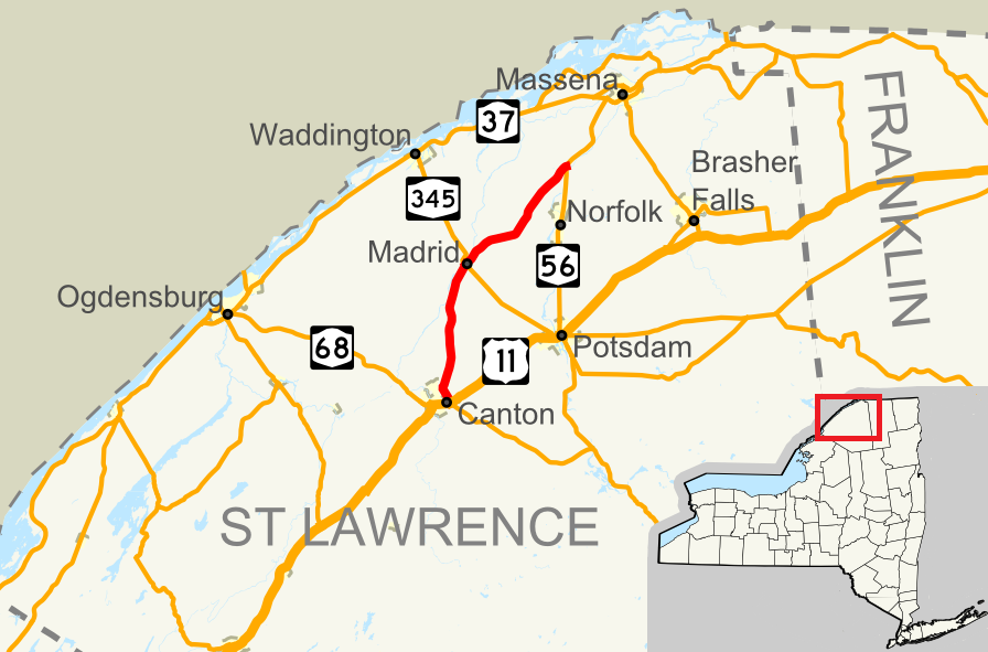
Map of the North Country with NY 310 highlighted in redRoute information Maintained by NYSDOT Length: 21.43 mi[2] (34.49 km) Existed: September 1, 1982[1] – present Major junctions South end: 
 US 11 / NY 68 near Canton
North end:  NY 56 near Norfolk
Location Counties: St. Lawrence Highway system Numbered highways in New York
Interstate • U.S. • N.Y. (former) • Reference • County←  NY 309
NY 311  →
→← NY 56
NY 57  →
→New York State Route 310 (NY 310) is a north–south state highway located entirely within St. Lawrence County in the North Country of the U.S. state of New York. The southern terminus is at NY 68 and U.S. Route 11 in the town of Canton, just east of the village of Canton. The northern terminus is at NY 56 in the community of Raymondville in the town of Norfolk.
Contents
Route description
NY 310 begins at U.S. Route 11/NY 68 near Canton just north of the St. Lawrence University. It heads north-northwest for a time on Tupper Road, which then becomes Canton-Madrid Road. It intersects with CR 85, which is just east of the Partridge Run Golf and Country Club. The route turns north-northeast, passing between several small lakes and ponds. It heads almost due-north and enters Bucks Bridge. In a mostly rural area, an intersection with NY 345 as NY 310 enters Madrid. This intersection brings a name change to Madrid-Norfolk Road. NY 310 then intersects with CR 44, and proceeds northeast to its intersection with CR 39, allowing NY 310 to terminate at NY 56 near Norfolk.[3]
History
The portion of modern NY 310 from NY 345 in Madrid to County Road 38 near Norfolk was originally designated as part of NY 56A in the 1930 renumbering. South of Madrid, the route followed what is now NY 345 to meet NY 56 in Potsdam; in the vicinity of Norfolk, the route used current CR 38.[4][5] Although signed as a state highway, the segment of NY 56A from the modern junction of NY 310 and NY 345 in Madrid to River Road west of Norfolk was maintained by St. Lawrence County.[6][7][8] NY 56A remained unchanged until its deletion on April 10, 1980.[9]
The NY 310 designation was created on September 1, 1982, as a result of a highway maintenance swap between New York State, St. Lawrence County, and the towns of Norfolk and Canton. As part of the swap, the state assumed maintenance over all of what is now NY 310,[1] which had been county-maintained from State Street north of Canton to Madrid-Norfolk Road west of Norfolk and town-maintained past those points.[6][7][8][10] In exchange, the county was given control over the portion of West Main Street (former NY 56A) between River Road and NY 56.[1][8]
Major intersections
The entire route is in St. Lawrence County.
Location Mile[2] Destinations Notes Town of Canton 0.00 US 11 / NY 68Madrid 10.69  NY 345
Town of Norfolk 21.43 NY 56Hamlet of Raymondville 1.000 mi = 1.609 km; 1.000 km = 0.621 mi References
- ^ a b c New York State Legislature. "Highway Law, Article 12, Section 341". http://public.leginfo.state.ny.us/menugetf.cgi?COMMONQUERY=LAWS. Retrieved March 29, 2008.
- ^ a b "2008 Traffic Volume Report for New York State" (PDF). New York State Department of Transportation. June 16, 2009. p. 211. https://www.nysdot.gov/divisions/engineering/technical-services/hds-respository/NYSDOT%20TVR%202008%20by%20Route.pdf. Retrieved January 30, 2010.
- ^ Google, Inc. Google Maps – overview map of NY 310 (Map). Cartography by Google, Inc. http://maps.google.com/maps?hl=en&q=from:+RT-310%20@44.849208,%20-74.978545+to:+RT-310%20@44.597863,%20-75.147857. Retrieved April 8, 2008.
- ^ Dickinson, Leon A. (January 12, 1930). "New Signs for State Highways". The New York Times: p. 136.
- ^ Sun Oil Company (1935). Road Map & Historical Guide - New York (Map). Cartography by Rand McNally and Company.
- ^ a b New York State Department of Transportation (1969). Chase Mills Digital Raster Quadrangle (Map). 1:24,000. http://www.nysgis.state.ny.us/gisdata/quads/drg24/dotpreview/index.cfm?code=b38. Retrieved April 2, 2010.
- ^ a b New York State Department of Transportation (1969). Morley Digital Raster Quadrangle (Map). 1:24,000. http://www.nysgis.state.ny.us/gisdata/quads/drg24/dotpreview/index.cfm?code=c37. Retrieved April 2, 2010.
- ^ a b c New York State Department of Transportation (1969). Norfolk Digital Raster Quadrangle (Map). 1:24,000. http://www.nysgis.state.ny.us/gisdata/quads/drg24/dotpreview/index.cfm?code=b39. Retrieved April 2, 2010.
- ^ New York State Department of Transportation (January 2009) (PDF). Official Description of Highway Touring Routes, Bicycling Touring Routes, Scenic Byways, & Commemorative/Memorial Designations in New York State. https://www.nysdot.gov/divisions/operating/oom/transportation-systems/repository/2009%20tour-bk.pdf. Retrieved March 29, 2008.
- ^ New York State Department of Transportation (1969). Canton Digital Raster Quadrangle (Map). 1:24,000. http://www.nysgis.state.ny.us/gisdata/quads/drg24/dotpreview/index.cfm?code=d37. Retrieved April 2, 2010.
External links
Categories:- State highways in New York
- Transportation in St. Lawrence County, New York

Wikimedia Foundation. 2010.