Penn South

Penn South

Coordinates: 40°44′52″N 73°59′54″W / 40.747911°N 73.998359°W / 40.747911; -73.998359

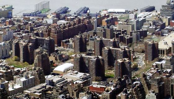
The Penn South cooperative as seen from the Empire State Building
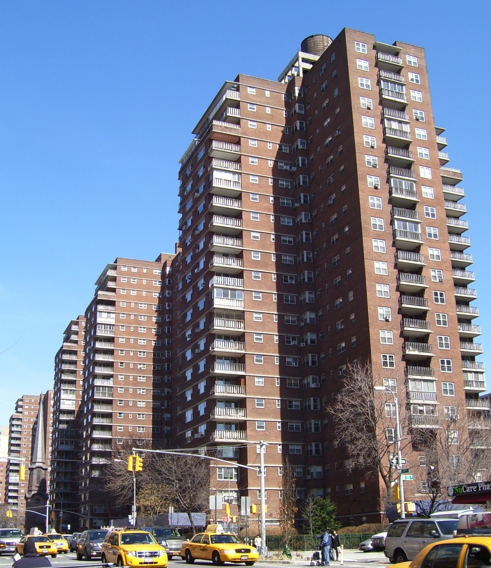
Penn South buildings along Ninth Avenue

Penn South is the common name for the Mutual Redevelopment Houses, a limited-equity[1] housing cooperative development located between Eighth and Ninth Avenues and East 23rd and 29th Streets, in the Chelsea neighborhood of Manhattan, New York City. The 10-building 2,820-unit complex was built in 1962, and was sponsored by the International Ladies' Garment Workers Union based on the cooperative model promoted by the United Housing Foundation.[1] It was designed by Herman Jessor.[2]

To help keep Penn South affordable to those with limited incomes, New York City gave the development 25 years of tax abatements, from 1961 to 1986. After that, the cooperative's shareholders voted for a 25-year phase-in of real-estate taxes, which was approved by the city's Board of Estimate. A further adjustment was made when the development asked the city in 1999 for tax relief when the building boom in Chelsea caused the project's assessed value to skyrocket. The city responded in 2001 by allowing the development's taxes to be calculated based on the cooperative's income, as is done with Mitchell-Lama housing. In return, the development must remain a limited-equity cooperative until 2022.[1]

See also

References

Notes
  1. ^ a b c "About" on the Penn South website. Accessed:2011-03-10
  2. ^ White, Norval & Willensky, Elliot (2000). AIA Guide to New York City (4th ed.). New York: Three Rivers Press. ISBN 0812931076. , p. 188

External links


Wikimedia Foundation. 2010.

Игры ⚽ Поможем сделать НИР

Look at other dictionaries:

  • South Amboy (NJT station) — Infobox Station name=South Amboy style=NJT Rail image size= image caption= address=Mason Street and Bordentown Avenue South Amboy, New Jersey line=rail color box|system=NJT|line=North Jersey Coast other=NJT Bus: 815 and 817 platform=2 side… …   Wikipedia

  • Penn, West Midlands — Penn is an area now divided between Wolverhampton in the West Midlands and South Staffordshire. Originally, it was a village in the historic county of Staffordshire. There is considerable confusion about exactly which areas fall within Penn. In… …   Wikipedia

  • Penn Radio — Penn Jillette Hosting Penn Jillette Michael Goudeau Updates Daily Debut January 3, 2006 End date March 2, 2007 …   Wikipedia

  • Penn Quarter, Washington, D.C. — Penn Quarter is a neighborhood in the East End of downtown Washington, D.C., located just north of Pennsylvania Avenue, halfway between the White House and the U.S. Capitol Building between 3rd Street on the east and 15th Street on the west,… …   Wikipedia

  • Penn State Milton S. Hershey Medical Center — Geography Location Hershey, Pennsylvania, United States …   Wikipedia

  • Penn Fields — is an area of the city of Wolverhampton, West Midlands, situated about one mile to the south west of the city centre within the Graiseley ward. It lies on Penn Road, the A449 trunk road to Kidderminster. The housing stock varies from modest… …   Wikipedia

  • Penn Masala — is the world s first Hindi a cappella group, [cite news | last = Matheson | first = Kathy | title = UPenn group spices up college a cappella scene with Hindi songs | publisher = Associated Press | date = 2007 02 24 | url… …   Wikipedia

  • Penn's Landing — is the waterfront area of the Center City along the Delaware River section of Philadelphia, Pennsylvania, United States. It is so named because the founder of Pennsylvania, William Penn, was supposed to have first docked here in 1682. In reality …   Wikipedia

  • PENN, JACK — (1909–1996), South African plastic surgeon. Penn was born in Cape Town and studied at the University of Witwatersrand. He was appointed professor of plastic maxillo facial surgery at the University of Witwatersrand, Johannesburg in 1944. During… …   Encyclopedia of Judaism

  • South Boston, Boston, Massachusetts — South Boston is a densely populated neighborhood in Boston, Massachusetts, United States, located south of the Fort Point Channel and abutting Dorchester Bay. It was formerly known as Dorchester Neck and today is referred to as Southie by its… …   Wikipedia

Share the article and excerpts

Direct link
Do a right-click on the link above
and select “Copy Link”