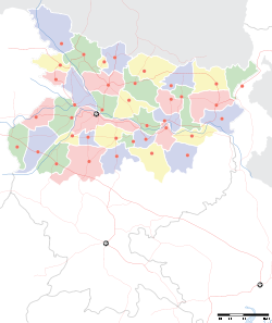
- Dumra, Sitamarhi
-
Dumra — town — Coordinates 25°01′N 83°58′E / 25.02°N 83.97°ECoordinates: 25°01′N 83°58′E / 25.02°N 83.97°E Country India State Bihar District(s) Sitamarhi Parliamentary constituency Sitamarhi Assembly constituency Sitamarhi Population 14,538 (2001[update]) Time zone IST (UTC+05:30) Area
• 86 metres (282 ft)
For the Punjabi Kshatri surname, see Dumra.Dumra is a town and a notified area in Sitamarhi district in the state of Bihar, India.
Geography
Dumra is located at 25°01′N 83°58′E / 25.02°N 83.97°E.[1] It has an average elevation of 86 metres (282 feet).
Demographics
As of 2001[update] India census,[2] Dumra had a population of 14,538. Males constitute 57% of the population and females 43%. Dumra has an average literacy rate of 77%, higher than the national average of 59.5%: male literacy is 80% and, female literacy is 73%. In Dumra, 11% of the population is under 6 years of age.
Dumra is the Head Quarter of district Sitamarhi. District Magistrate, District Judge and Supritendant of Police are based at Dumra with their residence and offices.
References
- ^ Falling Rain Genomics, Inc - Dumra
- ^ "Census of India 2001: Data from the 2001 Census, including cities, villages and towns (Provisional)". Census Commission of India. Archived from the original on 2004-06-16. http://web.archive.org/web/20040616075334/http://www.censusindia.net/results/town.php?stad=A&state5=999. Retrieved 2008-11-01.
Cities and towns in Tirhut Division East Champaran district Muzaffarpur district Sheohar district Sitamarhi district Vaishali district West Champaran district See also Tirhut Division topicsCities and towns
in other DivisionsCategories:- Cities and towns in Sitamarhi district
- Bihar geography stubs
Wikimedia Foundation. 2010.


