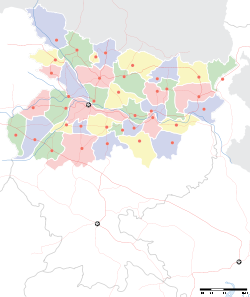
- Chanpatia
-
Chanpatia — town — Coordinates 26°56′44″N 84°33′09″E / 26.94543°N 84.55238°ECoordinates: 26°56′44″N 84°33′09″E / 26.94543°N 84.55238°E Country India State Bihar District(s) Pashchim Champaran Parliamentary constituency Paschim Champaran Assembly constituency Chanpatia Population 22,029 (2001[update]) Time zone IST (UTC+05:30) Website westchamparan.bih.nic.in/ Chanpatia (Hindi: चन्पटिया) is a city and a notified area in Paschim Champaran district in the state of Bihar, India.
Demographics
As of 2001[update] India census,[1] Chanpatia had a population of 22,029. Males constitute 52% of the population and females 48%. Chanpatia has an average literacy rate of 49%, lower than the national average of 59.5%; with male literacy of 58% and female literacy of 39%. 19% of the population is under 6 years of age.
Chanpatia is 17 kilometres from Bettiah. Farming is the main industry in the area. The Budhi Gandak river runs through the town.
basmati rice and marcha chiuda of chanpatia is famous in all over india.the sugar mill of chanpatia,which was producing the best quality of sugar in biar,has been closed for 18 years due to some political and technical problems.References
- ^ "Census of India 2001: Data from the 2001 Census, including cities, villages and towns (Provisional)". Census Commission of India. Archived from the original on 2004-06-16. http://web.archive.org/web/20040616075334/http://www.censusindia.net/results/town.php?stad=A&state5=999. Retrieved 2008-11-01.
Cities and towns in Tirhut Division East Champaran district Muzaffarpur district Sheohar district Sitamarhi district Vaishali district West Champaran district See also Tirhut Division topicsCities and towns
in other Divisions26°56′44″N 84°33′09″E / 26.94543°N 84.55238°E
Categories:- Bihar geography stubs
- Cities and towns in West Champaran district
Wikimedia Foundation. 2010.


