- Chikura, Chiba
-
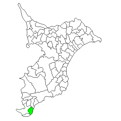
Chikura
千倉町Former municipality Since March 20, 2006 Currently part of Minamibōsō 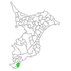
Chikura's location in Chiba, Japan.Location Country Japan Region Kantō region Prefecture Chiba District Awa District, Physical characteristics Area 34.64 km² Population (as of October 1, 2004) Total 12,527 Density 342/km² Symbols Flower Prunus mume
Chikura (千倉町 Chikura-chō) is a former town located in Awa District, Chiba, Japan. As of October 1, 2004, the town had an estimated population of 12,527 and a density of 342 persons per km². The total area was 36.64 km².Contents
Geography
Tomiyama was located at southern end of Chiba Prefecture, at the southeast extremity of Bōsō Peninsula, facing the Pacific Ocean. The town had a temperate maritime climate with hot, humid summers and mild, cool winters.
Chikura is the cable landing point for several submarine communications cables. The Chikura cable station is next to Setohama beach and lands:
History
Asai Village was created on April 1, 1889 within Asai District, which became part of Awa District from April 1, 1897. It became a town on June 25, 1900, and was renamed Chikura on October 1, 1920.
The town expanded through merger with Nanaura, Takeda, and Chitose villages in 1954. On March 20, 2006 Chikura was merged with the neighboring towns of Tomiyama, Wada, Shirahama, Maruyama and Tomiura, and the village of Miyoshi, all within Awa District, to form the new city of Minamibōsō.
Economy
The economy of Chikura was largely based on commercial fishing, horticulture (primarily herbs and flowers), and summer tourism.
Transportation
Highway
- Japan National Route 128
- Japan National Route 410
Railway
Local events
The area has an annual summer festival, Chikura Matsuri. The only Shinto shrine in town is Takabe-jinja Shrine, which is devoted to the God of Cooking. Twice a year, a special ceremony is held where a fish is cleaned and prepared without being touched by the priests' hands.
The Minamibōsō Two Day Flower Walk is held every first weekend of March. In this framework, there is a close relationship and exchange program with the city of Blankenberge, Belgium, and the link Two Day March of Flanders. In the summer the area is a very popular place as beach resort and surfing.
External links
- Chikura official website (part of Minami Boso site) in Japanese
- Unity Trans-Pacific cable press release
Coordinates: 34°57′N 139°57′E / 34.95°N 139.95°E

This Chiba Prefecture location article is a stub. You can help Wikipedia by expanding it.