- Donnington, Oxfordshire
-
Coordinates: 51°44′17″N 1°14′02″W / 51.738°N 1.234°W
Donnington 
 Donnington
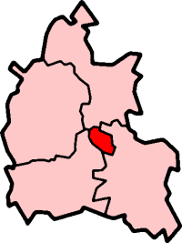
Donnington shown within OxfordshireOS grid reference SP527044 Parish unparished District Oxford Shire county Oxfordshire Region South East Country England Sovereign state United Kingdom Post town Oxford Postcode district OX4 Dialling code 01865 Police Thames Valley Fire Oxfordshire Ambulance South Central EU Parliament South East England UK Parliament Oxford East List of places: UK • England • Oxfordshire Donnington is a small housing estate in Oxford, England located adjacent to the River Thames in the post-war housing developments either side of Donnington Bridge and around Boundary Brook Road. It is bordered by Iffley Village to the south, Iffley Fields to the North and Cowley to the east.[1]
References
- ^ Oxford, Chipping Norton and Bicester (Landranger Maps) (D1 ed.), Ordnance Survey, 2006, ISBN 978-0319229132
Categories:- Oxfordshire geography stubs
- Districts of Oxford
- Estates of Oxfordshire

Wikimedia Foundation. 2010.