- Northway, Oxford
-
Coordinates: 51°46′16″N 1°13′16″W / 51.771°N 1.221°W
Northway 
 Northway
Northway shown within OxfordshireOS grid reference SP538081 Parish unparished District Oxford Shire county Oxfordshire Region South East Country England Sovereign state United Kingdom Post town Oxford Postcode district OX3 Dialling code 01865 Police Thames Valley Fire Oxfordshire Ambulance South Central EU Parliament South East England UK Parliament Oxford East List of places: UK • England • Oxfordshire Northway is a suburban area in northeast Oxford, England, just inside the Oxford ring road. It is close to Headington Hill and with it forms a ward in Oxford.
There is a Community Centre in Dora Carr Close[1] and a Sports Centre in Maltfield Road.[2] There is a Northway Evangelical Church.[3]
To the southwest is Headley Way and to the northwest is Marsh Lane. To the northeast is the Northern Bypass of the ring road. To the southeast is the John Radcliffe Hospital, the main hospital in Oxford.
References
Wards, suburbs,
neighbourhoods
and districtsBarton • Binsey • Cowley (Florence Park, Temple Cowley) • Cutteslowe • Donnington • Godstow • Grandpont • Headington (Headington Hill, New Headington, Old Headington) • Holywell • Iffley • Jericho • New Botley • New Hinksey • New Marston • Norham Manor • North Oxford (Central North Oxford, Park Town) • Northway • Osney • Port Meadow • St Clement's • St. Ebbes • St John Street area • St. Thomas' (Oxpens) •Science Area • Summertown • Sunnymead • Walton Manor • Wolvercote • Waterways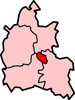
Civil parishes Blackbird Leys (Greater Leys) • Littlemore (Rose Hill) • Marston • Risinghurst and Sandhills (Risinghurst, Sandhills, Barton, Headington Quarry, Wood Farm)Former district
and boroughFormer
constituenciesCategories:- Districts of Oxford
- Oxfordshire geography stubs


Wikimedia Foundation. 2010.