- Marston, Oxford
-
Coordinates: 51°46′37″N 1°14′10″W / 51.777°N 1.236°W
Marston 
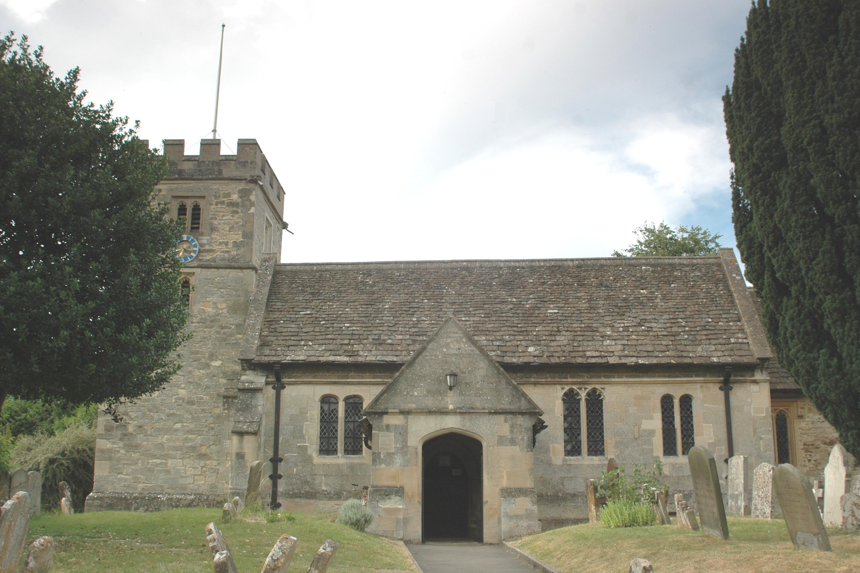
St. Nicholas' parish church
 Marston
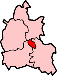
Marston shown within OxfordshirePopulation 3,321 (parish) (2001 census)[1] OS grid reference SP5208 Parish Marston District Oxford Shire county Oxfordshire Region South East Country England Sovereign state United Kingdom Post town Oxford Postcode district OX3 Dialling code 01865 Police Thames Valley Fire Oxfordshire Ambulance South Central EU Parliament South East England UK Parliament Oxford East Website Old Marston Parish Council List of places: UK • England • Oxfordshire Marston is a village and civil parish about 2 miles (3.2 km) northeast of the centre of Oxford, England. It was absorbed within the city boundaries in 1991. It is commonly called Old Marston to distinguish it from the suburb of New Marston that developed between St. Clement's and the village in the 19th and 20th centuries. The A40 Northern Bypass, part of the Oxford Ring Road, passes just north of Marston village.
Contents
History
The toponym is said to come from 'Marsh-town', because of the low-lying nature of the land near the River Cherwell, which in earlier times was liable to frequent flooding.
The parish used to be part of the manor of Headington. The Church of England parish church of St Nicholas began as a chapel, first mentioned in a charter of 1122 by which it was granted to the Augustinian canons of St Frideswide's Priory. The building dates from the 12th century, and has substantial additions in the 15th century.
The village played an important part in the Civil War, during the siege of Oxford. While the Royalist forces were besieged in the city, which had been used by King Charles I as his capital, the Parliamentary forces under Sir Thomas Fairfax had quarters in Marston, and used the church tower as a lookout post for viewing the enemy's artillery positions in what is now the University Parks. Oliver Cromwell visited Fairfax at what is now known as "Cromwell House" at 17 Mill Lane, and the Treaty for the Surrender of Oxford was signed there in 1646.
In the 20th century expansion of Oxford, new housing followed the Marston Road from St Clement's towards Marston, which was soon absorbed by the city. New Marston became a separate parish in the 1950s.
Old Marston parish become part of the City of Oxford in 1991. It retains its parish council.
Marston has had a number of notable residents, including members of the Oxford penicillin team: Howard Florey and his second wife Margaret Jennings, and Norman Heatley.
Amenities
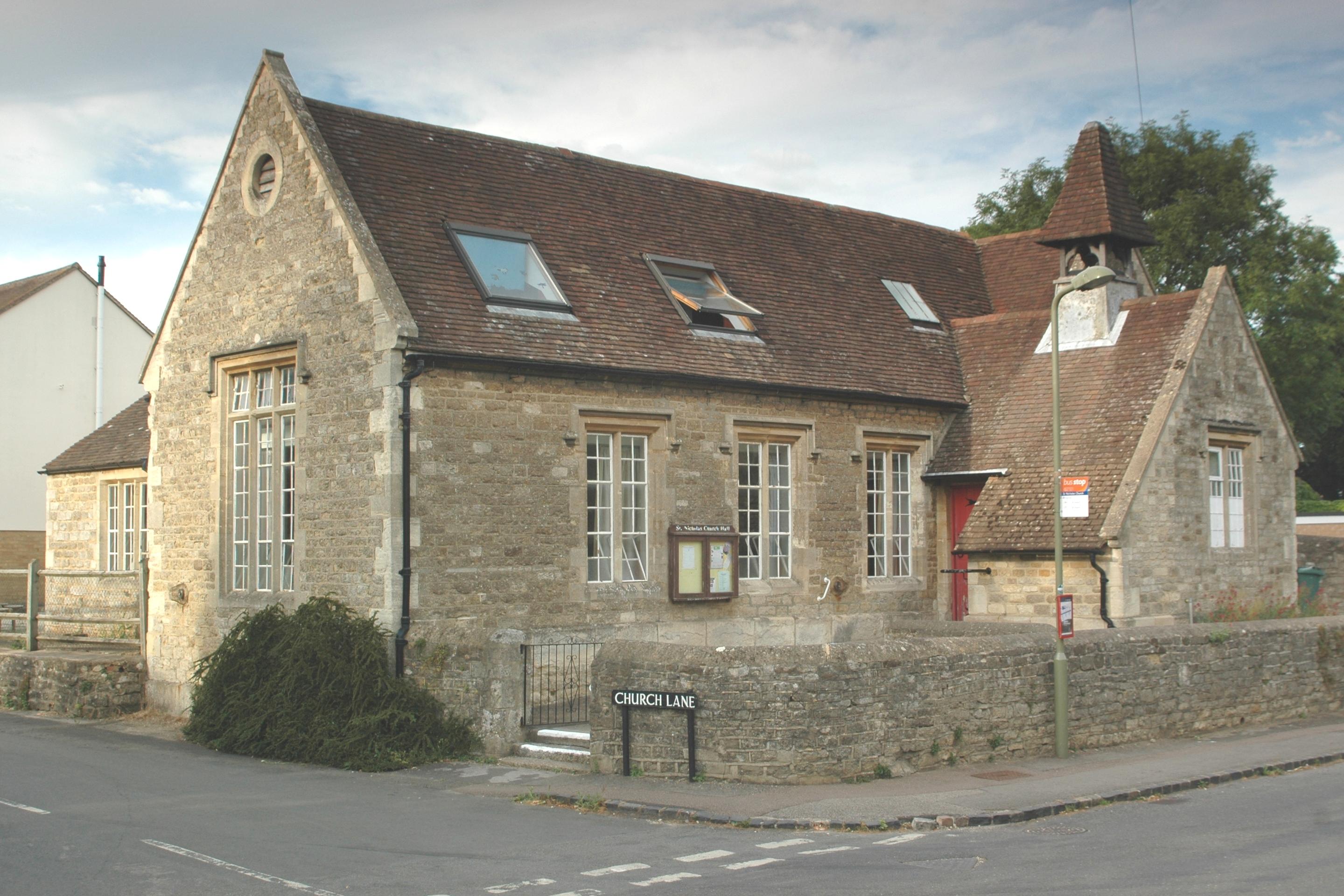
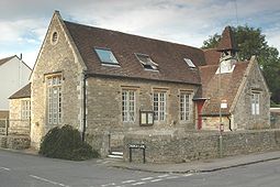 St. Nicholas' church hall, formerly the parish school
A cycle route links Marston with central Oxford via the meadows west of New Marston, over a bridge on the River Cherwell, past the southern boundary of The Parks to the junction of South Parks Road and St Cross Road near the Science Area of Oxford University. It is also possible to walk on footpaths across the meadows to the Parks, either via Mesopotamia Walk or Rainbow Bridge.
References
- ^ "Area selected: Oxford (Non-Metropolitan District)". Neighbourhood Statistics: Full Dataset View. Office for National Statistics. http://neighbourhood.statistics.gov.uk/dissemination/viewFullDataset.do?instanceSelection=03070&productId=779&$ph=60_61&datasetInstanceId=3070&startColumn=1&numberOfColumns=4&containerAreaId=790497. Retrieved 3 April 2010.
Further reading
- Lobel, Mary D, ed (1957). A History of the County of Oxford: Volume 5: Bullingdon Hundred. Victoria County History. pp. 214–221.
- Sherwood, Jennifer; Pevsner, Nikolaus (1974). Oxfordshire. The Buildings of England. Harmondsworth: Penguin Books. pp. 699–700. ISBN 0 14 071045 0.
External links
Categories:- Villages in Oxfordshire
- Districts of Oxford

Wikimedia Foundation. 2010.