- Corfe Mullen
-
Coordinates: 50°46′12″N 2°01′03″W / 50.7701°N 2.0175°W
Corfe Mullen 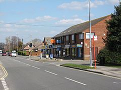
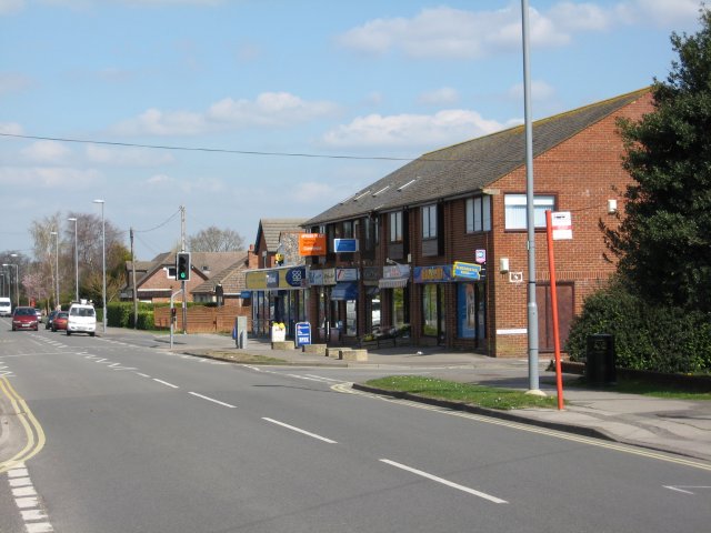
Wareham Road, Corfe Mullen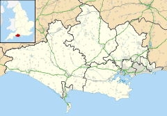
 Corfe Mullen
Corfe Mullen shown within DorsetPopulation 10,147 (2001) OS grid reference SY986978 District East Dorset Shire county Dorset Region South West Country England Sovereign state United Kingdom Post town WIMBORNE Postcode district BH21 Dialling code 01202 Police Dorset Fire Dorset Ambulance South Western EU Parliament South West England UK Parliament Mid Dorset & North Poole List of places: UK • England • Dorset Corfe Mullen is a village in Dorset, England, on the north-western urban fringe of the South East Dorset conurbation and is part of the rural district of East Dorset. The population is 10,147 (2001).
The name Corfe Mullen is derived from the Old English for a cutting or pass; 'corf' and the Old French for a Mill; 'molin'. The mill referred to is the old water mill on the River Stour, mentioned in the Domesday Book, where the village originally stood.
Despite the proximity of the urban area, Corfe Mullen is surrounded by Green Belt and has six churches, five pubs, five schools, a library, various shops and local businesses, a village hall, and a whole host of community and sports organizations which help to preserve its community spirit and identity.
Contents
History
Early nomadic tribes and settlers
The first evidence of people living in the area consists mainly of a number of flint axeheads that have been found within the village and which date from the Old and Middle Stone Ages. Around 3000 BC, the first real settlers came, cleared the forests and began to farm, although even they were largely nomadic. Later settlers, during the Bronze Age, built burial mounds or Barrows, examples of which may be found to the east of the village at Barrow Hill and at Naked Cross at the southern end of the village. These forms of occupation continued into the Iron Age; evidence of pottery manufactured around the 1st century BC may be found at East End. Just prior to the coming of the Romans, in around 50 BC, the area was inhabited by the Belgae.
Romans
The Roman Second Legion under Vespasian arrived in the Corfe Mullen area during the Forties AD and built a 40-acre (160,000 m2) fortress just to the north of the village at Lake Farm. The location of this fortress was important; the River Stour provided a defensive barrier to the north and the site is only 3 miles (4.8 km) from the Iron Age Hill Fort at Badbury Rings. Lake cut this important tribal centre off from the settlements at Dudsbury and Hengistbury Head.
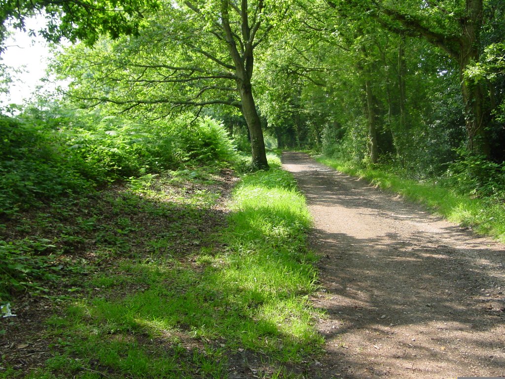
 The Roman Road
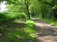
In order to subjugate the local tribes and keep themselves supplied and in communication with other Roman centres, the Legion built several roads that run through or close to the area. Probably the most important of these, and the only one visible today, is the road that connected the deep water anchorage at Morionio (now Hamworthy) and Lake, and continues northwards to Badbury and Hod Hill. This road forms the eastern boundary of the village. Note that in the picture the original road is the overgrown bank on the left, not the farm track on the right.
In addition, traces of two other roads have been found, both of which are underneath or follow the course of modern roads. One of these linked Lake with Dorchester, and is roughly aligned with the present A31. The third road found ran through the spine of the village and followed the present road to Wareham.
Although the Roman occupation of Britain lasted nearly 400 years, the military presence at Corfe Mullen was very short lived, lasting only until the Sixties AD However, there is ample evidence that the Roman influence continued in agriculture and industry even after they had left and the Celtic speaking people that descended from the original tribes took over the area again.
Saxons
The Saxons probably settled in the area around the 7th century. Christianity arrived before 700 AD and open air services were believed to be held on the same site as the old village church (see the Normans below). During the centuries leading up to the millennium, division of land into Hundreds and tithe took place and Manorial courts dealt with disputes. The name of Corf came into usage during this period and was located in the hundred of Cogdean, with the court being held at Cogdean Elms in the north of the present village.
A number of other land holdings dating from this period have been found around the village, the most notable being at Mountain Clump and the Knoll, where the remains of cottages may be seen.
Norman period and Middle Ages
After the Norman Conquest, Corf's entry in the Domesday Book shows that it appears to have been a single manor under 'Robert, son of Gerold', but was previously held by two Saxon lords; Waga and Egelric. At some time during the next two or three centuries, the village reverted to two manors; probably Corf Molin and Corf Hubert. The latter manor was almost certainly named after a former lord, Hubert de la Vielle. By 1469 the two manors were combined into one again, although the two names were still preserved at that time. It was probably another century before the present day name came about; this merger was probably driven by the general depopulation of the country that occurred in the Middle Ages due to migration to the towns and the Black Death.
A third part of the village came to be known as Corfe Mullen St Nicholas and the origin of this appears to date back to a land acquisition by St Nicholas Hospital (a Salisbury charity) in 1279. The present day areas of Lambs Green, East End and Brog Street were still called this until the early part of the 20th Century.
Construction of the original parish church, then called St Nicholas but now St Hubert's, was commenced during the 13th Century, with the tower being added a little later.
Elizabethan to Georgian times
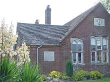 Part of Lockyer's Middle School in 2006
After the major changes seen after the Normans, a period of stability came to the village for about 300 years. From Elizabethan to Georgian times, the story is mainly one of growing prosperity with a number of wealthy families being the major landowners as the years passed. None of these families built their homes within the parish boundaries, although the Phelips family took over an Elizabethan Manor House (the Court House) near the church and lived there for many years. Apart from this, the major architectural legacies of this period are some notable farm houses, a few cottages and the original building that housed Lockyer's Charity School, formed in 1706 by Richard Lockyer. This building is still used by the present day Lockyer's Middle School.
One important change was the construction of a toll road by private enterprise during the latter half of the 18th Century. The present Higher Blandford Road and Mill Street (the A31 from the old church, past the Coventry Arms pub and mill) was part of a completely new route between Poole and Blandford. This development provided the people of Corfe Mullen with access to the major markets of these two towns
Victorian era
During the reign of Queen Victoria, the whole of Britain went through major changes brought about by the Industrial Revolution, and Corfe Mullen benefited from advances in technology. More toll roads were constructed, including an extension to Mill Street which provided a new route from Bere Regis to Wimborne. By the late 19th century however, the railways had arrived, with tracks first appearing within walking distance of the village at Wimborne and later with a route that went through the village. Even though the village had a number of tracks through it, it was well into the 20th century before a Halt was provided, and even that was never a success.
20th century
The story of the village through the 20th century is one of accelerating development. Prior to the Second World War, some new properties were built, with the populated area gradually extending up the hill from the river. Even a casual inspection of the housing in the village reveals that the original centre was along Mill Street with cottages also being found at Brog Street, Lambs Green and East End. Development between the wars is noticeable along Higher Blandford Road and Wareham Road, with few older properties in evidence away from those roads. Then, in the fifties and sixties, development took off, with major new housing estates around Phelips Road and Hillcroft Road. In the last forty years of the century, most of the area between Broadstone and the eastern boundary of the village has been filled in and a stranger could be forgiven for thinking that Corfe Mullen was part of Poole.
During the early part of the century, the village became famous for its Violet and Lavender cultivation, which was centred around Violet Farm. The trade diminished however and the farm was demolished in the 1960s, along with a 300 year old tithe barn, to make way for new bungalows.
Modern times
As the village has grown so the population has changed. It is probably true to say that very few of the inhabitants actually work in the village or the immediate area, or were even born there. Large numbers of people commute to the nearby towns and cities of Wimborne, Poole, Bournemouth, Ferndown, Verwood and even Southampton every day. Even so, pride in the village is high, with the general level of crime and vandalism being pretty low despite the close proximity of the South East Dorset conurbation with a combined population of three to four hundred thousand people. It is one of the biggest villages in England.
The countryside around the village is split between agriculture and heathland, with woodland to be found fringing most areas. The existence of many bridleways criss-crossing the area around the village encourages horse riding and there are a number of stables nearby. The village also has a large Recreation Ground with facilities for outdoor sports including football, cricket and tennis. This is run by the CMSA (Corfe Mullen Sports Association), which is made up of volunteers from various sports clubs around Corfe Mullen. There are allotments between the Recreation Ground and Lockyer's school which are popular and currently have a waiting list.
Churches
- St Hubert's, the original parish church.
- St Nicholas, the new Anglican church.
- Corfe Mullen Baptist Church
- Corfe Mullen Family Church
- East End Methodist Church (part of the Wimborne Circuit)
- Wareham Road Methodist Church (part of the Poole and Swanage Circuit)
- Knoll Farm Christian Fellowship
Pubs
- The Coventry Arms
- The Dorset Soldier
- The Holme Bush
- The Lambs Green Inn
- The Mount Inn
Schools
- Henbury View First School
- Lockyer's Middle School
- Rushcombe County First School
- Corfe Hills School (actually just outside the village in Broadstone, but serves older village children)
- Castle Court Preparatory School (A private school for 3 to 13 year olds)
- Chapel in the Valley Pre School (Held in the Baptist Church Hall for 2 to 5 year olds)
Library
- Corfe Mullen Library, 54 Wareham Road (By the Co-op Supermarket)
Children's Centre
- Corfe Mullen's Sure Start Children's Centre, 54 Wareham Road (The Children's Centre and Library share the same building)
Sport
Corfe Mullen Cricket Club runs a number of senior and junior sides catering for all abilities and is based at Corfe Mullen Recreation Ground under the auspices of the Corfe Mullen Sports Association. Other members of the association include tennis and football clubs, and most recently even a baseball team.
Other places of entertainment
Apart from the local pubs, a weekly youth club is held near to Lockyer's School and various activities are available in the Village Hall. For those who require entertainment of a more commercial nature, Wimborne, Poole and Bournemouth provide a good choice with cinemas, theatres, and night clubs. The nearest beach, at Sandbanks, is less than 10 miles (16 km) away.
Future plans
During the first decade of the 21st Century, proposals were made by the South West Regional Assembly to build 800 new homes on green belt land on the edge of the village. These plans caused considerable consternation, because the village is already something of a dormitory and a survey of villagers at the time rejected these proposals overwhelmingly.
These extensive developments were ultimately shelved and the District Council later published much more modest plans to build on the sites of the Middle School or Recreation Ground. These plans define three housing blocks as options; with 80 or 150 houses on each. The adoption of any of these sites would require relocation of the school or recreational facilities. A public consultation period ended in January 2011 and the results are awaited.
Notable residents
- Isaac Gulliver, the famous Smuggler lived in Highe House in East End
- William Joyce, who is better known as 'Lord Haw-Haw', once lived in the Court House.
- Gladys Mitchell, the detective writer and creator of Mrs Bradley, lived in the village at the end of her life.
- Hugh Miles, British filmmaker who specialises in wildlife films.
References
- A History of Dorset, John Hutchins, 1774
- A Neolithic "A" Habitation Site at Corfe Mullen, JB Calkin, MA & Stuart Piggot, FSA, Proceedings of the Dorset Natural History and Archaeological Society, Vol 60, 1938
- The Course of the Hamworthy - Badbury Roman Road, HP Smith, MBE, BA, FCP, Proceedings of the Dorset Natural History and Archaeological Society, Vol 65, 1943
- Proceedings of the Dorset Natural History and Archaeological Society, Vol 83, 1961
- Some Early Iron Age Sites in the Bournemouth Area, J Bernard Calkin, MA, FSA, Proceedings of the Dorset Natural History and Archaeological Society, Vol 86, 1965
- Ramblings in the Past: The Story of Corfe Mullen, J Bernard Calkin
- The Romano-British Settlement at Corfe Mullen, J Bernard Calkin, MA
- Corfe Mullen: The Origins of a Dorset Village, 1988, Norman Field
- The Millennium Exhibits - Corfe Mullen Parish Council Office
- Corfe Mullen Parish Plan 2006
- Dorset Smugglers, Roger Guttridge, 1986
External links
Categories:- Villages in Dorset


Wikimedia Foundation. 2010.