- Dell'Arcano del Mare
-
Dell'Arcano del Mare by Sir Robert Dudley is a 17th century maritime encyclopedia, the sixth part of which comprises a maritime atlas of the entire world, which is the first such in print, the first made by an Englishman, and the first to use the Mercator projection. The work was first published in Italian at Florence in 1645 and 1646 in three folio volumes.
Among other things, it is remarkable for its inclusion of a proposal for the construction of a navy in five rates (sizes) which Dudley designed and described. It was reprinted in Florence in a two volume folio edition in 1661 without the charts of the first edition.
Scope
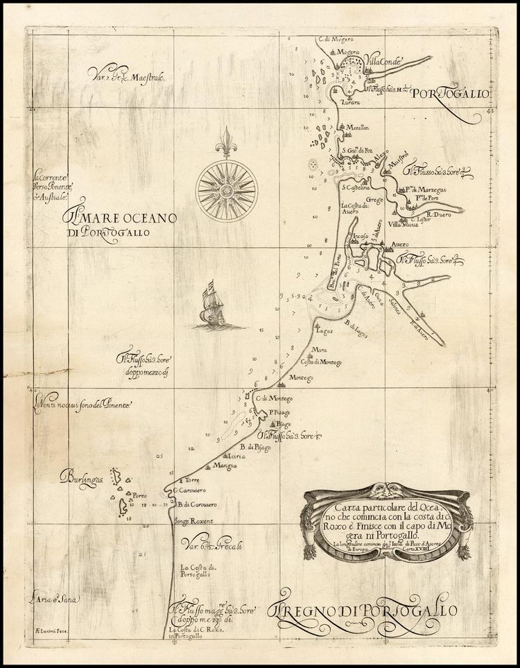
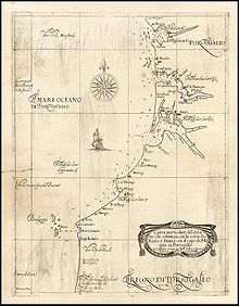 Dell'Arcano del Mare: chart of Portugal (Florence, 1646)
The six-part work covered navigation, shipbuilding and astronomy, with 130 maps in two volumes (nos. 2 and 6) . Unlike the vast majority of his contemporaries, Dudley's maps are all his own and were not copied from other mapmakers. They have an instantly recognizable style, closer to the pre-17th-century manuscript portolan charts than the richly decorated maps of Mercator, Hondius and Blaeu.
Style
The distinctive Baroque style of Dudley's charts is in part attributable to the elegant engraving of Antonio Francesco Lucini.
Later map-makers chose not to copy Dudley's style and so it remains unique in the annals of cartography. The engraving by Antonio Francesco Lucini, who stated that he spent 12 years and used 5,000 pounds of copper to produce the plates, is of exceptional quality, as is the calligraphy.
Individual maps
Carta Particolare Che Mosta Il Capo Buona Speranza
"Carta Particolare Che Mosta Il Capo Buona Speranza" is a very large sea chart of southwest Africa from Cape Fria to Cape of Good Hope, including Tristan da Cunha. Engraved by Antonio Lucini for Sir Robert Dudley's sea atlas Dell' Arcano del Mare, "the first English sea-atlas, the first sea-atlas of the whole World, and the first on Mercator's projection". Decorated with ships and swash lettering. Florence 1646
Carta Quarta Generale di Europa
"Carta Quarta Generale di Europa", 1646 is one of the larger scale, generalized (Carta Generale) maps and shows the West coast of France, southward from La Rochelle, and the Northern coast of Spain. This is the least ornate of the styles adopted by Dudley with no adornment other than the cartouche and a compass rose and fairly plain calligraphy.
Smaller scale maps
Four additional maps represent the majority of the smaller scale, more specific (Carta Particolare) maps and include sailing ships, notes on prevailing winds and currents and more stylized calligraphy.
Carta Particolare della Costa Australe scoperta dalla Ollandesia
"Carta Particolare della Costa Australe scoperta dalla Ollandesia", 1646. According to Tooley, this map is the first separately printed map of Australia and is consequently of great value. It shows, in addition to the west side of the Cape York peninsula, much of the island of New Guinea. By labeling the Torres Strait "Golfo Incognito" Dudley leaves open the question of whether New Guinea is connected to the Southern continent.
Carta Particolare della Rio d' Amazone con la costa sin al fiume Maranhan
"Carta Particolare della Rio d' Amazone con la costa sin al fiume Maranhan" of 1646 shows the mouth of the Amazon River.
Carta particolare che comincia con l' Isola di S. Tomaso o Tome....Clara e finisce con Il c. d' Aldeas
"Carta particolare che comincia con l' Isola di S. Tomaso o Tome....Clara e finisce con Il c. d' Aldeas". This map of the shoreline of the African Congo includes an elegant cartouche, and islands off the coastline.
Carta particolare della Brasilia Australe che comincia dala Poro del Spirito Santo e finisce con il capo Bianco
"Carta particolare della Brasilia Australe che comincia dala Poro del Spirito Santo e finisce con il capo Bianco" reveals a strip of the southern Brazil coastline and includes São Paulo and the area later to become Rio de Janeiro. Noted for some of the most peculiar representations of mountains near the coastline found on any Dudley map.
French Guiana, Guyana and a small portion of Brazil.
Untitled, (N-E South America)
The seventh map is one of only two in the atlas which have no title but instead dedications to the Grand Duke of Tuscany and, in this case, the Grand Duchess, Dudley's patrons. This is another double page map and probably comes from the 1646 edition. These two maps are probably different because they are the only ones where Dudley was able to use his own observations as they cover the North East coast of South America, the area he visited in 1594. This map shows the coasts of French Guiana, Guyana and a small portion of Brazil. Considerably more elaborate than the others, this map includes soundings and numerous illustrations, namely: two ships, a canoe, two magnificent sea monsters, a (?) cougar and two natives. It also has a legend stating that Monoa - more often known as El Dorado is only 12 days journey up-river from the coast.
References
- Sir Robert Dudley. (2009). In Encyclopædia Britannica. Retrieved October 15, 2009, from Encyclopædia Britannica Online
- Gerard L'Estrange Turner, Elizabethan instrument makers: the origins of the London trade in precision instrument making, Oxford University Press, Oxford 2000, pages 77-91
External links
- Dell'Arcano del Mare, 1646. Digitized by the National Library of Finland (large PDF files).
Categories:- 1645 books
- 1646 books
- 1661 books
- 17th century in Italy
- Atlases
- English non-fiction books
- Italian encyclopedias
- Encyclopedias on science and mathematics
Wikimedia Foundation. 2010.