- Myszków County
-
Myszków County
Powiat myszkowski— County — 
Flag
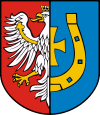
Coat of armsLocation within Silesian Voivodeship Coordinates (Myszków): 50°35′N 19°19′E / 50.583°N 19.317°ECoordinates: 50°35′N 19°19′E / 50.583°N 19.317°E Country  Poland
Voivodeship Silesian Seat Myszków Gminas Total 5 (incl. 1 urban)Area – Total 478.62 km2 (184.8 sq mi) Population (2006) – Total 71,619 – Density 149.6/km2 (387.6/sq mi) – Urban 39,754 – Rural 31,865 Car plates SMY Website http://www.powiatmyszkowski.pl/ Myszków County (Polish: powiat myszkowski) is a unit of territorial administration and local government (powiat) in Silesian Voivodeship, southern Poland. It came into being on January 1, 1999, as a result of the Polish local government reforms passed in 1998. Its administrative seat and largest town is Myszków, which lies 44 kilometres (27 mi) north-east of the regional capital Katowice. The county also contains the towns of Żarki, lying 7 km (4 mi) north-east of Myszków, and Koziegłowy, 11 km (7 mi) west of Myszków.
The county covers an area of 478.62 square kilometres (184.8 sq mi). As of 2006 its total population is 71,619, out of which the population of Myszków is 32,830, that of Żarki is 4,419, that of Koziegłowy is 2,505, and the rural population is 31,865.
Neighbouring counties
Myszków County is bordered by Częstochowa County to the north, Zawiercie County to the south-east, Będzin County to the south, and Tarnowskie Góry County and Lubliniec County to the west.
Administrative division
The county is subdivided into five gminas (one urban, two urban-rural and two rural). These are listed in the following table, in descending order of population.
Gmina Type Area
(km²)Population
(2006)Seat Myszków urban 72.7 32,830 Gmina Koziegłowy urban-rural 159.2 14,420 Koziegłowy Gmina Poraj rural 58.5 10,467 Poraj Gmina Żarki urban-rural 100.7 8,138 Żarki Gmina Niegowa rural 87.6 5,764 Niegowa References
Seat: Myszków (urban gmina)Urban-rural gminas 
Rural gminas Counties of Silesian Voivodeship City counties Katowice (capital) • Bielsko-Biała • Bytom • Chorzów • Częstochowa • Dąbrowa Górnicza • Gliwice • Jastrzębie-Zdrój • Jaworzno • Mysłowice • Piekary Śląskie • Ruda Śląska • Rybnik • Siemianowice Śląskie • Sosnowiec • Świętochłowice • Tychy • Zabrze • Żory
Land counties Categories:- Myszków County
- Land counties of Silesian Voivodeship
Wikimedia Foundation. 2010.

