- Mogilno County
-
Mogilno County
Powiat mogileński— County — 
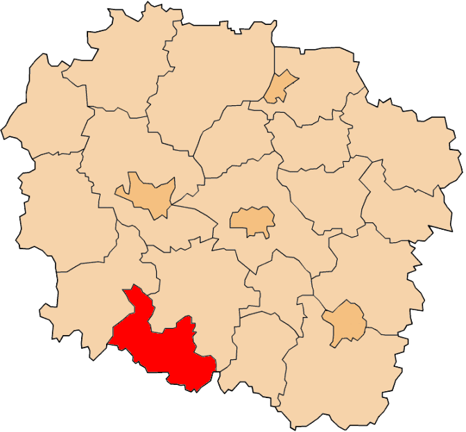
Coat of armsLocation within the voivodeship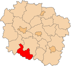
Coordinates (Mogilno): 52°39′N 17°57′E / 52.65°N 17.95°ECoordinates: 52°39′N 17°57′E / 52.65°N 17.95°E Country  Poland
Voivodeship Kuyavian-Pomeranian Seat Mogilno Gminas Area – Total 675.86 km2 (261 sq mi) Population (2006) – Total 46,875 – Density 69.4/km2 (179.6/sq mi) – Urban 18,413 – Rural 28,462 Car plates CMG Website http://www.powiat.mogilno.pl Mogilno County (Polish: powiat mogileński) is a unit of territorial administration and local government (powiat) in Kuyavian-Pomeranian Voivodeship, north-central Poland. It came into being on January 1, 1999, as a result of the Polish local government reforms passed in 1998. Its administrative seat and largest town is Mogilno, which lies 52 km (32 mi) south of Bydgoszcz and 62 km (39 mi) south-west of Toruń. The only other town in the county is Strzelno, lying 16 km (10 mi) east of Mogilno.
The county covers an area of 675.86 square kilometres (261.0 sq mi). As of 2006 its total population is 46,875, out of which the population of Mogilno is 12,359, that of Strzelno is 6,054, and the rural population is 28,462.
Neighbouring counties
Mogilno County is bordered by Inowrocław County to the north-east, Konin County and Słupca County to the south, Gniezno County to the west, and Żnin County to the north-west.
Administrative division
The county is subdivided into four gminas (two urban-rural and two rural). These are listed in the following table, in descending order of population.
Gmina Type Area
(km²)Population
(2006)Seat Gmina Mogilno urban-rural 256.1 24,822 Mogilno Gmina Strzelno urban-rural 185.3 12,308 Strzelno Gmina Jeziora Wielkie rural 124.0 5,034 Jeziora Wielkie Gmina Dąbrowa rural 110.5 4,711 Dąbrowa References
Urban-rural gminas 
Rural gminas Counties of Kuyavian-Pomeranian Voivodeship City counties 
Land counties Categories:- Mogilno County
- Land counties of Kuyavian-Pomeranian Voivodeship


Wikimedia Foundation. 2010.