- Mount Baxter (California)
-
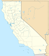
Mount Baxter Location of Mount Baxter in California Elevation 13,136 ft (4,004 m) NGVD 29[1] Prominence 603 ft (184 m) [1] Parent peak Acrodectes Peak [2] Location Location Fresno and Inyo counties, California, USA Range Sierra Nevada Coordinates 36°51′41″N 118°21′57″W / 36.8613235°N 118.3659315°WCoordinates: 36°51′41″N 118°21′57″W / 36.8613235°N 118.3659315°W[3] Topo map USGS Kearsarge Peak Geology Type Granitic Age of rock Cretaceous Climbing First ascent 1905 by George Davis Easiest route Scramble, class 3 Mount Baxter is a peak along the crest of the Sierra Nevada Mountains in California. Mount Baxter is in the John Muir Wilderness just north of Baxter Pass and to the northeast of the Rae Lakes, a popular backpacking destination along the John Muir Trail.
Mount Baxter is named for John Baxter who was a rancher in the Owens Valley.[4]
Access to Mount Baxter is limited to the period between December 15 and July 1 since a flock of protected bighorn sheep live in the vicinity.
References
- ^ a b "Mount Baxter, California". Peakbagger.com. http://www.peakbagger.com/peak.aspx?pid=2756. Retrieved 2008-11-24.
- ^ "Mount Whitney - California Mountain Atlas". Peaklist.org. http://www.peaklist.org/CAmtnatlas/tables/whitney/whitney.html. Retrieved 2009-01-18.
- ^ "Mount Baxter". Geographic Names Information System, U.S. Geological Survey. http://geonames.usgs.gov/pls/gnispublic/f?p=gnispq:3:::NO::P3_FID:256603. Retrieved 2008-11-24.
- ^ Browning, Peter (1986). Place Names of the Sierra Nevada. Berkley: Wilderness Press. p. 12. ISBN 978-0-89997-119-3.
- Secor, R. J.. The High Sierra: Peaks, Passes, and Trails (2nd ed.). ISBN 0-89886-625-1.
Categories:- Mountains of Kings Canyon National Park
- Mountains of Inyo County, California
- Mountains of Fresno County, California
- Fresno County, California geography stubs
- Inyo County, California geography stubs
Wikimedia Foundation. 2010.

