- Newtownards Airport
-
Newtownards Airport 
View of airport from Scrabo Tower IATA: none – ICAO: EGAD Summary Airport type Public Operator Ulster Flying Club Serves Newtownards Elevation AMSL 9 ft / 3 m Coordinates 54°34′52″N 005°41′31″W / 54.58111°N 5.69194°WCoordinates: 54°34′52″N 005°41′31″W / 54.58111°N 5.69194°W Map Location in Northern Ireland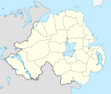
 EGAD
EGADRunways Direction Length Surface m ft 04/22 1,024 3,360 Asphalt 08/26 566 1,857 Asphalt 16/34 644 2,113 Asphalt Sources: UK AIP at NATS[1] Newtownards Airport (ICAO: EGAD) is a local airfield in Newtownards, County Down, Northern Ireland. It is located 8.5 NM (15.7 km; 9.8 mi) east[1] of Belfast. Newtownards airport is the home of the Ulster Flying Club. The Ulster Flying Club (UFC) was founded in 1961 and over this period has grown to become Northern Ireland's largest flying school and one of the largest, non commercial training, flying organizations in Ireland.
Newtownards Aerodrome has a CAA Ordinary Licence (Number P659) that allows flights for the public transport of passengers or for flying instruction as authorised by the licensee (Ulster Flying Club (1961) Limited).[2]
References
External links
 Airports in the United Kingdom and the Crown Dependencies
England Birmingham · Blackpool · Bournemouth · Bristol · Doncaster-Sheffield · Durham Tees Valley · East Midlands · Exeter · Humberside · Leeds-Bradford · Liverpool · London City · London-Gatwick · London Heathrow · London Luton · London Southend · London Stansted · Manchester · Newcastle · Newquay · Norwich · Plymouth · Southampton
Biggin Hill • Cambridge • Gloucestershire • Kent • Land's End • Oxford • Lydd • Penzance • St Mary's • TrescoScotland Aberdeen · Edinburgh · Glasgow International · Glasgow Prestwick · Inverness
Barra • Benbecula • Campbeltown • Dundee • Eday • Fair Isle • Islay • Kirkwall • Lerwick • North Ronaldsay • Oban • Papa Westray • Sanday • Scatsta • Stornoway • Stronsay • Sumburgh • Tiree • Westray • WickWales Northern Ireland Crown Dependencies Alderney · Guernsey · Isle of Man · Jersey
Smaller font-size indicates airports handling domestic, charter or private services only. Airports in Ireland Northern Ireland 
Republic of Ireland Smaller font-size indicates airports handling domestic, charter or private services only. Categories:- Airports in Northern Ireland
- Aero clubs
- County Down
- Newtownards
- United Kingdom airport stubs


Wikimedia Foundation. 2010.