- U.S. Route 166
-
U.S. Route 166
Route information Auxiliary route of US 66 Length: 166 mi (267 km) Existed: 1926 – present Major junctions West end:  US-81 in South Haven, KS
East end: 
 I-44 / US 400 near Joplin, MO
Highway system United States Numbered Highways
List • Bannered • Divided • ReplacedU.S. Route 166 is an 166-mile (267 km) east–west United States highway. This route and US-266 are the only two remaining spurs of historic U.S. Highway 66, since US-666 was renumbered in 2003.
US-166 meets the old route of US-66, now designated Alt US-69, in Baxter Springs in the southeast corner of Kansas.
Contents
Route description
Lengths mi km KS 163.223[1] 262.682 MO 0.6[2] 1.0  US-166's western terminus in South Haven, Kansas

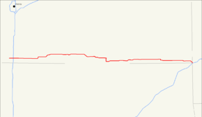
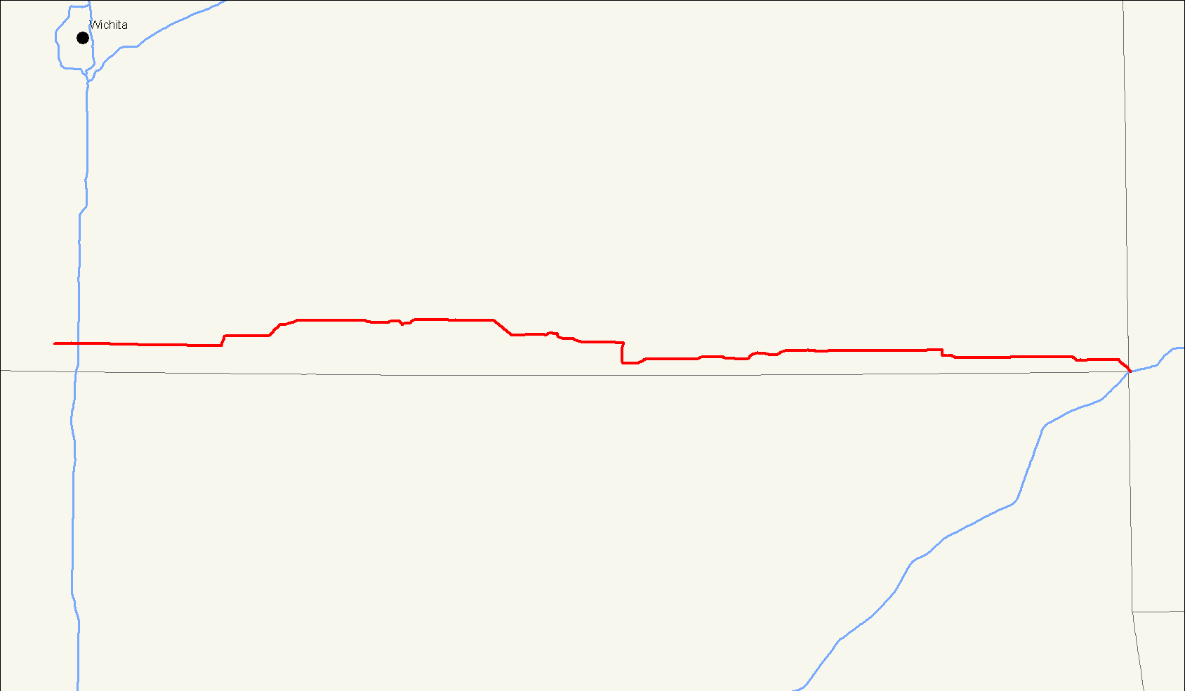
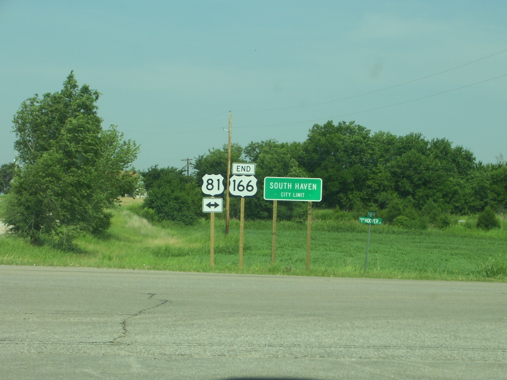
As of 2006, the highway's western terminus is in South Haven, Kansas at an intersection with US-81, approximately 1-mile (1.6 km) north of the northern terminus of U.S. Highway 177. From this point, it heads east for about four miles (6 km), where it intersects the Kansas Turnpike (Interstate 35) at exit 4. It then enters Arkansas City, where it meets US-77 and overlaps it for approximately two miles, splitting off near Parkerfield.
US-166 crosses into Chautauqua County shortly before passing through Cedar Vale. It runs south of Sedan, intersecting K-99. Near Havana, US-166 has an interchange with US-75, where the two routes begin a concurrency. US-166 splits off just north of Caney. It has a brief concurrency with US-169 in the Coffeyville area. It also overlaps US-59 through Chetopa before crossing U.S. Route 69 north of Treece. In Baxter Springs, it crosses US-69 Alternate before joining with US-400 west of town. Just before crossing into Missouri, it serves as the southern terminus of K-26.
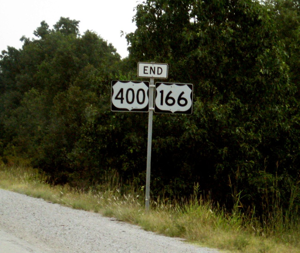
U.S. 166's eastern terminus is southwest of Joplin, Missouri at an intersection with Interstate 44 0.6 miles (0.97 km) from the Kansas border.[2] It is also about 1000 feet (300 m) from the point where Kansas, Missouri, and Oklahoma meet. U.S. Route 400 also ends here, and the routes are co-signed from this point to near Baxter Springs, Kansas, a distance of approximately 10 miles (16 km).
History
US 166 is an original 1926 route and originally ran from Baxter Springs, Kansas to South Haven. In 1945, it was extended east through Joplin, Missouri, where it paralleled U.S. Route 66 to Springfield, Missouri. This extension absorbed Route 38,[vague] which had been formed in 1922 from Carthage to west of Springfield and realigned to Joplin in about 1930, with the former route becoming Route 38N and soon U.S. Route 71 Alternate. In 1966, following the completion of the last section of Interstate 44 in Missouri, the east end of US 166 was truncated back from Springfield to its current terminus. Most sections of US 166 between Joplin and Springfield were not upgraded to Interstate Highway standards and were renumbered as I-44 Business Loops, state highways (such as Route 174) or turned over to local or county jurisdiction.
Bannered routes
Business loops and spurs
- U.S. Route 166 Business – Sedan, Kansas
- Springfield, Missouri – Decommissioned
Junction list
County Location Mile[1][2] Destinations Notes Sumner South Haven 0.000 US-81Western terminus 3.481 
 I-35 / KTA
Parclo interchange Cowley Arkansas City 20.540  US-77
US-7722.993 US-7740.883  K-15
K-1544.833 K-15Chautauqua 66.984 


 US-166 Bus.
Western terminus of US 166 BUS 71.325 
 US-166 Bus. / K-99
Eastern terminus of US 166 BUS Montgomery 85.579  US-75
US-75Trumpet interchange 88.577 US-75Coffeyville 106.083  US-169
108.104 US-169Labette 120.743  K-101
K-101Southern terminus of K-101 128.927  K-134
K-134Southern terminus of K-134 Chetopa 135.054  US-59
US-59136.548 US-59Cherokee 150.694  US-69
US-69Baxter Springs 156.181 
US-69 Alt.158.017 US-400161.322  K-26
K-26Southern terminus of K-26 Missouri state line Newton 0.6 I-44I-44 exit 1; eastern terminus of US 166, eastern terminus of US 400 1.000 mi = 1.609 km; 1.000 km = 0.621 mi References
- ^ a b Kansas Department of Transportation. "Pavement Management Information System". http://www.ksdot.org:9080/matreslab/pmis/query.asp. Retrieved 2008-09-26.
- ^ a b c Google, Inc. Google Maps – U.S. Route 166 (Map). Cartography by Google, Inc. http://maps.google.com/maps?f=d&saddr=KS-166%2FUS-400&daddr=US-166%2FUS-400&hl=en&geocode=FQqmNAIdjj5c-g%3BFQqMNAIdxFRc-g&mra=ls&sll=37.023113,-94.733402&sspn=0.002514,0.005686&ie=UTF8&z=16. Retrieved 2008-09-16.
Browse numbered routes ←  K-163
K-163KS K-167  →
→←  Route 165
MO Route 168  →
→U.S. Routes related to US 66  Categories:
- Three-digit U.S. Highways
- U.S. Highways in Kansas
- U.S. Highways in Missouri

Wikimedia Foundation. 2010.