- Doonside, New South Wales
-
- Doonside redirect here. For the South African town see Doonside, KwaZulu-Natal
Doonside
Sydney, New South Wales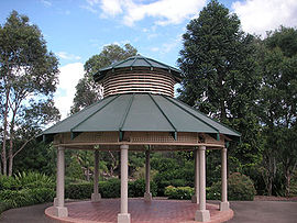
Nurragingy Nature ReservePopulation: 13,000 (2006) Established: 1929 Postcode: 2767 Location: 40 km (25 mi) west of Sydney CBD LGA: City of Blacktown State District: Blacktown Federal Division: Chifley Suburbs around Doonside: Glendenning Quakers Hill Woodcroft Rooty Hill Doonside Blacktown Eastern Creek Huntingwood Arndell Park Doonside is a suburb of Sydney, in the state of New South Wales, Australia. Doonside is located 40 kilometres west of the Sydney central business district, in the local government area of the City of Blacktown and is part of the Greater Western Sydney region. Featherdale Wildlife Park and the Nurragingy Nature Reserve are popular tourist attractions in Doonside. Doonside is now colloquially known as 'Doony'.
Contents
History
Early settler Robert Crawford (1799 to 1848) named his 2,000 acre (8 km²) grant Hill-end but later the area became known as Crawford. By the time the railway station was built on his land in 1886 it had been changed to Doonside, after his father’s estate in Scotland. When the railway station was being constructed, an Aboriginal name ‘Wolkara’ was used and this was also the name of the post office that opened here in 1921, but in April 1929 it was changed to Doonside. [1]
Transport
Doonside railway station is on the Western Line of the City Rail network. It provides direct links to Blacktown, Parramatta and Sydney CBD. The Great Western Highway runs along the southern border and the M4 motorway is just to the south.
People
Doonside's population was 13,031 in the 2006 Australian census. There was a mix of housing tenures in the suburb with 22% of properties owned outright, 33% being purchased and 39% being rented. Of the latter, 60% were rented from the Department of Housing. The median family income of $1097 per week was slightly lower than average and while the average rent ($170 per week) was also lower than average, the average mortgage repayment of $1554 per month was higher than average. The proportion of the labour force employed full time (62%) was higher than average with the most common industry of employment being hospitals (4.2%).[2]
References
- ^ The Book of Sydney Suburbs, Compiled by Frances Pollen, Angus & Robertson Publishers, 1990, Published in Australia ISBN 0-207-14495-8
- ^ Australian Bureau of Statistics (25 October 2007). "Doonside (State Suburb)". 2006 Census QuickStats. http://www.censusdata.abs.gov.au/ABSNavigation/prenav/LocationSearch?collection=Census&period=2006&areacode=SSC11307&producttype=QuickStats&breadcrumb=PL&action=401. Retrieved 2009-04-12.
Coordinates: 33°46′10″S 150°52′00″E / 33.7694°S 150.8666°E
Suburbs of the City of Blacktown · Western Sydney Acacia Gardens · Arndell Park · Bidwill · Blackett · Blacktown · Colebee · Dean Park · Dharruk · Doonside · Eastern Creek · Emerton · Glendenning · Glenwood · Hassall Grove · Hebersham · Huntingwood · Kellyville Ridge · Kings Langley · Kings Park · Lalor Park · Lethbridge Park · Marayong · Marsden Park · Minchinbury · Mount Druitt · Oakhurst · Newbury · Parklea · Plumpton · Prospect · Quakers Hill · Riverstone · Rooty Hill · Ropes Crossing · Rouse Hill · Schofields · Seven Hills · Shalvey · Shanes Park · Stanhope Gardens · Toongabbie · The Ponds · Tregear · Vineyard · Whalan · Willmot · WoodcroftCategories:- Suburbs of Sydney
- Sydney geography stubs

Wikimedia Foundation. 2010.