- Bidwill, New South Wales
Infobox Australian Place | type = suburb
name = Bidwill
city = Sydney
state = nsw
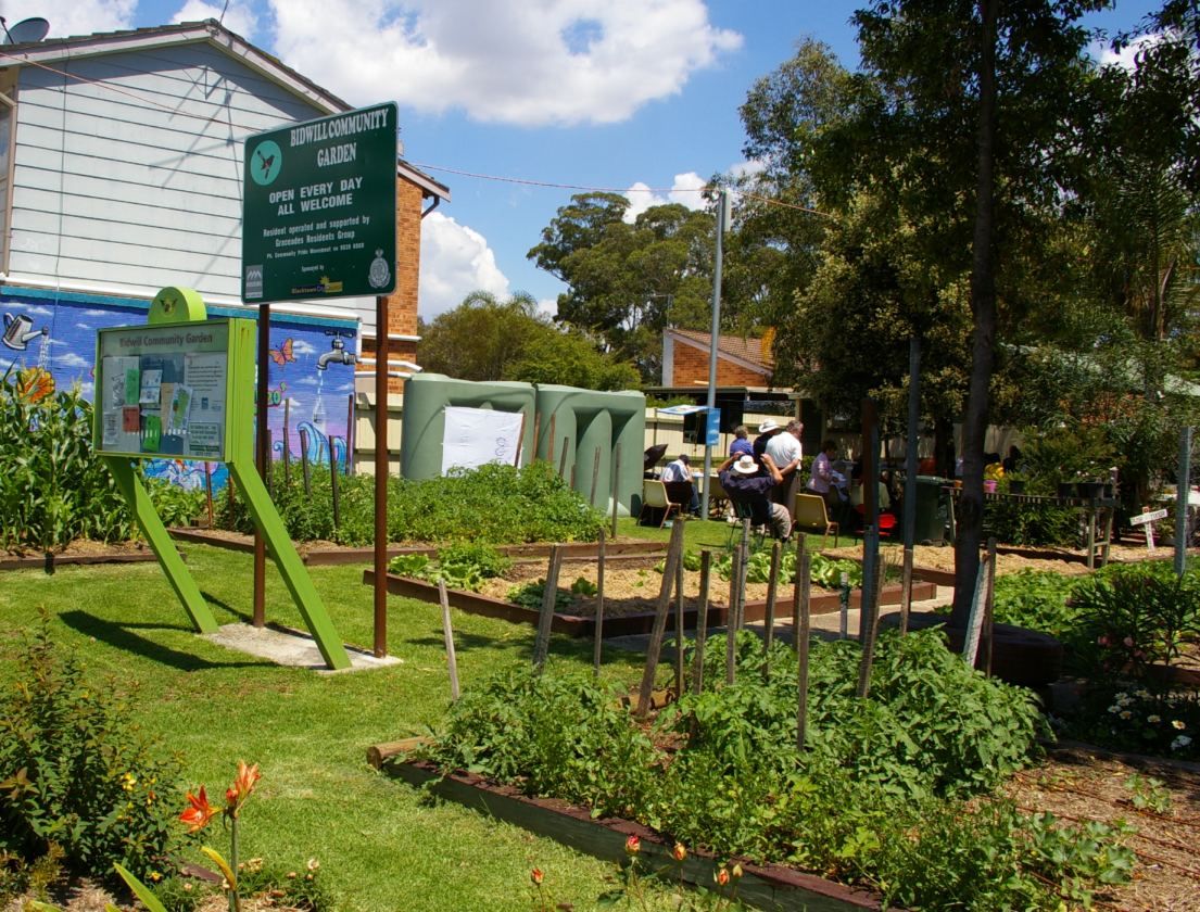
caption = Bidwill Community Garden, Chestnut Crescent
lga = City of Blacktown
postcode = 2770
est =
pop = 2,489
area =
propval = [http://www.domain.com.au/public/suburbprofile.aspx?mode=%20$257,000&suburb=Bidwill&postcode=2770 $212,500] (2007)
stategov = Mount Druitt
fedgov = Chifley
near-nw = Marsden Park
near-n = Marsden Park
near-ne = Marsden Park
near-w = Shalvey
near-e = Hassall Grove
near-sw = Dharruk
near-s = Hebersham
near-se = Oakhurst
dist1 = 48
dir1 = west
location1=Sydney CBD Bidwill is a
suburb ofSydney , in the state ofNew South Wales ,Australia . Bidwill is located 48kilometres west of theSydney central business district , in the local government area of theCity of Blacktown and is part of theGreater Western Sydney region.History
Bidwill takes its name from
John Carne Bidwill (1815-1853) appointed as botanist in charge at the Botanic Gardens in 1847. [ cite web | url = http://www.gnb.nsw.gov.au/name_search/extract?id=ujlpWyqb | title = Bidwill| publisher =Geographical Names Board of New South Wales | accessdate = 2007-01-05 ] Prior to settlement and colonisation of Australia, Bidwill and the surrounding area was inhabited by the Darug tribe.Bidwill was dominated by the development of public housing in the 1960s and 1970s. In recent times, Bidwill has been associated with social and economic problems. These have resulted in an increase of crime and such trouble as riots. [ cite web | url = http://news.ninemsn.com.au/article.aspx?id=85914 | title = Nineteen on riot charges after street clash| publisher =
NineMSN | accessdate = 2007-10-30 ] [ cite web | url = http://www.theage.com.au/news/national/dispute-between-families-sparks-riot/2007/01/07/1168104859012.html| title = Dispute between families sparks riot| publisher =The Age | accessdate = 2007-10-30 ]Commercial areas
Bidwill is primarily a residential suburb with extremely limited commercial activity. It is quite close to the suburbs of
Mount Druitt and St Marys, which have larger shopping centres, banking facilities and railway stations.Limited commercial facilities such as
supermarket s andservice station s are available at Emerton and Plumpton rather than in Bidwill itself. A small supermarket complex existed at Bidwill in the 1990s, which was closed partly due to crime.Transport
In the 2001 census, for people travelling to work using just one method of transportation from this postcode, 66.3% travelled in a car as the driver, 17.4% travelled in a car as passenger, 4.6% took the train 4.0% took the bus, 3.6% travelled by truck, 2.5% walked and 0.5% travelled by motorcycle. Public transport through this area is provided by
Busways .By road Bidwill is adjacent to the
Westlink M7 motorway which can provide very easy access to theGreat Western Highway and the M4 Motorway, providing road access to the western sections of the city and eastward to the Sydney CBD.This suburb is linked by several private bus companies to the train stations located at Mount Druitt and St Marys.Cycleways running through Bidwill run from Poppondetta Park all the way to Mt Druitt and the M7 cycleway, which in turn connects to the cycleways on the M4 and M2 Motorways. [http://www.blacktown.nsw.gov.au/shadomx/apps/fms/fmsdownload.cfm?file_uuid=2BB6A799-E7FF-0ADF-9452-D485A85CB5C3&siteName=blacktown "2004 Bike Routes Around Blacktown City"] , Blacktown City Council, 2004. Accessed
6 June 2007 . ]Education
Bidwill Primary School [ [http://www.bidwill-p.schools.nsw.edu.au/ Bidwill Primary School] ] and the Bidwill campus [ [http://www.bidwill-h.schools.nsw.edu.au/ Bidwill campus] ] of
Chifley College share a campus with a pre-school. Combined, these separate organisations provide care and education from pre-school (3 years) to Year 12 (17-18 years).Upon completing year 10 at the Bidwill campus, students continuing public education can either move on to [http://www.chifcolsnr-h.schools.nsw.edu.au/ Chifley College Senior Campus] located in Mount Druitt, or continue their final years at Bidwill Campus.
As of the 2001 Census, 1077 residents were enrolled at or below
high school level. A further 178 residents were enrolled in post-secondary courses.Population
In the 2001
Australian Bureau of Statistics Census of Population and Housing, the population of the Bidwill postcode area was 4, 577 people, in an area of 1.4square kilometres .The population was 52.8% females, 47.2?% males.9.3% of the population identified themselves as an indigenous Australian, including 0.2% who identified themselves as beingTorres Strait Islanders . This is much greater than the average of 2.1% for the entire state ofNew South Wales . 21.7% of the population was born overseas .The five strongest religious affiliations in the area were in descending order:
Catholic ,Anglican , No religion,Uniting Church in Australia andIslam .Census 2001 AUS|id=SSC11236|name=Bidwill (State Suburb)|accessdate=2007-06-30]Housing
Housing is very heavily dominated by public housing built throughout the 1960s and 1970s, with large numbers of freestanding fibro houses and extensive terrace-style complexes. The houses are gradually transferring to private ownership and as this continues these government-built premises are being replaced with privately built, modern homes, similar to those being built in other areas of SydneyFact|date=June 2007.
Most local housing is owned by either the Department of Housing or Aboriginal Housing Office.
The three most common forms of dwelling were in decreasing order:a separate house;a
semi-detached , row or terrace house, or townhouse;a flat, unit or apartment.Politics
For federal elections, Bidwill is in the safe Labor electoral division of Chifley. This seat is currently held by current parliamentary Speaker Roger Price, of the Australian Labor Party. He was last re-elected in the 2007 elections. The seat has been held continuously by the Australian Labor Party since it was proclaimed in 1984.
During the 2004 election, Price enjoyed strong support from voters in the Bidwill area compared to the rest of the electorate, achieving a positive swing locally against an overall negative swing of 0.65%. [http://results.aec.gov.au/12246/results/HouseDivisionFirstPrefs-12246-111.htm 2004 Election Results - Chifley]
Australian Electoral Commission 2004. Accessed5 June 2007 .]For NSW state elections, Bidwill is in the
Electoral district of Mount Druitt . This seat is currently held byRichard Amery , of the Australian Labor Party. It has been held by a Labor candidate since it was proclaimed in 1971.See also
*
Westbus
*2005 Macquarie Fields riots Notes
# " [http://vtr.elections.nsw.gov.au/lafirstcandidatespost.mount%20druitt.aspx State Election 2007 - Polling Booth Results] , courtesy State Electoral Office of NSW."
# " [http://results.aec.gov.au/12246/results/HousePollingPlaceFirstPrefs-12246-386.htm Federal Election 2004 - Polling Booth Results for Chifley] , courtesyAustralian Electoral Commission ."References
External links
* [http://www.gnb.nsw.gov.au/mrsid/lgamap/show_map.pl?client=gnb&
] , from the
Geographical Names Board of New South Wales .
Wikimedia Foundation. 2010.