- Victory Boulevard (Staten Island)
-
Victory Boulevard 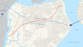
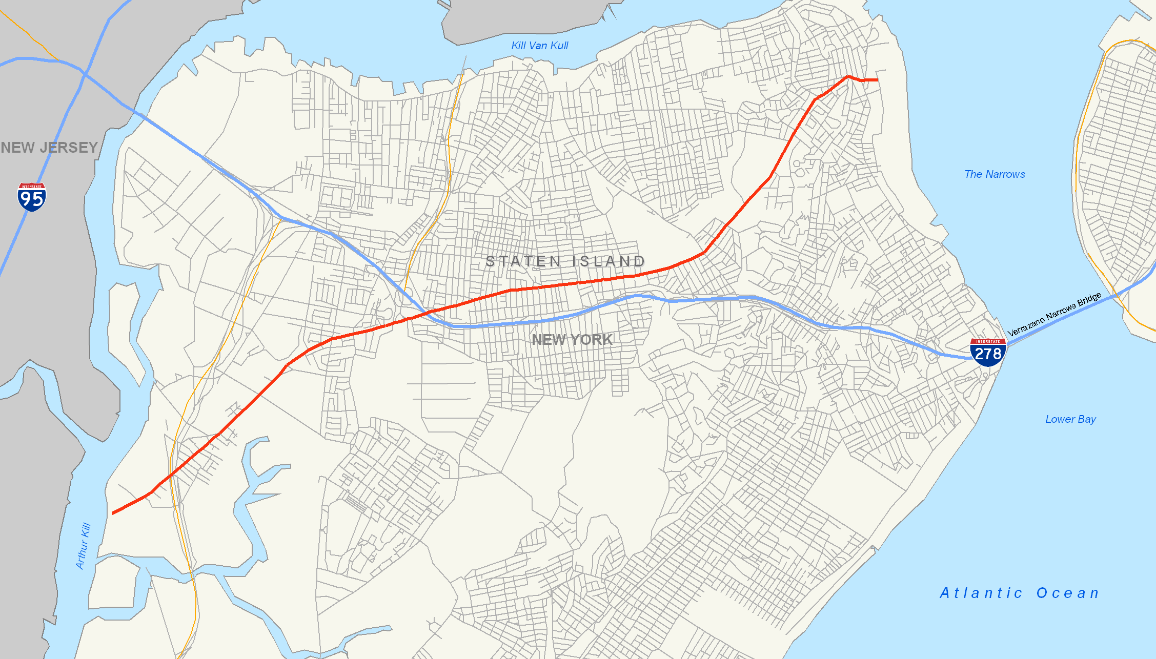
Map of Staten Island with Victory Boulevard highlighted in redRoute information Length: 8.06 mi[1] (12.97 km)
Former NY 439A: 4.42 miles (7.11 km)[1]Existed: 1816[2] – present Major junctions West end: Dead end at Arthur Kill in Travis  NY 440 in Travis
 I-278 in Willowbrook
East end: Bay Street Landing in St. George Location Counties: Richmond Highway system Numbered highways in New York
Interstate • U.S. • N.Y. (former) • Reference • County←  NY 439
NY 440 →Victory Boulevard is a major thoroughfare on Staten Island, measuring approximately 8.0 miles (12.87 km) and stretching from the west shore community of Travis to the upper east shore communities of St. George and Tompkinsville. In the late 1940s, the portion of Victory Boulevard between Richmond Avenue and Forest Avenue was designated as New York State Route 439A. The section between Forest Avenue and Bay Street became part of NY 439 at the same time. Both designations were removed in the late 1960s.
Contents
Route description
The street follows a path similar to the Staten Island Expressway, an integral Staten Island traffic route. Both roadways intersect Clove Road, Slosson Avenue, Todt Hill Road, Bradley Avenue, the Dr. Martin Luther King, Jr. Expressway, Richmond Avenue and the West Shore Expressway, as well as each other. Forest Avenue, too, is intersected by both roads; however, Forest and the Staten Island Expressway are on the opposite extremities of the island.
Incidentally, the boulevard is the only street on Staten Island that meets three different expressways by way of interchanges. It is exit 7 for the West Shore Expressway, exit 10 for the Staten Island Expressway westbound (exit 8 eastbound) and exit 11 for the Dr. Martin Luther King, Jr. Expressway.
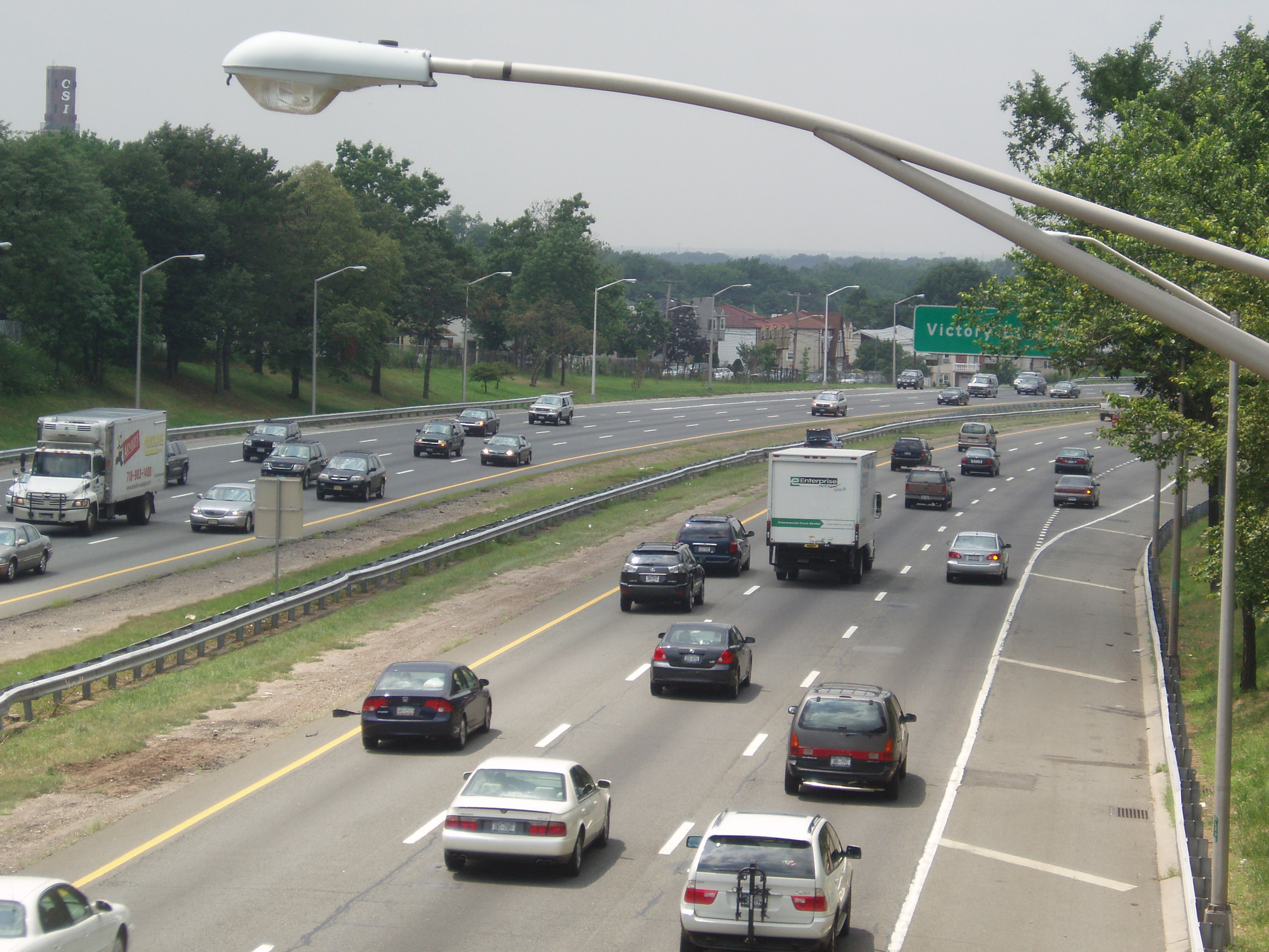
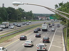 Victory Boulevard exit on the Staten Island Expressway
A number of prominent Staten Island sites and events are located along Victory Boulevard. Among these are the Travis Independence Day Parade, the Sylvan Grove Cemetery, the Mid-Island Little League field and CSI (College of Staten Island), formerly the Willowbrook State School. The Bulls' Head Tavern, a pub known for its Tory meetings during the American Revolution, also stood on Victory Boulevard, on the corner with Richmond Avenue.
History
Victory Boulevard was established in 1816 by the Richmond Turnpike Company as the Richmond Turnpike. The toll road was owned by Daniel D. Tompkins, a prominent Staten Islander who, a year later, became Vice President of the United States. The route was "promoted as the fastest...from New York to Philadelphia."[2] Ferries from Manhattan and Brooklyn would dock at the eastern end of the turnpike, at Bay Street.[citation needed] Horse-drawn carriages would carry passengers to Travis, known at the time as Long Neck or the New Blazing Star Ferry, whence a ferry would carry people over the Arthur Kill to Woodbridge Township, New Jersey.[citation needed] From the 1860s to 1930, Travis was known as Linoleumville, the home of America's first Linoleum factory.[3]
 East end
After World War I, the Richmond Turnpike was renamed Victory Boulevard in honor of the allied victory.[citation needed] The segment of Victory Boulevard from Richmond Avenue (then-NY 440) in Bulls Head to Forest Avenue (then-NY 439) in Silver Lake was designated as NY 439A in the late 1940s. East of Forest Avenue, Victory Boulevard was designated as part of NY 439 down to Bay Street.[4][5] Both designations were removed from Victory Boulevard ca. 1968.[6][7]
Major intersections
The entire route is in Richmond County.
Location Mile[1] Destinations Notes Travis 0.00 Dead end at Arthur Kill 0.58 NY 440 (West Shore Expressway)Exit 7 (NY 440) Willowbrook 2.66 Richmond Avenue Former routing of NY 440; former western terminus of NY 439A 3.31 I-278 (Staten Island Expressway)Exits 8 and 10 (I-278) Tompkinsville 7.08 Forest Avenue Former routing of NY 439; former eastern terminus of NY 439A St. George 8.06 Bay Street 1.000 mi = 1.609 km; 1.000 km = 0.621 mi References
- ^ a b c "National Highway Planning Network GIS data". Federal Highway Administration. version 2005.08. http://www.fhwa.dot.gov/planning/nhpn/. Retrieved February 24, 2008.
- ^ a b "Staten Island Timeline – 1800s". New York Public Library. Archived from the original on March 11, 2007. http://web.archive.org/web/20070311131410/http://www.nypl.org/branch/staten/history/timeline4.html. Retrieved February 3, 2010.
- ^ "William T. Davis Wildlife Refuge Historical Sign". New York City Department of Parks & Recreation. http://www.nycgovparks.org/sub_your_park/historical_signs/hs_historical_sign.php?id=12298. Retrieved January 25, 2010.
- ^ State of New York Department of Public Works. Official Highway Map of New York State (Map). Cartography by General Drafting (1947–48 ed.).
- ^ Socony-Vacuum Oil Company (1950). New York (Map). Cartography by Rand McNally and Company.
- ^ H.M. Gousha Company (1967). Gousha Road Atlas – New York and vicinity (Map). http://www.broermapsonline.org/members/NorthAmerica/UnitedStates/Midatlantic/NewYork/NewYorkCity/gousha_ra_1967_038.html. Retrieved February 29, 2008.
- ^ American Automobile Association (1968). New York City and Vicinity including Long Island (Map) (1968–69 ed.).
External links
Streets and Avenues of Staten Island Amboy Road · Arden Avenue · Arthur Kill Road · Bay Street · Bloomingdale Road · Castleton Avenue · Clove Road · Father Capodanno Boulevard · Fingerboard Road · Flagg Place · Forest Avenue · Forest Hill Road · Four Corners Road · Garretson Avenue · Giffords Lane · Greeley Avenue · Guyon Avenue · Hylan Boulevard · Jefferson Avenue · Justin Avenue · Lily Pond Avenue · Lincoln Avenue · McClean Avenue · Midland Avenue · Mill Road · New Dorp Lane · Old Mill Road · Old Town Road · Olympia Boulevard · Quintard Street · Reid Avenue · Richmond Avenue · Richmond Hill Road · Richmond Road · Richmond Terrace · Rockland Avenue · St. Paul's Avenue · Sand Lane · School Road · Seaview Avenue · Slosson Avenue · South Avenue · Steuben Street · Targee Street · Todt Hill Road · Tompkins Avenue · Vanderbilt Avenue · Van Duzer Street · Victory Boulevard · West Fingerboard RoadCategories:- Streets in Staten Island
- World War I memorials in the United States

Wikimedia Foundation. 2010.