- Doreen, Victoria
-
Doreen
Victoria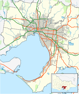
 Doreen
Population: 3,451 (2006) [1] Established: 1844 Postcode: 3754 Elevation: 159 m (522 ft) Location: - 36 km (22 mi) from Melbourne
- 10 km (6 mi) from Hurstbridge
LGA: State District: Yan Yean Federal Division: McEwen Suburbs around Doreen: Yan Yean Arthurs Creek Mernda Doreen Nutfield South Morang Yarrambat Hurstbridge Doreen is a suburb in Melbourne, Victoria, Australia, 36 kilometres (22 mi) north-east from Melbourne's central business district. Its Local Government Area is the City of Whittlesea and Shire of Nillumbik. At the 2006 Census, Doreen had a population of 3,451.
Patrick Reid settled the area in 1844, calling it "Hazel Glen". The Post Office opened on 8 December 1870 as Hazelglen and was renamed Doreen in 1895. [2]
The area contains two private schools and a primary school, a community hall and a CFA fire station.
Suburban development
Doreen is unusual in that the eastern portion in the Shire of Nillumbik remains rural, being contiguous with the rural localities of Yarrambat and Nutfield. The western portion in the City of Whittlesea is contiguous with the suburbs of Mernda and South Morang and suburban development has proceeded. Yan Yean Road separates the two portions.
Residential development is of two kinds — rural residential estates and nurseries to the south, and a new residential estate, Laurimar, in the north with its emphasis on "semi-rural" living, being developed by Delfin, a subsidiary of Lend Lease Corporation.
References
- ^ Australian Bureau of Statistics (25 October 2007). "Doreen (State Suburb)". 2006 Census QuickStats. http://www.censusdata.abs.gov.au/ABSNavigation/prenav/LocationSearch?collection=Census&period=2006&areacode=SSC25499&producttype=QuickStats&breadcrumb=PL&action=401. Retrieved 2007-09-25.
- ^ Premier Postal History, Post Office List, https://www.premierpostal.com/cgi-bin/wsProd.sh/Viewpocdwrapper.p?SortBy=VIC&country=, retrieved 2008-04-11
External links
- Doreen (Shire of Nillumbik]
- Laurimar Estate (Delfin)
Coordinates: 37°36′18″S 145°08′46″E / 37.605°S 145.146°E
Suburbs of the City of Whittlesea | Melbourne | Victoria Aurora · Beveridge · Bundoora · Donnybrook · Doreen · Eden Park · Epping · Humevale · Kinglake West · Lalor · Mernda · Mill Park · South Morang · Thomastown · Whittlesea · Wollert · Woodstock · Yan Yean
Arthurs Creek • Bend of Islands • Christmas Hills • Cottles Bridge • Diamond Creek • Doreen • Eltham • Eltham North • Hurstbridge • Kangaroo Ground • Nutfield • Panton Hill • Plenty • Research • Smiths Gully • St Andrews • Strathewen • Warrandyte North • Watsons Creek • Wattle Glen • Yarrambat •
Categories:- Suburbs of Melbourne
- Melbourne geography stubs

Wikimedia Foundation. 2010.