- Epping, Victoria
-
Epping
Melbourne, Victoria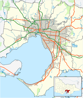
 Epping
Population: 19,222 (2006) [1] Postcode: 3076 Area: 14.8 km² (5.7 sq mi) Location: 22 km (14 mi) from Melbourne LGA: City of Whittlesea State District: Yan Yean, Mill Park, Thomastown Federal Division: Scullin Suburbs around Epping: Craigieburn Wollert Mernda Somerton Epping South Morang Campbellfield Lalor Mill Park Epping is a suburb in Melbourne, Victoria, Australia, 22 km north from Melbourne's central business district. Its Local Government Area is the City of Whittlesea. At the 2006 Census, Epping had a population of 19,222.
Epping is bound by Mill Park and Lalor to the south, Somerton to the west, South Morang to the east and Wollert to the North.
Epping has a mainly flat terrain though, towards the north lie several large hills, which provide an excellent view of Melbourne. McDonalds Road and High Street are the main thoroughfares. The majority of commercial activity is located on High Street and Cooper Street, where Epping Plaza is located.
Contents
History
A village reserve was surveyed in 1839 where Epping later developed. The village was named Epping in 1853, by which time a hotel (from 1844) and a Catholic school were established. Epping Post Office opened on September 1, 1857.[2] The Epping Road Board was established a year later. In 1870 the area around Epping became Darebin Shire, which was re-named Epping Shire in 1893 until united with Whittlesea Shire in 1915. By the time the Shire was created, Epping township contained several churches, hotels and a state school as well as church school. Farmers of Irish origin predominated, but English, Scots and Germans settled there. There were several dairy farms. The Melbourne to Whittlesea railway (1889–1960) had a station at Epping, and the main areas to benefit were the transport of milk and quarry products.
The original Epping township is on higher ground west of the Darebin Creek (the Catholic Church being the only one not to have moved from lower flood-risk land). Several older buildings are constructed in bluestone, plentiful in the surrounding volcanic plains.
Major suburban development took place from the 1970s onwards and the northern fringes of the area are currently in the process of being developed for housing.
Facilities
 The Northern Hospital from the south
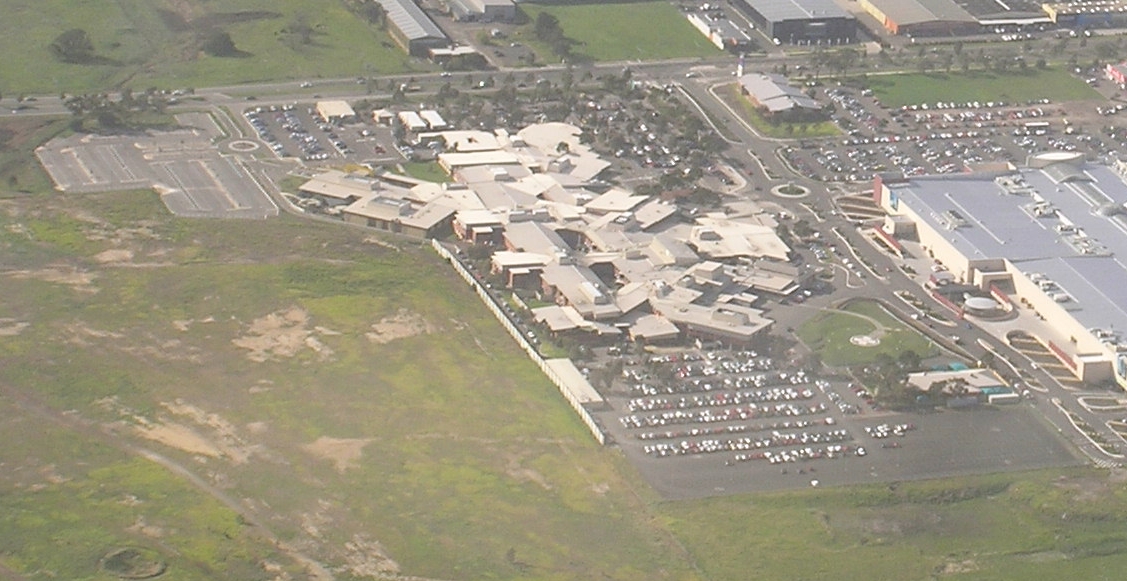
One of Melbourne's many shopping centres, Epping Plaza, is located 500m away from the Epping train station. The Northern Hospital adjoins it. Dalton Village is a small shopping centre (currently undergoing extension) which is located on Dalton Road in Epping. There are many parks and reserves scattered in the suburb.
Education
There are several government and private schools in Epping, including one of the biggest Catholic High Schools in Australia St Monica's College and the second largest public school in Victoria Mill Park Secondary College with its senior campus located in the east of Epping. Epping Secondary College and Lalor North Secondary College. Primary schools include Epping Primary School opened in 1872,[3] Epping Views Primary School, Greenbrook Primary School, Meadow Glen Primary School and St Peter’s Primary School.[4]
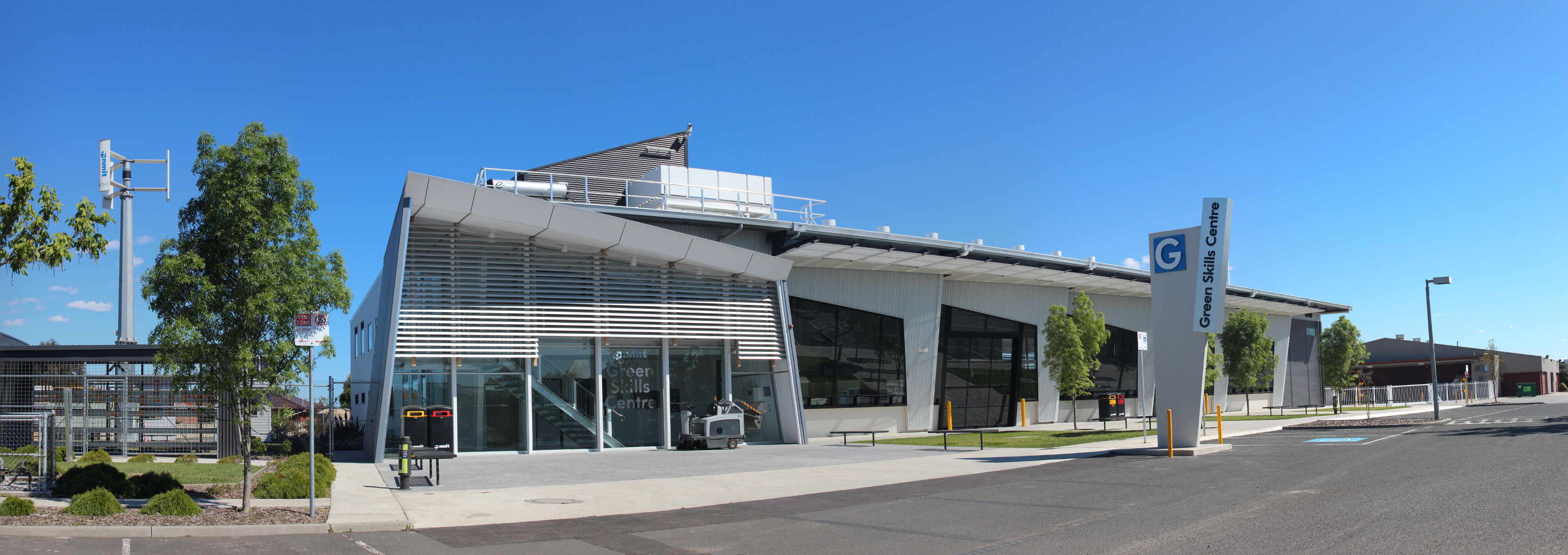
Northern Melbourne Institute of TAFE has a campus at Epping which was developed in 1992 with State Government funding. Along with NMIT Rural training centres of Northern Lodge Equine Stud farm at Eden Park, a farm at Yan Yean and the Growling Frog Vineyard, the Epping campus of NMIT is the largest provider in Victoria of training to the agriculture sector offering courses from certificate to Bachelor degree level in Aquaculture, Equine Studies, Agriculture and Land Management, and Viticulture and Winemaking.[5] A new Green Skills Centre, built in 2009/2010, provides courses and training in renewable energy, sustainable design, and building and construction.[6] The campus boasts one of Victoria's few indoor recirculating aquaculture facilities. Many other vocational education and training courses are also available.
Transport
The Epping railway station is the terminus for the Epping railway line. The East West bus route runs in conjunction with the train line to and from South Morang to Epping Plaza. Several other bus routes operate within the area which connects commuters with train and tram services.
Sport
Epping Football Club, an Australian Rules football team, competes in the Northern Football League.[7] Epping Tennis Club is also located next to the Epping Football Club.
See also
References
- ^ Australian Bureau of Statistics (25 October 2007). "Epping (State Suburb) - Vic.". 2006 Census QuickStats. http://www.censusdata.abs.gov.au/ABSNavigation/prenav/LocationSearch?collection=Census&period=2006&areacode=SSC21259&producttype=QuickStats&breadcrumb=PL&action=401. Retrieved 2007-09-17.
- ^ Premier Postal History, Post Office List, https://www.premierpostal.com/cgi-bin/wsProd.sh/Viewpocdwrapper.p?SortBy=VIC&country=, retrieved 2008-04-11
- ^ www.eppingps.vic.edu.au/our-school/history.php
- ^ http://www.whittlesea.vic.gov.au/content/content.asp?a2z=overide&cnid=1903
- ^ Andrew Coulthard, Operations Manager, Faculty of Earth Science, NMIT. pp27, Hansard, House of Representatives Standing Committee on Agriculture, Fisheries and Forestry regarding Rural skills training and research. Monday 14 November 2005
- ^ Paige Mason, Skills with green tinge, Whittlesea Leader, 16 November 2010. Accessed 17 September 2011
- ^ Full Points Footy, Northern Football League, http://www.fullpointsfooty.net/diamond_valley_football_league.htm, retrieved 2009-04-15
External links
Coordinates: 37°38′46″S 145°01′48″E / 37.646°S 145.03°E
Suburbs of the City of Whittlesea | Melbourne | Victoria Aurora · Beveridge · Bundoora · Donnybrook · Doreen · Eden Park · Epping · Humevale · Kinglake West · Lalor · Mernda · Mill Park · South Morang · Thomastown · Whittlesea · Wollert · Woodstock · Yan Yean
Categories:- Suburbs of Melbourne

Wikimedia Foundation. 2010.