- Diakopto
-
Diakopto
ΔιακοπτόLocation 
 Diakopto
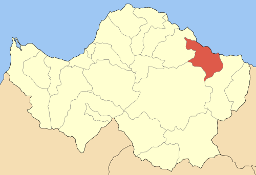
Coordinates 38°11′N 22°11′E / 38.183°N 22.183°ECoordinates: 38°11′N 22°11′E / 38.183°N 22.183°E Location within the peripheral unit
Government Country: Greece Region: West Greece Regional unit: Achaea Municipality: Aigialeia Districts: 12 Population statistics (as of 2001) Municipal unit - Population: 7,023 - Area: 109.03 km2 (42 sq mi) - Density: 64 /km2 (167 /sq mi) Other Time zone: EET/EEST (UTC+2/3) Elevation (min-max): 0 - 60 m (0 - 197 ft) Postal: 250 03 Telephone: 24230 Auto: BO Website www.diakopto.gr Diakopto (Greek: Διακοπτό) is a town and a former municipality in Achaea, West Greece, Greece. Since the 2011 local government reform it is part of the municipality Aigialeia, of which it is a municipal unit.[1] Population app. 7,005 (2001). The town of Diakopto is situated on the Gulf of Corinth, (located 1 km north) and at the lower end of the Vouraikos Gorge. A 750 mm (2 ft 5 1⁄2 in) gauge rack and pinion railway built in 1885 leads up to the town of Kalavryta passing at about halfway the Mega-Spileon Monastery. In the area there were three ancient cities, Bura, Helike and Keryneia. Diakopto is served with the old GR-8 (Athens - Corinth - Patras) which passes 1 km to the south. Diakopto is located approximately 175 km west of Athens, about 40 km east of Patras, about 40 km north of Kalavryta, 20 km east of Aigio and about 15 km west of Aigeira.
The municipality was created in 1835, fourteen years after the start of the Greek War of Independence and a couple of years after the final victory. The municipality was known as Voura (Βουρά).
Contents
Subdivisions
The municipal unit Diakopto is subdivided into the following communities (constituent villages in brackets):
- Ano Diakopto (Ano Diakopto, Pounta)
- Diakopto (Diakopto, Kalyvitis, Kernitsa, Lofos)
- Elaionas (Elaionas, Metochi, Terpsithea)
- Eliki (Eliki, Kalanteri)
- Katholiko
- Keryneia (Keryneia, Nea Keryneia)
- Mamousia (Mamousia, Derveni, Stavria)
- Nikoleika
- Rizomylos
- Rodia
- Trapeza (Trapeza, Paralia Trapezis)
- Zachloritika
Coat of arms
Its logo is stylistic and modernized. The scribbly form of the letter delta is on the right over the golden wave. A gray line is on the right end. The three main features are over the purple rock wall with a golden rim, ordered from top to bottom, it features the ancient column from Diakopto, its ancient theatre and the rack railway. The municipal name written in Greek is at the bottom.
Geography
Its geography consists of farmlands that stretch as far as 500 m from the gulf. Its main production includes olives, fruits and vegetables, pastures and other crops. The mountains cover the southern portion with forests dominating the greater part with some grasslands and bushes and rocks and ledges especially in the gorge located to the south. The Vouraikos river flows about 1 km west Diakopto. It has a beach located 1 km north of the town centre.
Population
Year Municipality population Village population 1981 - 1,848 1991 7,023 2,109 2001 7,005 2,290 History
The village was ruled by the Ottoman Turks with some interruption by the Venetians in the mid to late-15th century and the mid to late-16th century. Diakopto was finally Greek after the Greek War of Independence of 1821, right after the signing of the declaration of independence.
After World War II and the Greek Civil War many of its buildings were rebuilt; the population boomed since that time and emigration has been small. The population reached the 2,000 mark in the late-1980s. The tremendous fire that ravaged Central Aigialeia and south of the village had little effect on the village. Overall no fires were reported and the entire area north of the mountains was protected from that huge forest fire. The southern part of the district was affected in an area of Ano Diakopto located south of the town.
Persons
- Dionyssis Papayannopoulos (1912–1984) actor
Sporting clubs
- Lykoi Diakoptou
- Floga Rodias
- Iraklis Zachloritikon
- Niki Nikoleikon
See also
References
- ^ Kallikratis law Greece Ministry of Interior (Greek)
External links
Municipal unit of Aigeira Aigeira · Aiges · Ampelokipoi · Chrysanthio · Exochi · Monastiri · Oasi · Perithori · Seliana · Sinevro · VelaMunicipal unit of Aigio Aigio · Chatzis · Dafnes · Digeliotika · Kouloura · Koumari · Kounina · Mavriki · Melissia · Paraskevi · Pteri · Selinounta · Temeni · ValimitikaMunicipal unit of Akrata Agia Varvara · Akrata · Ampelos · Kalamias · Krathio · Mesorrougi · Paralia Platanou · Peristera · Platanos · Porovitsa · Sylivena · Valimi · Voutsimos · ZarouchlaMunicipal unit of Diakopto Ano Diakopto · Diakopto · Elaionas · Eliki · Katholiko · Keryneia · Mamousia · Nikoleika · Rizomylos · Rodia · Trapeza · ZachloritikaMunicipal unit of Erineos Municipal unit of Sympoliteia Agios Konstantinos · Alsos · Dimitropoulo · Doukanaiika · Gkraika · Grigori · Krini Aigaleias · Lakka · Longos · Mageiras · Myrovrysi · Nerantzies · Rododafni · Selianitika · Toumpa · VerinoCategories:- Populated places in Achaea
- Aigialeia

Wikimedia Foundation. 2010.