- Aigio
Infobox Greek Dimos
name = Aigio
name_local = Αίγιο
periph =West Greece
prefec =Achaea
population = 27812
population_as_of = 2001
area = 151.101
elevation = 40
lat_deg = 38
lat_min = 15
lon_deg = 22
lon_min = 05
postal_code = 251 00
area_code = 26910
licence = ΑΧ
mayor = Apostolos Karafotias
website = [http://www.aigio.gr/ www.aigio.gr]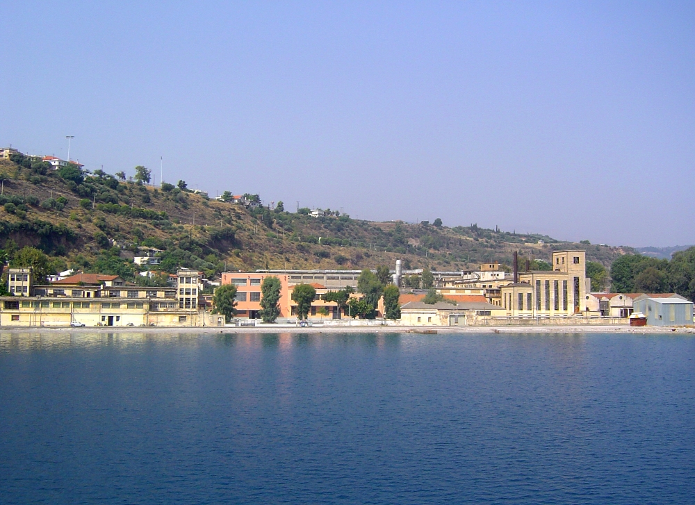
caption_skyline = Port of Aigio
city_
city_
districts =
party =
since =
elevation_min = 0
elevation_max = 40Aigio (Greek: Modern: Αίγιο, Ancient/Katharevousa: -on,
Latin : Aegium) also, Egio or Egion is a town in northeastAchaea , Greece, that has a population of around 30,000, with quite a few squares, a bus terminal and a fountain downtown. Aigio is one of the oldest cities in Greece and the Balkans. Aigion is surrounded by trees in the north and cliffs in the northwest. The city can be accessed by GR-8A from the south and west with one full and one partial interchange, and has a rest area and is also bounded. Mountains neighbor the southern part. The town sits on arable land which covers over a quarter of the community. The mountains of thePanachaicus andErymanthus are rarely seen. The commune was known as Vostitsa or Vostitza in the Middle Ages to the late 20th century.About the city
There are beautiful beaches only 5 to 10 minutes drive from the city centre. The sites of interest includes a
Mycenean House dating back to ancient times. The location is near the cliffs. Windmills are located in farmlands and groved SW of the community boundary. Hills are southwest of the city.There are squares, one closer to the hospital and a circle shaped-square slightly from the city hall are in the SW with some bushes and a fountain and is located on the old highway. The city has a hospital founded slightly west of the city and a rest area situated south of the city at GR-8A/E65. Residential houses are within and in the western part of Aigio.
History
Antiquity
Before the founding of the city, the area had a
Neolithic settlement. Aegium was founded duringHomer ic times. It became a part of theAchaean League in around 800 BC. During that peroid, it had several Olympic athletes including Straton (Στράτων), Athenodorus (Αθηνόδωρος) and more. From 330 BC until 281 BC, it was part of theKingdom of Macedonia . It was later the capital of theAchaean League from 281 BC until the annexation with theRoman Empire in 146 BC, after the fall of Greece, the Romans removed the wall of the city and Aigio lost its importance. Aegium took the territory ofHelike . Aegium split from the Roman Empire and became a part of theEastern Roman Empire and later the Byzantine Age, during that time, it was renamed Vostitsa (Βοστίτσα) after the Slavic invasion in 805, its origin of the name came from theOld Church Slavonic words vosta and vostan which meant the city of gardens or the garden city.Frankish/Ottoman Era
It was handed to the Franks in the 1200s and later in the 1457 joined the
Ottoman Empire with brief interruptions by the Venetians from 1463 until 1470 and from 1685 until 1715 before being conquered and returned to Ottoman hands. It was renamed after the Greek Independence. It was the first city to be liberated onMarch 26 during the revolution of 1821. Its economy improved after 600 years of non-Greek rule, 370 years without a nation and 300 years of Turkish rule. Agriculture was expanded and several farmlands were created around the area. Its population expanded later on and received its train station.Modern Era
After
World War II and theGreek Civil War , many buildings were rebuilt and four to five storey buildings were built. A bypass was opened in 1972, its hospital was opened and the economy expanded.A mid-1995 earthquake rumbled and damaged buildings in downtown core with a few casualties. In 1995, an earthquake shattered Aigio. It devastated the southwestern subdivision destroying houses.
Agricultural protests in February, 2004. It had blocked GR-8A. The protests lasted several days, and blockades were created and closed main highways for two days. It was followed by rioting in the groves and rioting at a building in the night. On February 4, 2004, riots over demanding wage hikes for farmers took place in the 172nd km interchange or the Aigio interchange, a sign, a 172nd km post facing the westbound lanes, some bushes were damaged as they clashed with the police. Another one a day later took place near the olive grove and trapped some people. Supertrucks were blocking the superhighway. On January 28, 2005, tractors from the rural areas near Aigio were blocking streets so the farmers can demand better wages. It happened between noon and afternoon hours.
2007 Forest Fires
South of Aigio on Thursday
July 19 ,2007 , a forest fire struck in the area ofDervenaria causing panic to its residents and danger. Residents were evacuated to their families outside the danger zone. Firefighters with their fire trucks and their emergency vehicles battled the enormous blaze and took hours to contain. One of the vehicles were on a straight road that contains forests. Alongside, helicopters and planes battled the fire. The fire quickly spread over the mountains and into the settlement. Some of its blazes were towering as high as 30 m on a fir (Greek Fir ) tree. Several residents were cut off with hydro. Several houses and properties were destroyed along with a part of the village, one report included two cars and carriage trucks being burnt in its entirely leaving without a cover. The ground was unfavorably transformed into a groggy ashy scenery from its natural beauty. The fire disintegrated onJuly 20 . The fire was seen around area and across in Fokida.Six days later on
July 25 that was also a heatwave that staggered the southern and the southeastern portion of the continent, a larger fire consumed several villages in south of Aigio and includes Mavriki, Kounina, Paraskevi and Pyrgaki, Pteri and Koumari, it later spread to almost the entire municipality includingMamoussia ,Ano Diakopto andZachloritika outside the municipality, fires are almost entirely founded sporadically and burnt approximately one-third of the area. It rapidly consumed forests and pine trees especially the area of Dervenakia. It became the areas' worst fire in years and decades in the peninsula. Several firefighters, planes and helicopters battled the blaze that several were towering. The fire was seen in the Fokida prefecture but the haze was limited. Its smokes were towering and residents were panicking yet again. Hundreds of properties were damaged along with several farms. The fire slowed onJuly 28 and ended in the northwestern portions includingKounina and parts of Chatzi, it later ended in its entirety onJuly 29 . Several more villages stopped its fires in central Aigialeia. It transformed a natural view into an ugly unpopular scenery. One report was that a house built on the hilltop saw its rooftop burnt and another one uphill and nearly surrounded with forests. The fire did not affect the villages of Dafnes,Valmitika ,Temeni , the northwestern portion and the city of Aigio along with almost the entire plain.Transportation
The Port of Aigion serves ferry service to
Agios Nikolaos in the northeast. Ferry service is very small and only has three Ferries daily. The trip is 45 minutes long. It is on a road off the old highway. The port is crossed by rail. East of the port is a railway station and some buildings. The city is bounded by a river in the east and west. It can be accessed by another highway forTemeni , Pteri andKalavryta on GR-31.Municipal districts
*Aigio
*Chantzi
*Dafnes
**Agios Ilias
*Digeliotika
*Kouloura
*Koumari
*Kounina
**Agia Anna
**Pelekistra
**Petrovouni
*Mavriki
**Ano Mavriki
**Agios Ioannis
**Kato Mavriki
*Melissia
**Lakka
**Pyrgaki
*Paraskevi
*Pteri or Fteri
**Achladea
**Agios Andreas
**Agios Panteleimonas
**Boufouskia
**Kato Pteri
*Pirgaki
*Selinountas
*Temeni
*Valimitika ettlements
*Agios Nikolaos
*Foniskaria
*SotirasNearest places
*Myrtia, west
*Temeni , eastHistorical population
Newspapers
*"
Filodimos "
*"Proti tis Aigialeias "porting clubs
*
Aris Valimitika
*Egieas Egion
*Olympiakos Aigio
*Panaigialeios - fourth division
*T.A.D. '93 Aigiou
*Thyella Aigio ee also
*
List of settlements in the Achaea prefecture
*Gabriel Aghion References
External links
* [http://www.aigio.gr/ Official website of the city of Aigio]
* [http://www.aigiorama.gr The directory of the city of Aigio] el icon
* [http://www.gtp.gr/LocPage.asp?id=3276 GTP - Aigio]
* [http://www.gtp.gr/LocPage.asp?id=3275 GTP - Municipality of Aigio]
* [http://www.gtp.gr/LocPage.asp?id=61009 Ancient Aegium]
Wikimedia Foundation. 2010.