- Observatory Hill, Darjeeling
-
Observatory Hill is a hill near Chowrasta square, or The Mall as it is popularly known, in Darjeeling, West Bengal, India. Magnificent views of snow-clad peaks, including Mount Kanchenjunga, are visible from the Observatory Hill. The Bhutia Busty monastery was originally located here. Now the hill has the temple of Mahakal. Two important arteries of the town, Nehru Road and Bhanubhakta Sarani, meet at Chowrasta.[1]
Contents
Monastery
The Bhutia Busty monastery, the oldest monastery in Darjeeling, was first located on Observatory Hill. It was built in 1765 by Lama Dorje-Rinzing. The name Darjeeling is believed to have originated when monks of the monastery referred to the region as "Dorje-ling", meaning the land of the thunderbolt. Another school of thought believes that it was named after Dorje-Rinzing. The monastery was sacked by a Gorkha invasion in 1815. It was rebuilt in 1861 and was moved to its present location in Bhutia Busty in 1879.[2] The ill-fated monastery was again destroyed by a 1934 earthquake and owes its present existence to the Raja of Sikkim.[1]
Temple
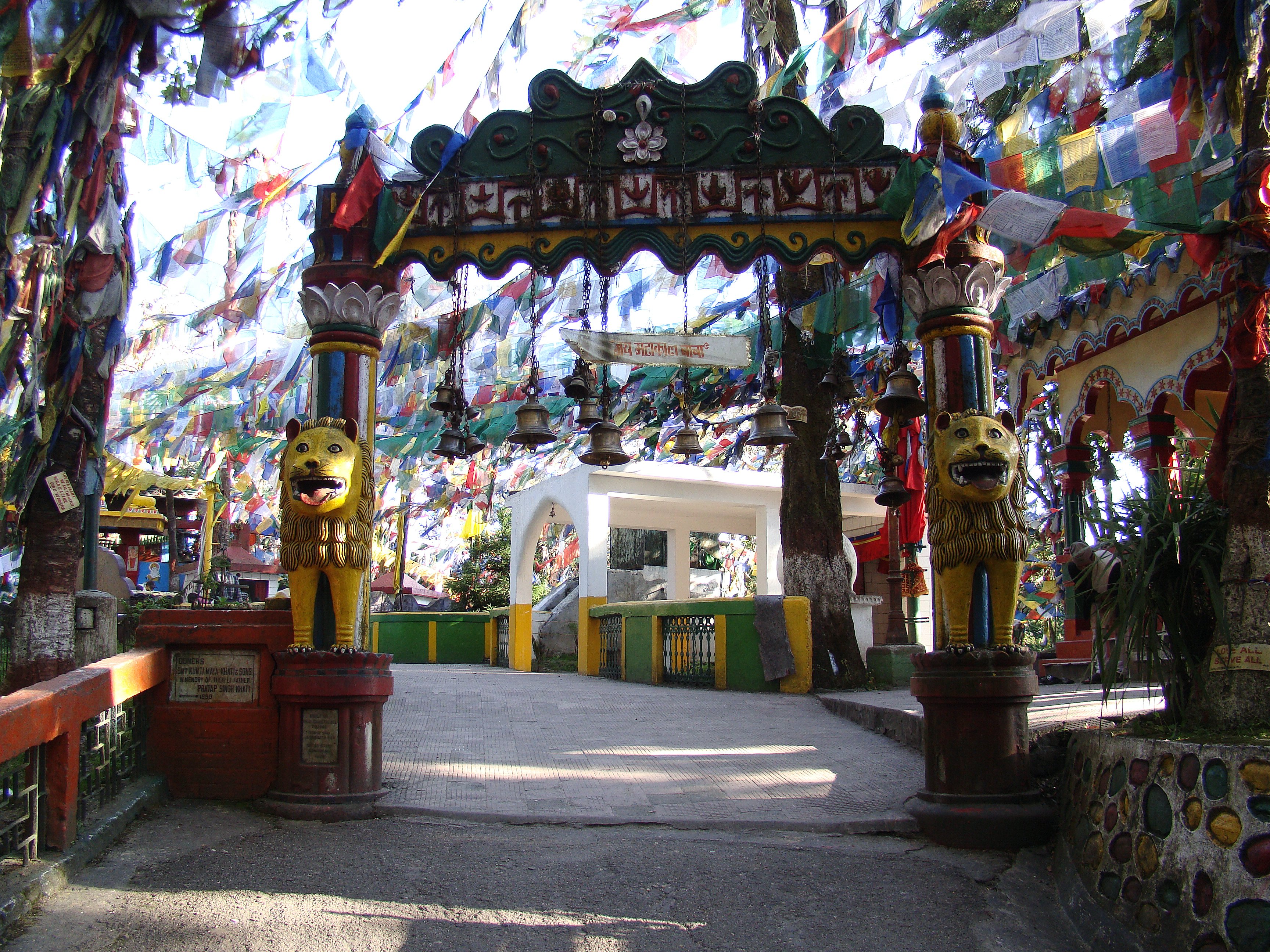
 Entrance to the temple complex at Observatory Hill
Rising abruptly from Chowrasta is the hilltop. Situated atop is the ancient temple of Mahakal, a form of Lord Shiva.[1] There is a cave sacred to worshippers in the temple. In Sanskrit, the word "Durjay Ling", means "Shiva of invincible prowess, who rules the Himalayas." There is a suggestion that the name Darjeeling could have emanated from this name.[3] The place where the Mahakal Temple stands was once occupied by the Buddhist monastery. It is still a place of great sanctity for the Bhutias. Bells ring in the midst of fluttering flags,[1] which are used to pray in the shrine. Monkeys are seen in plenty at the Observatory Hill.[4]
Tourist centre
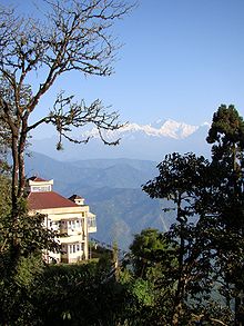
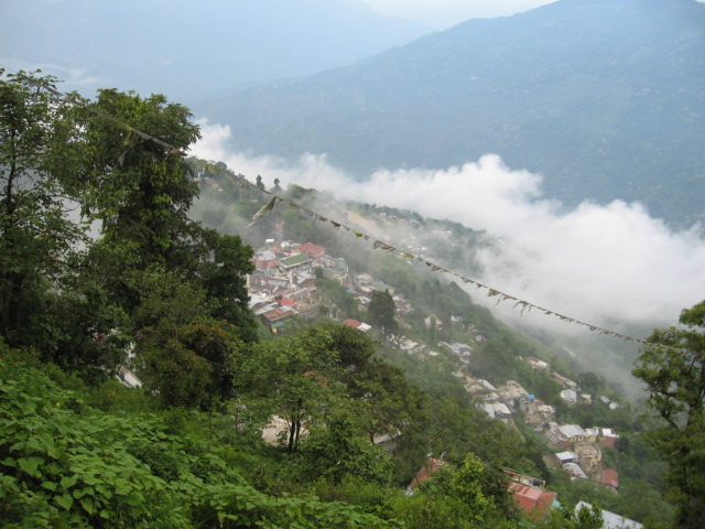
Chowrasta and The Mall around Observatory Hill are the main centres of tourist attraction in Darjeeling. They spread on hill slopes at an altitude of 2,134 metres (7,000 feet). In clear weather, one can see Mount Kanchenjungha and twelve other peaks, all above 20,000 feet.[1] The view is clear during October to November. At other times of the year, it is a matter of luck, with clouds engulfing the entire area and some portions of the view available at opportune moments. There are many people similar to the characters in Satyajit Ray’s Kanchenjungha, who wait for long periods of time for the mist to clear so that they may have a view of third highest peak in the world.[5]
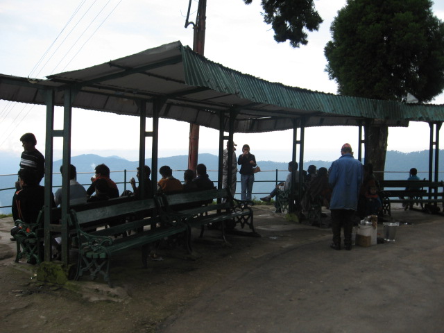
In spite of the high tourist flow, The Mall is the cleanest area in Darjeeling. Apart from the mountain views, tourists flock to the Chowrasta for pony rides (mostly by children) and collecting souvenirs.[2] There are benches for tourists to sit and enjoy the "show". Vehicles are not allowed in The Mall, except for a small stretch near Raj Bhavan and Windamere Hotel.[6]
Around the hill
There are several important places around Observatory Hill. Birch Hill, or Jawahar Parbat, an off-shoot from The Mall, is an exclusive residential section where the Raj Bhavan is situated.[7] The Himalayan Mountaineering Institute is located on the western spur of Jawahar Parbat, about a kilometre and half from Observatory Hill.[8] The Windamere Hotel and West Bengal Government’s Tourist Lodge stand above The Mall. Windamere, a cozy boarding area of the bachelor English and Scottish tea planters, was converted into a hotel in 1939.[9] There are a number of hotels and restaurants in and around Chowrasta or The Mall. A road from The Mall leads to "Step Aside" - the house of the eminent freedom fighter Chittaranjan Das.[10] He died in Darjeeling on 16 June 1925.[11] The latest addition coming up is a large “Ranga Manch” (theatre) overlooking the Chowrasta.
The range on which Darjeeling is located is Y-shaped with the base resting at Katapahar and Jalapahar and two arms diverging north from Observatory Hill. The northeastern arm dips suddenly and ends in the Lebong spur, while the northwestern arm passes through North Point and ends in the valley near Tukver Tea Estate.[12]
Gallery
-
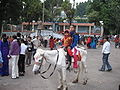
Children getting ready for a pony ride on Chowrasta
-
Windamere Hotel Darjeeling
-
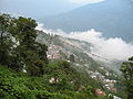
A view from The Mall
-

A view-point on The Mall
References
- ^ a b c d e Agarwala, A.P. (editor), Guide to Darjeeling Area, 27th edition, p. 68, ISBN 81-87592-00-1.
- ^ a b Chattopadhyay, Suhrid Sankar. "Return of the Queen". Focus on Darjeeling. Frontline, 1-14 Jan 2005. http://www.hinduonnet.com/fline/fl2201/stories/20050114006111400.htm. Retrieved 2 July 2007.
- ^ "Darjeeling". Hill Stations. webindia123. http://www.webindia123.com/tourism/hillstations/darjeeling.htm. Retrieved 2 July 2007.
- ^ "Observatory Hill in Darjeeling". Sight seeing in Darjeeling. asiarooms.com. http://www.fr.asiarooms.com/travel-guide/india/darjeeling/sightseeing-in-darjeeling/observatory-hill-in-darjeeling.html. Retrieved 2 July 2007.
- ^ "Kanchenjungha". Life and filmmaking of Satyajit Ray. satyajitray.org. http://www.satyajitray.org/films/kanchen.htm. Retrieved 2 July 2007.
- ^ "Trip Advisor". http://www.tripadvisor.in.
- ^ A Road Guide to Darjiling, p. 9, TTK Healthcare Ltd, Publications Division, ISBN 81-7053-173 X..
- ^ "Himalayan Moutaineering Institute". darjeelingnews.net. http://www.darjeelingnews.net/himalayan_mountaineering_institute.html. Retrieved 2 July 2007.
- ^ "Hotel Windamere, Darjeeling". Heritage hotel in Darjeeling. himalayan-adventure.com. http://www.windamerehotel.com. Retrieved 2 July 2007.
- ^ "Darjeeling". Places to go – hillside. Swarnakshar Prakasani Pvt. Ltd 2004. Archived from the original on 11 June 2007. http://web.archive.org/web/20070611202519/http://www.bhraman.com/places_to_go/hillside/darjeeling.html. Retrieved 2 July 2007.
- ^ "Deshbandhu Chittaranjan Das (1870 - 1925)". political figures. Lokpriya. http://www.lokpriya.com/personalities/political/past/deshbandhu.html. Retrieved 26 April 2010.
- ^ Khawas, Vimal (2003). "Urban Management in Darjeeling Himalaya: A Case Study of Darjeeling Municipality.". The Mountain Forum. http://www.mtnforum.org/resources/library/khawv03e.htm. Retrieved 2 July 2007. Now available in the Internet Archive in this URL (accessed on 2 July 2007)
Categories:- Visitor attractions in Darjeeling
-


Wikimedia Foundation. 2010.