- Natuna Islands
-
Natuna Islands — Islands and Regency — Location in Lampung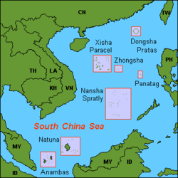
Country Indonesia Province Riau Islands Capital Ranai Area – Total 3,420 km2 (1,320.5 sq mi) Population – Total 98,000 – Density 28.7/km2 (74.2/sq mi) Time zone WIB (UTC+7) Website http://www.natunakab.go.id/ The Natuna Islands archipelago (272 islands) is located in the Natuna Sea in the larger Tudjuh Archipelago, off the northwest coast of Borneo. The islands are administratively part of the Riau Islands province of Indonesia and are the northernmost non-disputed island group of Indonesia. The Natuna islands are divided into three groups: North Natuna, which includes Laut Island (Pulau Laut); Middle Natuna, which includes Natuna Besar; and South Natuna, which includes Subi Besar.
Contents
Economy
Despite important natural gas reserves, most of the locals work as fishermen or farmers. There is no significant tourism industry.
Geography
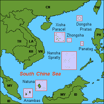
The Natuna Islands are a 272-island archipelago of Indonesia, located in the Natuna Sea between Peninsular Malaysia to the west and Borneo to the east. The Natuna Sea itself is a section of the South China Sea.
Natural resources
Natuna has large reserves of natural gas (estimated to 1.3 billion m³) that is exported to neighboring countries such as Singapore. Matak Island now serves as an offshore exploitation base.
Ecology
The Natuna Islands have a remarkable avifauna with 71 species of bird registered, including the near-threatened Lesser Fish-eagle, the Natuna Serpent-eagle or the rare Silvery Pigeon. Among other species endangered species, we find the Green Iora, the Brown Fulvetta or the Green Broadbill.
Colorful coral reef is found in the neighboring waters. Natuna Banded Leaf Monkey is among the 25 most endangered primates on Earth.
See also
- Anambas Islands
- Badas Islands
- Tambelan archipelago
Further reading
- National Geospatial-intelligence Agency (2005) "Borneo: Northwest Coast and Kepulauan Tudjuh" Sailing directions (enroute): Borneo, Jawa, Sulawesi, and Nusa Tenggara United States National Geospatial-Intelligence Agency
Coordinates: 4°00′N 108°15′E / 4°N 108.25°EMain Islands of Riau Islands Province (Propinsi Kepulauan Riau) Riau Archipelago: Bintan | Batam | Rempang | Galang | Bulan | Combol | Kundur | Karimun (Riau Is)
Natuna Islands: Natuna Besar | South Natuna archipelago | Tambelan archipelago
Anambas Islands: Tarempa | P. Matak | Jemaja Andriabu
Lingga Islands: Lingga | Singkep | Sebangka | Bakung | P. Selayar (Riau Is) | Posik | P. Serak | Lalang | Temiang | Mesawak

Regencies and cities of Riau Islands Province Capital: Tanjung PinangRegencies
Cities
Categories:- Regencies of Riau Islands
- Natuna Islands
- Archipelagoes of Indonesia
- Riau
Wikimedia Foundation. 2010.