- Meols Cop
-
This article is about the suburb of Southport. For the village on the Wirral Peninsula, see Meols.
Coordinates: 53°38′24″N 2°58′19″W / 53.640°N 2.972°W
Coordinates: 53°38′12″N 2°58′17″W / 53.6366°N 2.9714°W
Meols Cop 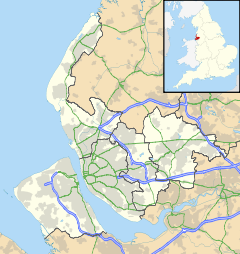
 Meols Cop
Meols Cop shown within MerseysideMetropolitan borough Sefton Metropolitan county Merseyside Region North West Country England Sovereign state United Kingdom Post town SOUTHPORT Postcode district PR8 Dialling code 01704 Police Merseyside Fire Merseyside Ambulance North West EU Parliament North West England UK Parliament Southport List of places: UK • England • Merseyside Meols Cop is not an area of Southport, but simply a railway station located within Blowick, Southport Merseyside in north-western England. It is not to be confused with Meols on the Wirral Peninsula. The two can be differentiated by pronunciation — Meols Cop is pronounced Meels, but Meols, Wirral is pronounced Mells.
The station is served by trains to Southport railway station or Wigan Wallgate railway station and beyond. Meols Cop railway station opened on 2 September 1887, and served both lines. The line from Butts Lane Junction to Altcar & Hillhouse closed on 26 September 1938, but the line through Meols Cop is still open today. As in 1965, the direct line from Pool Hey Junction to St. Luke's closed and trains to and from Wigan were diverted to run via the former Altcar line and a section of the former Southport to Preston line. Meols Cop railway station remained open and is served by Wigan and Southport trains today; goods train services were however withdrawn on 27 November 1967.
Districts and wards of the Metropolitan Borough of Sefton Districts Ainsdale · Aintree · Birkdale · Blowick · Blundellsands · Bootle · Brighton-le-Sands · Carr Houses · Churchtown · Crosby · Crossens · Ford · Formby · Freshfield · Great Crosby · Hightown · Highpark · Hillside · Ince Blundell · Kennessee Green · Kew · Lady Green · Litherland · Little Altcar · Little Crosby · Lunt · Lydiate · Maghull · Marshside · Melling · Meols Cop · Netherton · Orrell · Seaforth · Sefton · Southport · Thornton · Waddicar · Waterloo · WoodvaleCouncil Wards Categories:- Towns and villages in Sefton
- Southport
- Merseyside geography stubs

Wikimedia Foundation. 2010.