- Oklahoma State Highway 71
-
State Highway 71
Route information Maintained by ODOT Length: 20.92 mi[1] (33.67 km) Major junctions South end:  SH-31 in Quinton
North end:  SH-2 south of Porum
Highway system Oklahoma State Highways
Oklahoma turnpike system←  US-70
US-70SH-72  →
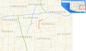
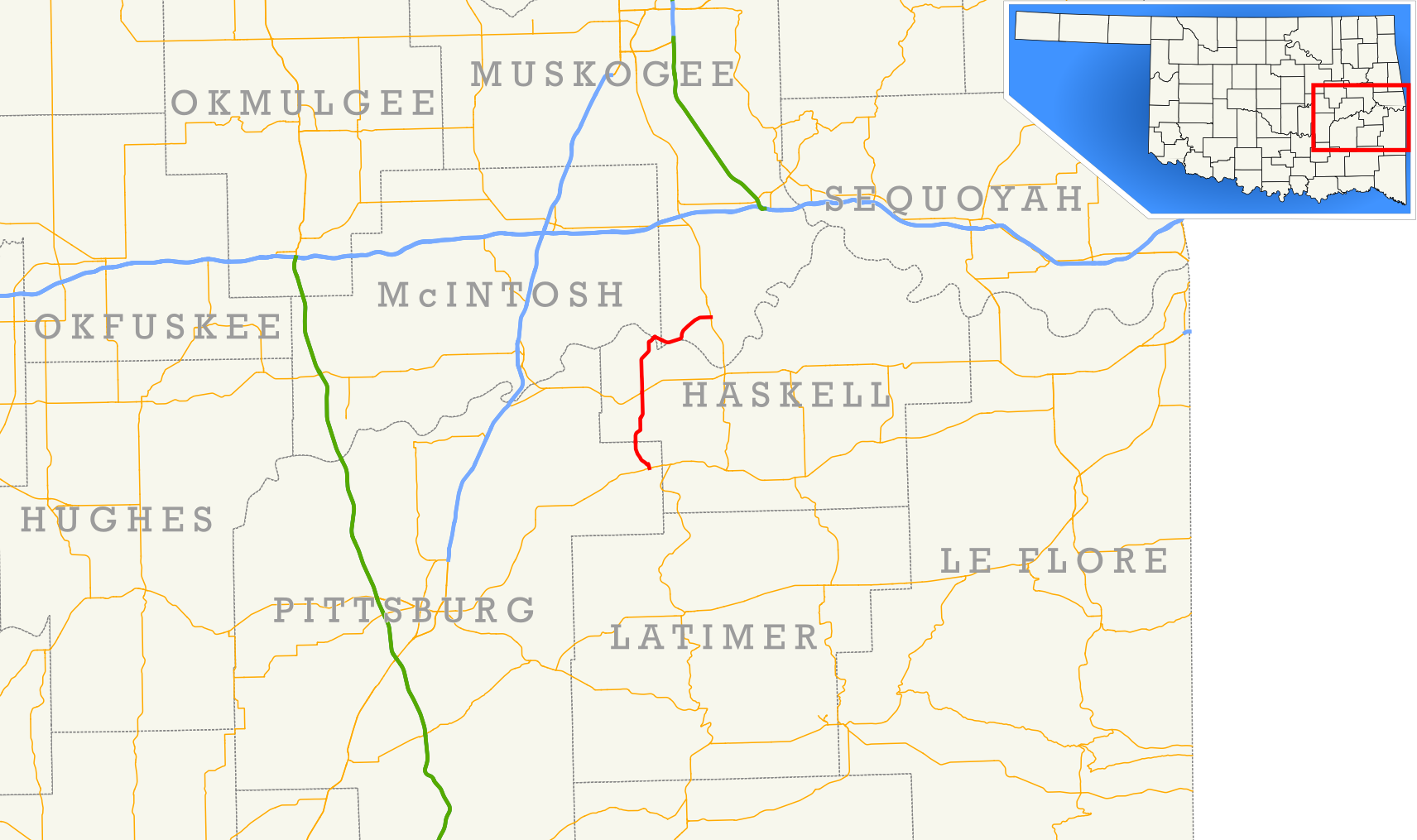
→State Highway 71 (abbreviated as SH-71 or OK-71) is a state highway in eastern Oklahoma. It runs from State Highway 31 in Quinton north to intersect State Highway 9 near Enterprise. It then continues north to Lake Eufaula Dam, and then turns east to end at State Highway 2. It has no lettered spur routes.
Contents
Route description

State Highway 71 begins at SH-31 on the west side of Quinton in northeast Pittsburg County. The highway initially follows the Quinton street grid, which takes it in a north-northwest direction. As the grid peters out on the outskirts of town, SH-71 breaks away to the west and then to the northwest to avoid Beaver Mountain, gradually curving around to a northerly heading as it approaches the county line.[2] The route crosses into Haskell County about three miles north of Quinton.[3]
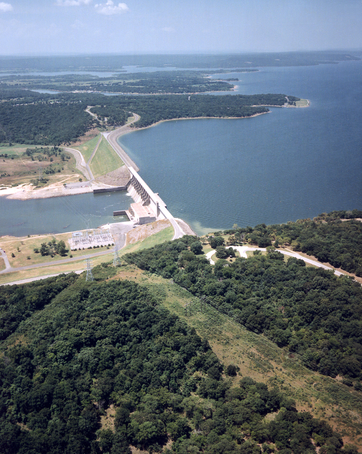
The road continues north in Haskell County until it veers northeast and crosses Longtown Creek. The road then turns back north, passing through rural parts of the county.[2] SH-71 intersects SH-9 in the unincorporated community of Enterprise, just over five miles (8 km) north of the Pittsburg–Haskell county line.[4] North of Enterprise, SH-71 parallels Brooken Creek until it drains into Lake Eufaula.[2] The highway serves the boat docks and campgrounds on the east side of the lake, which is the largest entirely within Oklahoma.[5] SH-71 then runs across the dam impounding the lake, bringing it into McIntosh County.
SH-71 merely cuts across the southeast corner of McIntosh County; the highway spends only 1.01 miles (1.63 km) within its boundaries.[6] It soon enters Muskogee County, now on an eastbound trajectory. The road runs through the Canadian River valley, staying between the river and Hi Early Mountain. The route next turns northeast, away from the river but still skirting the mountain's base. It finally comes to an end at SH-2 about 1.5 miles (2.4 km) south of Porum.[2][7]
History
Junction list
County Location Mile[1] Destinations Notes Pittsburg Quinton 0.00 SH-31Southern terminus Haskell Enterprise 8.24  SH-9
SH-9McIntosh No major junctions Muskogee 20.92 SH-2Northern terminus 1.000 mi = 1.609 km; 1.000 km = 0.621 mi References
- ^ a b Oklahoma Department of Transportation. 2008 Control Section Maps, Pittsburg, Haskell, McIntosh, and Muskogee Counties. See individual map references below.
- ^ a b c d DeLorme (2006). Oklahoma Atlas and Gazetteer (Map). 1:200,000. p. 46.
- ^ Oklahoma Department of Transportation. 2008 Control Section Maps (Map). p. Pittsburg. http://www.odot.org/hqdiv/p-r-div/maps/control-maps/pittsburg.pdf. Retrieved 2010-03-09.
- ^ Oklahoma Department of Transportation. 2008 Control Section Maps (Map). p. Haskell. http://www.odot.org/hqdiv/p-r-div/maps/control-maps/haskell.pdf. Retrieved 2010-03-09.
- ^ U.S. Army Corps of Engineers. "Tulsa District Lake Information—Eufaula Lake". http://www.swt.usace.army.mil/recreat/OPSField.CFM?tblOPSField__LakeName=Eufaula%20Lake. Retrieved 2010-03-09.
- ^ Oklahoma Department of Transportation. 2008 Control Section Maps (Map). p. McIntosh. http://www.odot.org/hqdiv/p-r-div/maps/control-maps/mcintosh.pdf. Retrieved 2010-03-09.
- ^ Oklahoma Department of Transportation. 2008 Control Section Maps (Map). p. Muskogee. http://www.odot.org/hqdiv/p-r-div/maps/control-maps/muskogee.pdf. Retrieved 2010-03-09.
External links
Categories:- State highways in Oklahoma

Wikimedia Foundation. 2010.