- NASA Causeway
-
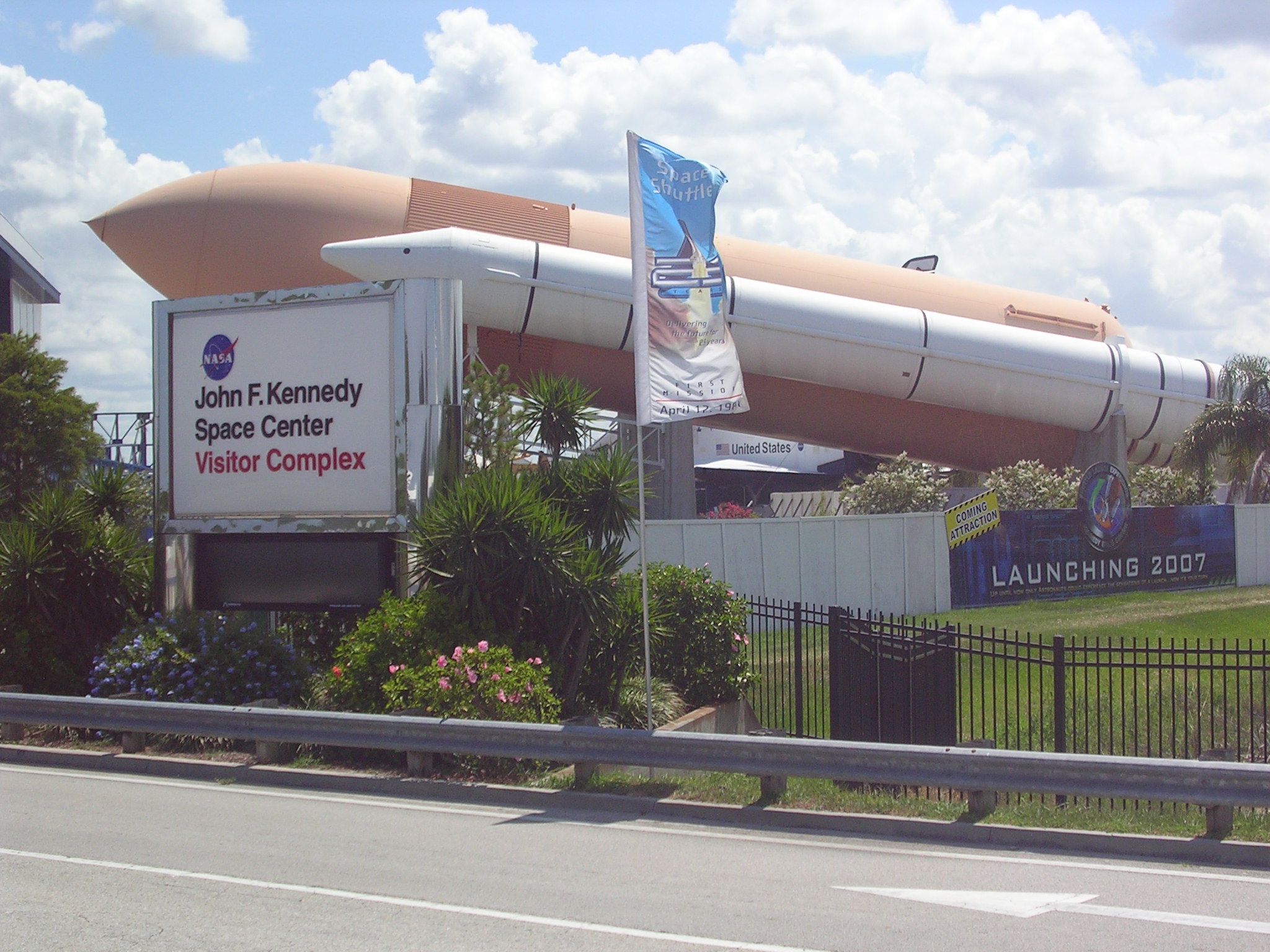
 Visitors Complex from NASA Parkway
NASA Parkway is an east-west roadway in Brevard County, Florida, frequently referred to by its easternmost section, the NASA Causeway, from which the general public viewed NASA manned space launches. Designated as part of Florida State Road 405, the Parkway connects the Florida mainland to Merritt Island and onward—-over the NASA Causeway-- connects Merritt Island to Cape Canaveral. As such, the NASA Parkway is the main route connecting points of interest in Titusville, Florida to the Kennedy Space Center (on Merritt Island) to Cape Canaveral Air Force Station.
NASA Parkway West (from west to east)
The portion of the parkway between U.S. Route 1 and State Road 3 is designated NASA Parkway West and also known as NASA Causeway West.
Although the designation of Florida State Route 405 begins further inland, the Parkway itself begins on the mainland when Columbia Boulevard crosses U.S. Route 1 in Titusville. Continuing eastward, NASA Parkway West crosses the Indian River Lagoon. A bascule bridge permits boats on the Intercoastal Waterway to pass through the causeway. Continuing eastward, approximately 2 miles (3.2 km), it enters the Merritt Island National Wildlife Refuge and the John F. Kennedy Space Center near its intersection with Space Commerce Way (also known as Government Road). At this point, the Merritt Island peninsula is at its widest and about 6 miles (9.7 km) wide, permitting the Parkway to make maximum use of land sections in reaching Cape Canaveral.
East of Space Commerce Way, the Parkway passes the Kennedy Space Center Visitor Complex. The general public is not permitted beyond this point. Approximately 0.6 miles (0.97 km) east of the Visitor Complex, a NASA security gate permits access to authorized tour buses and Kennedy Space Center staff and supply vehicles only. Immediately east of the gate, the Parkway intersects with Florida State Route 3, the division line between the western and eastern portions of the Parkway.
Tour buses access the Vehicle Assembly Building, the Saturn V Center and the Space Shuttle landing strip by journeying north from this point on Kennedy Parkway.
NASA Parkway East (from west to east)
The eastern section of the NASA Parkway, designated NASA Parkway East begins at its intersection with State Road 3 in the former town of Orsino, Florida. Traveling east, it passes an area of support buildings and offices. At the end of this area, it reduces from four lanes to two and crosses the Banana River as a two-lane causeway with a bascule bridge.
The causeway over the Banana River is commonly referred to as The NASA Causeway, and serves as the closest viewing area to which the general public can be admitted for launches of the Space Shuttle. During launches, spectators with the appropriate tickets are bussed to the NASA Causeway from the Visitor Complex and can view Launch Complex 39 pads A and B, about 6 miles (9.7 km) away.
The NASA Parkway designation ends shortly after the NASA Causeway's eastern end, where the parkway terminates at the Samuel C Philips Parkway. From this point, authorized users can access the point of Cape Canaveral via Central Control Road. The Cape Canaveral Light is visible, and, via Lighthouse Road, authorized users can access Launch Complex 46.
Public alternatives to NASA Parkway West
While the NASA Parkway is the principal access route for tourists from Titusville and points west (such as Orlando, Florida), visitors from points to the south, such as Cocoa Beach, Florida need not use NASA Parkway West to cross the Indian River. Instead, they may approach the Kennedy Space Center from the south on Florida State Route 3. Diverted by a security gate, the general public must make a left on Space Commerce Way (Shown as Government Road on some maps), and travel north to join NASA Parkway West to the west of the Visitor Complex.
Notable bridges and tunnels in Florida Panhandle Escambia Bay · Garcon Point · John Gorrie · Mid-Bay · Pensacola Bay · St. George Island · Trammell · Victory
North Acosta · Bridge of Lions · Buckman · Dames Point · Fuller Warren · Hart · Mathews · Memorial · Strauss Trunnion
West Central East Central A. Max Brewer · Bennett Causeway · Bert Dosh · Broadway · Eau Gallie Causeway · Granada · Melbourne Causeway · Merritt Island Causeway · NASA Causeway · Pineda Causeway · Port Orange Causeway · Roosevelt · Wabasso
South Broad Causeway · Cape Coral · Coral Springs† · Julia Tuttle Causeway · John F. Kennedy Causeway · John Ringling Causeway · Lehman Causeway · MacArthur Causeway · Matanzas Pass · Midpoint · Rickenbacker Causeway · Sanibel Causeway · Snow-Reed‡ · Venetian Causeway
Keys Bahia Honda · Card Sound · Jewfish Creek · Overseas Highway · Seven Mile
Tunnels † – Covered bridge‡ - Swing bridge
See also: List of bridges in FloridaCoordinates: 28°31′39″N 80°46′15″W / 28.5275764°N 80.7709017°W
Categories:- Bridges in Brevard County, Florida
- Intracoastal Waterway
- Roads in Brevard County, Florida
- Road bridges in Florida
Wikimedia Foundation. 2010.