- Nea Kameni
-
Nea Kameni 
Nea Kameni (front), Palea Kameni (front-left), part of Aspronisi (far left) and Therasia (front, back) as seen from Thera, SantoriniLocation Location Santorini, Greece Coordinates 36°24′N 25°24′E / 36.4°N 25.4°ECoordinates: 36°24′N 25°24′E / 36.4°N 25.4°E Geology Type lava dome[1] Last eruption 1950  Boats, moored to large boulders of lava at Nea Kameni, Santorini
Nea Kameni is a small uninhabited Greek island of volcanic origin located in the Aegean Sea within the flooded Santorini caldera. Nea Kameni and the neighbouring small island Palea Kameni (the new and old burnt islands) have formed over the past two millennia by repeated eruptions of dacite lava and ash. Major eruptions over the past 300 years took place in 1707-1712, 1866–1870, 1925–1928, and 1939-1941. The last small eruption happened in 1950 and involved lava dome extrusion.[2]
Nea Kameni is nearly round and has a diameter of approximately 2 kilometers and an area of 3.4 km2. Nea Kameni is monitored closely by scientists from the Institute for the Study and Monitoring of the Santorini Volcano (ISMOSAV)[3] and is a protected scientific site. The island has many active sulfur vents, as well as a carpet of red grassy succulents on the thin soil in the summertime.
The nearly barren island is visited daily by dozens of tourist boats throughout the summer. Visitors climb a gravel path to reach the top of the 130-meter-high volcanic crater, where it is possible to complete a full circuit of the rim.
References
External links
- Nea Kameni Virtual Tour, Volcano 360 Panorama Virtual Tour in High Resolution
Islands of the Cyclades Main islands Uninhabited islands Articles on the Aegean Sea GeneralCountries Other Cyclades Amorgos · Anafi · Andros · Antimilos · Antiparos · Delos · Despotiko · Donoussa · Folegandros · Gyaros · Ios · Irakleia · Kardiotissa · Kea · Keros · Kimolos · Koufonisia · Kythnos · Milos · Mykonos · Nata · Naxos · Paros · Polyaigos · Rineia · Santorini · Schoinoussa · Serifopoula · Serifos · Sifnos · Sikinos · Syros · Therasia · Tinos · VousDodecanese Agathonisi · Arkoi · Armathia · Alimia · Astakida · Astypalaia · Çatalada · Chalki · Chamili · Farmakonisi · Gaidaros · Gyali · Imia/Kardak · Kalolimnos · Kalymnos · Kandelioussa · Kara Ada · Karpathos · Kasos · Kinaros · Kos · Küçük Tavşan Adası · Leros · Lipsi · Lebynthos · Nimos · Nisyros · Patmos · Pacheia · Platy · Pserimos · Rhodes · Saria · Salih Ada · Symi · Syrna · Telendos · Tilos · ZaforaNorth Aegean Agios Eustratius · Ammouliani · Ayvalık Islands · Büyük Ada · Chios · Chryse · Cunda · Foça Islands · Fournoi Korseon · Icaria · Imbros · Koukonesi · Lemnos · Lesbos · Metalik Ada · Nissiopi · Oinousses · Psara · Samiopoula · Samos · Samothrace · Tenedos · Thasos · ThymainaSaronic Sporades Adelfoi Islets · Agios Georgios Skopelou · Alonnisos · Argos Skiathou · Dasia · Erinia · Gioura · Grammeza · Kyra Panagia · Lekhoussa · Peristera · Piperi · Psathoura · Repio · Rineia Skyrou · Sarakino · Skandili · Skantzoura · Skiathos · Skopelos · Skyropoula · Skyros · Tsougria · ValaxaCretan Afendis Christos · Agia Varvara · Agioi Apostoloi · Agioi Pandes · Agioi Theodoroi · Agios Nikolaos · Anavatis · Arnaouti · Aspros Volakas · Avgo · Crete · Daskaleia · Dia · Diapori · Dionysades · Elasa · Ftena Trachylia · Glaronisi · Gramvousa · Grandes · Kalydon (Spinalonga) · Karavi · Karga · Katergo · Kavallos · Kefali · Kolokythas · Koursaroi · Kyriamadi · Lazaretta · Leon · Mavros · Mavros Volakas · Megatzedes · Mochlos · Nikolos · Palaiosouda · Peristeri · Peristerovrachoi · Petalida · Petalouda · Pontikaki · Pontikonisi · Praso Kissamou · Prosfora · Pseira · Sideros · Souda · Valenti · Vryonisi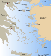
Other Categories:- Santorini
- New islands
- Volcanoes of Greece
- Volcanoes of the Aegean
- Uninhabited islands of Greece


Wikimedia Foundation. 2010.