- Molasse basin
-
Geology of the Alps 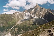
Tectonic subdivision Penninic nappes Austroalpine nappes Southern Alps Formations & rocks Geological structures Aarmassif | Dent Blanche klippe | Engadine window | Flysch zone | Giudicárie line | Greywacke zone | Hohe Tauern window | Molasse basin | Penninic thrustfront | Periadriatic Seam | Ivrea zone | Lepontin dome | Rechnitz window | Rhône-Simplon line | Sesia unit
Paleogeographic terminology Briançonnais zone Piemont-Liguria Ocean Apulian or Adriatic plate The Molasse basin is a foreland basin north of the Alps, that formed during the Oligocene and Miocene epochs. The basin formed due to the flexure of the European plate under the weight of the orogenic wedge of the Alps that was forming to the south.
In geology, the name "molasse basin" is sometimes also used in a general sense for a synorogenic (formed contemporaneously with the orogen) forelandbasin of the type north of the Alps. The basin is the type locality of molasse, a sedimentary sequence of conglomerates and sandstones, material that was removed from the developing mountain chain by erosion and denudation, that is typical for foreland basins.
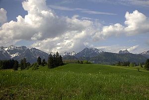 The Bavarian Alps rise from the green hills of the Molasse basin. The hills consist of tilted molasse beds, erosional material transported from the mountains into their foreland.
Contents
Geographic location
The Molasse basin stretches over a length of 1000 kilometers along the long axis of the Alps, in France, Switzerland, Germany and Austria. The western end is at Lake Geneva, where the basins outcrop is just 20 km wide. Further to the northeast the basin becomes wider. It forms the subsurface of the Swiss Mittelland and reaches its largest width (circa 130 km) in the Bavarian foreland of the Alps. From Amstetten to Sankt Pölten the basin forms a narrow band, just 10 km in width. After that is widens again to the east. North of the Danube River it connects with the Vienna basin, and is thus connected with the Pannonian Basin further east.
The region where the molasse crops out it divided into two. The Subalpine Molasse zone along the Alps and the Foreland Molasse zone further into the foreland. In the Foreland Molasse zone the molasse sediments are relatively undisturbed, in the Subalpine Molasse zone the beds are often tilted, folded and thrust over each other.
Tectonic history
Before the development of the Molasse basin, in the Mesozoic era, the region was covered by a shallow sea that was the northern margin of the Alpine part of the Tethys Ocean (Valais Ocean in the west, Tethys Ocean proper in the east). The Molasse basin was formed when the orogenic wedge of the forming Alps was pushed north over the European continental margin, due to the convergent movement of the European and Apulian plates during the Paleogene period. The weight of the orogenic wedge made the European plate bend downward, resulting in the formation of a deep marine foredeep. In the Eocene epoch (55 to 34 million years ago) the basin became deeper until it formed a small oceanic trench north of the developing orogen, in which flysch sediments were deposited.
Due to the huge amounts of sediments that were eroded from the forming mountain chain the basin was filled up and got shallower. During the Oligocene and Miocene epochs (more exactly between 10 and 30 million years ago), undeep marine to continental molasse was deposited in the basin. Around 10 to 5 million years ago, tectonic uplift had raised the basin to such a height that netto sedimentation stopped. From the south, the molasse deposits were overthrust about 10 kilometers by the Helvetic nappes, which caused the deformation in the Subalpine Molasse zone. The Jura mountains, a fold and thrust belt along the present Swiss-French border, also originated from this tectonic phase. In some places in the Jura mountains, molasse deposits were folded together with older Mesozoic limestones. In present day central Switzerland however, the molasse formed a thick, competent mass that was thrusted northward in one piece over a decollement horizon at the base of the Mesozoic, in Triassic evaporites. Deformation instead localized further north, thus forming the relatively flat Swiss Mittelland between the Alps and Jura Mountains.[1] The Swiss part of the Molasse basin is now located in between the Alps and the Jura mountains, as a large piggy-back basin. In the Eastern Alps an external mountain range such as the Jura Mountains never developed. Due to the last phase of tectonic uplift around 5 million years ago, the molasse in the Swiss Plateau, the South Bavarian plain and Eastern Austria is now at 350 to 400 meters above sea level at its northern rim, slowly rises southwards and can attain more than 1,000 m at its contact with the Alps.
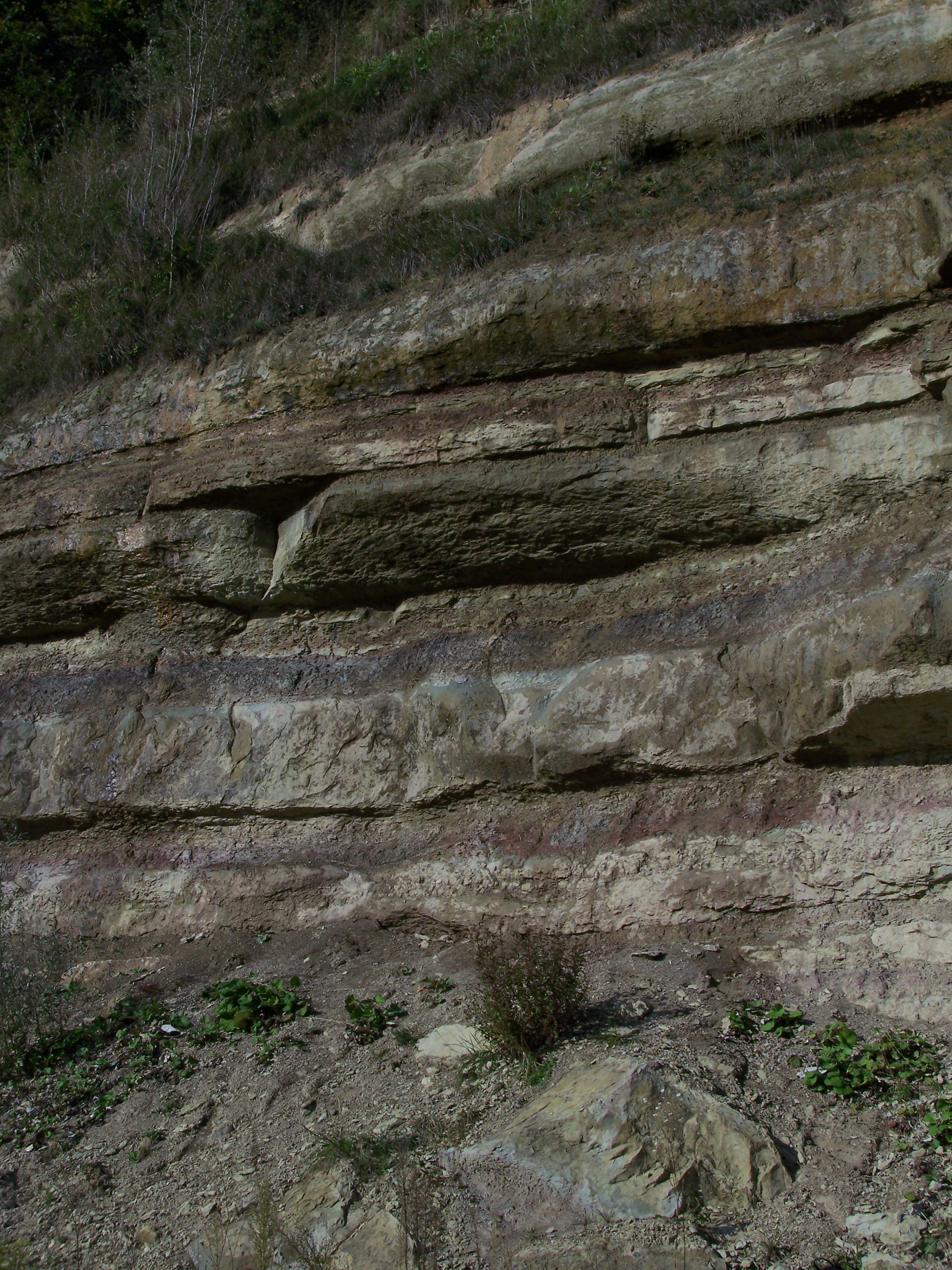
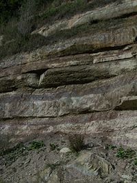 Alternating grey fluviatile sands and red silty marls of the Lower Freshwater Molasse at Wallenried, Switzerland.
Stratigraphy
The total thickness of molasse deposits in the basin can be up to 6 kilometers. Lithostratigraphically, this molasse is treated as a group that is divided into four formations. This division is made on weather the sedimentary facies is continental or marine.
The lowermost formation is the Lower Marine Molasse (in German: Untere Meeresmolasse). Its age is Rupelian (Early Oligocene, 34 to 28 million years old) and it consists of shallow marine sand, clay and marl. On top of this is the Lower Freshwater Molasse (German: Untere Süsswassermolasse) of Chattian and Aquitanian age (28 to 22 million years). Due to an eustatic drop of the sea level combined by tectonic uplift, the basin was now above sea level. This second formation therefore consists of fluviatile sands and clays and huge alluvial fan systems (conglomerates and breccias) originating from the Alps to the south.
By 22 million years ago, the Alpine foreland was flooded again due to tectonic subsidence. A shallow (intertidal) marine environment formed from Lyon to Vienna. In this environment the third formation, the Upper Marine Molasse, was formed. It consists of marine sands, clays and marls and new fan conglomerates and is of Burdigalian to Langhian age (22 to 16 million years old). More tectonic uplift caused the sea to retreat one final time and between 16 and 5 million years ago (during the Serravallian, Tortonian and Messinian/Pontian ages), the basin was in a continental facies again. The fluviatile sands and clays and fan conglomerates of this time form the Upper Freshwater Molasse, the topmost molasse formation.[2]
Around 5 million years ago a phase of uplift occurred in the Alps. During this phase the Molasse basin ceased to be an area of net sedimentation.
References
Literature
- Labhart, T.; 2005: Geologie der Schweiz, Ott Verlag, ISBN 3-7225-0007-9.
Coordinates: 47°46′08″N 10°08′25″E / 47.76889°N 10.14028°E
Categories:- Structural geology
- Sedimentology
- Geology of the Alps
- Geology of Switzerland


Wikimedia Foundation. 2010.