- Oklahoma State Highway 52
-
State Highway 52
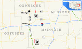
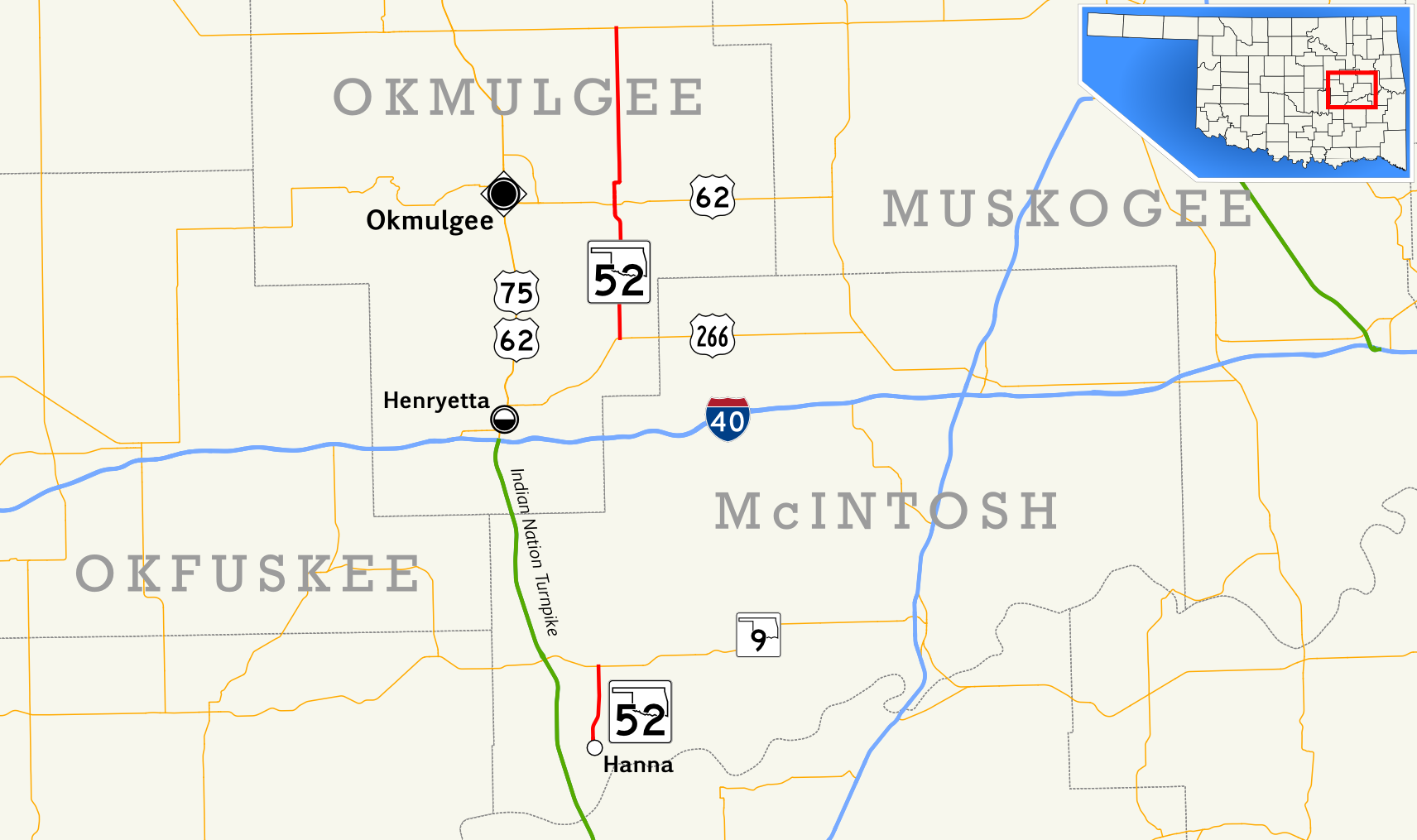
Route information Maintained by ODOT Section 1 Length: 4.2 mi (6.8 km) South end: Hanna North end:  State Highway 9
Section 2 Length: 16.5 mi (26.6 km) South end:  US-266 near Grayson
North end:  State Highway 16
Highway system Oklahoma State Highways
Oklahoma turnpike system←  SH-51
SH-51SH-53  →
→State Highway 52 (abbreviated SH-52 or OK-52) is a name for two once-connected highways in Oklahoma. There are no lettered spur routes from either of them.
Contents
Route description
Southern section
The southern SH-52 is a short, four-mile (6 km) long[1] (6.4 km long) state highway in McIntosh County, Oklahoma. It connects State Highway 9 to the town of Hanna.
Northern section
The northern SH-52 runs for 16½ miles[2](26½ km) from US-266 northeast of Grayson to SH-16. Along the way it intersects US-62 near Morris.
Connection between the two sections
At one time, at least as recently as 1972, the two sections of SH-52 were connected by a dirt section running from SH-9 to US-266. This section has since been decommissioned. [3]
References
- ^ Stuve, Eric. "OK-52s". OKHighways. http://www.okhighways.com/ok52s.html. Retrieved 2006-05-28.
- ^ Stuve, Eric. "OK-52n". OKHighways. http://www.okhighways.com/ok52n.html. Retrieved 2006-05-28.
- ^ McMahon, Martin. Terminus: SH-52 (North). Roadklahoma. 10 December 2002. URL accessed 28 May 2006.
Categories:- State highways in Oklahoma

Wikimedia Foundation. 2010.