- Mount Mulligan, Queensland
-
Mount Mulligan
Queensland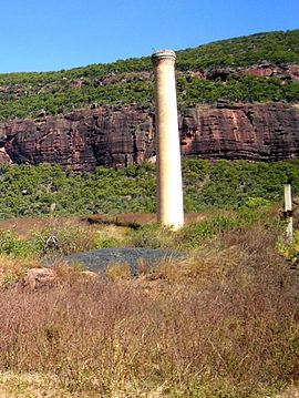
Chimney at Mount Mulligan (June 2006)
 Mount Mulligan
Population: 55[1] Postcode: 4871 Location: LGA: Tablelands Regional Council State District: Cook Federal Division: Leichhardt Mount Mulligan was a mining town in northern Queensland, Australia, the site of Queensland's worst mining disaster.
A railway connected Mount Mulligan with Dimbulah on the Chillagoe Railway. It opened on 7 April 1915 and was officially closed in January, 1958.[2]
It was a coal mining town from 1910 until 19 September 1921 when an underground explosion killed 75 miners (all the miners in the town). The mine closed, but reopened in 1923 and continued in production until 1957 when a hydro-electric scheme eliminated the need for the coal.[3]
The town's coal was mined from shafts dug into a Permian layer within the cliff face or escarpment of a large 18 km x 6.5 km free-standing conglomerate and sandstone massif (rising up to 400 metres above the township) known by the name given it by the small group of prospectors who first sighted it in 1874 while searching the Hodgkinson River for gold, under the leadership of James Venture Mulligan.[4]
The conglomerate and sandstone massif known to local Djungan aboriginal peoples as Ngarrabullgan[5] was given James Mulligan's surname. The name Mount Mulligan was later given to the township that grew in the shadows of the massif's escarpment.
The area of the township itself remains gazetted as a township,[4] but is now a ghost town, with a single cemetery, a single occupied residence, a single chimney stack, and the overgrown remains of the once busy mining operations and electricity generator.[3] At the 2006 census, Mount Mulligan and the surrounding area had a population of 55.[1]
Nearby towns are Julatten, Dimbulah, Mount Carbine and Mount Molloy.
See also
References
- ^ a b Australian Bureau of Statistics (25 October 2007). "Mount Mulligan (Mareeba Shire) (State Suburb)". 2006 Census QuickStats. http://www.censusdata.abs.gov.au/ABSNavigation/prenav/LocationSearch?collection=Census&period=2006&areacode=SSC36885&producttype=QuickStats&breadcrumb=PL&action=401. Retrieved 2009-05-03.
- ^ The Mount Milligan Branch Milne, Rod Australian Railway History, December, 2004 pp467-474
- ^ a b "Entry AHD100640". Australian Heritage Database. Department of Sustainability, Environment, Water, Population and Communities. http://www.environment.gov.au/cgi-bin/ahdb/search.pl?mode=place_detail;place_id=100640. Retrieved 30 October 2007.
- ^ a b Queensland Government's Placenames Database. Accessed 27 October 2007
- ^ David, Bruno (1996) The Ngarrabullgan Homeland Project: Current Research in Kuku Djungan country, north Queensland, Australian Archaeology. 43. Pages 32-36.
External links
- Queensland Government Placenames Database
- http://www.youtube.com/user/MikePearceFilms#play/all/uploads-all/0/yp6bysvSqcE
Coordinates: 16°51′S 144°52′E / 16.85°S 144.867°E
Categories:- Towns in Queensland
- Mining towns in Queensland
- Ghost towns in Queensland
- Queensland geography stubs


Wikimedia Foundation. 2010.