- Mull of Kintyre
-
Coordinates: 55°18′40″N 5°48′14″W / 55.311°N 5.804°W
Mull of Kintyre Scottish Gaelic: Maol Chinn Tìre 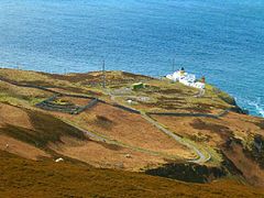
Mull of Kintyre Lighthouse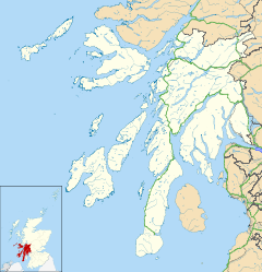
 Mull of Kintyre
Mull of Kintyre shown within Argyll and ButeOS grid reference NR5908 Parish Southend Council area Argyll and Bute Lieutenancy area Argyll and Bute Country Scotland Sovereign state United Kingdom Post town CAMPBELTOWN Postcode district PA28 Dialling code 01586 Police Strathclyde Fire Strathclyde Ambulance Scottish EU Parliament Scotland UK Parliament Argyll and Bute Scottish Parliament Argyll and Bute List of places: UK • Scotland • The Mull of Kintyre (formerly Cantyre) is the southwesternmost tip of the Kintyre Peninsula in southwest Scotland. From here, the Antrim coast is visible and an historic lighthouse, the second commissioned in Scotland, guides shipping in the intervening North Channel. The area has been immortalised in popular culture by the 1977 hit song "Mull of Kintyre" by Kintyre resident Paul McCartney's band of the time, Wings.
Contents
Etymology
The name is an Anglicisation of the Gaelic Maol Chinn Tìre (Scottish Gaelic pronunciation: [mɯːlˠ̪ çiɲˈtʲʰiːɾʲə]), or in English "The rounded [or bare] headland of Kintyre".
Mull as a geographical term is most commonly found in southwest Scotland, where it is often applied to headlands or promontories, and, often more specifically, for the tip of that promontory or peninsula.[citation needed]
The name "Mull" derives from Scottish Gaelic: Maol, meaning a headland, signifying a jutting crag, promontory, brow of a hill or rock, and also baldness or bareness.[1][2] The related derived noun refers to a land formation bare of trees, such as a rounded hill, summit, mountain or promontory.
Geography
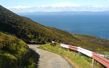
The Mull is at the extreme southwestern tip of the Kintyre peninsula, approximately 10 miles (16 km) from Campbeltown in Argyll and Bute, Western Scotland. It is about 8 miles beyond the southernmost village of the peninsula, Southend, and reached via a single track road.[3]
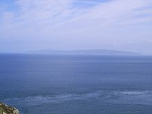
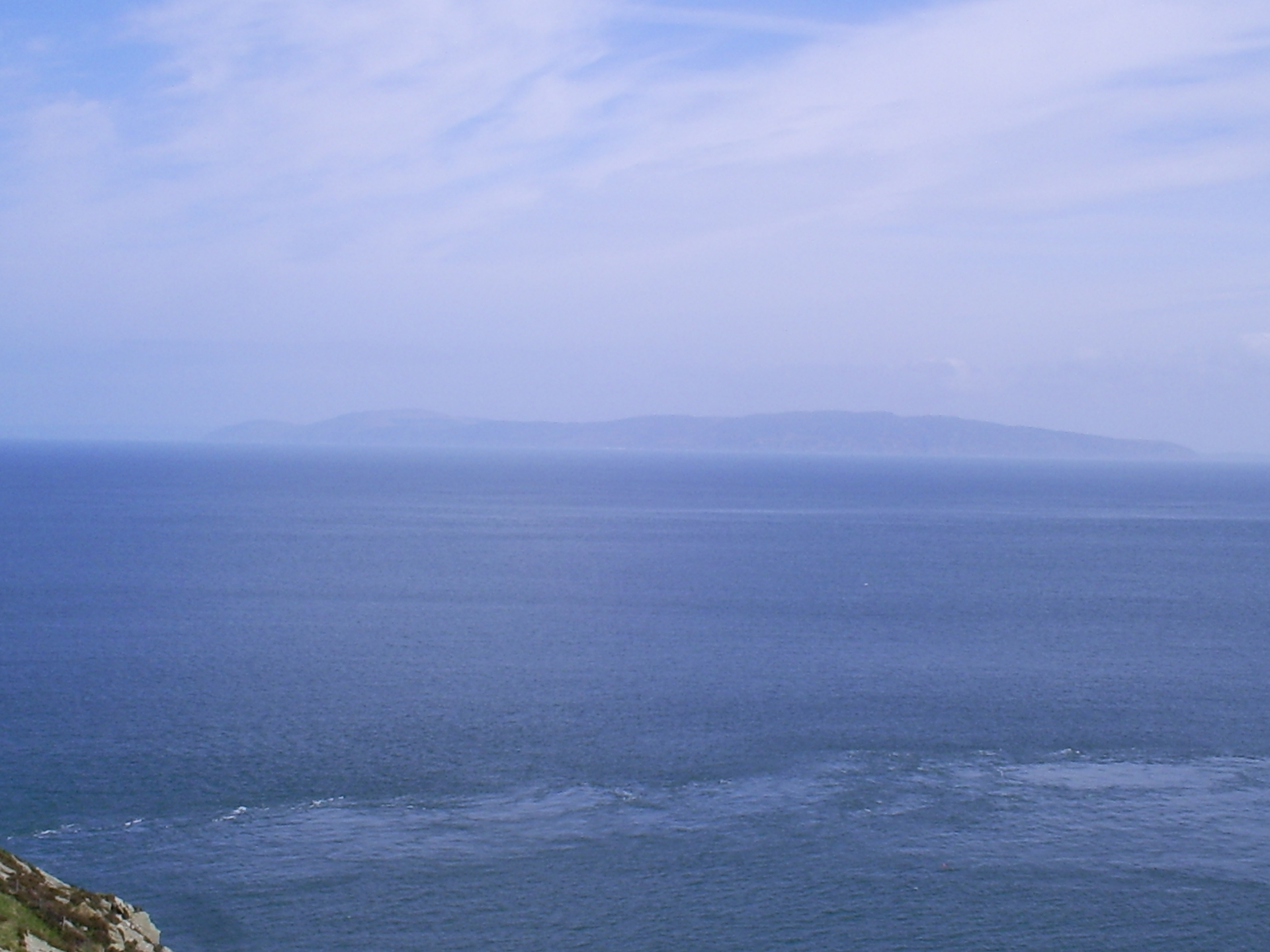
Ailsa Craig and the Antrim coast of Northern Ireland and Rathlin Island are all clearly visible from the Mull. On clearer days it is also possible to make out Malin Head in County Donegal in the Republic of Ireland, and the Ayrshire coast on the other side of Ailsa Craig. Other islands in the Firth of Clyde are also visible when looking east, especially from further back along the single track road from Southend village. The Straits of Moyle (part of the North Channel) allow sea passage from the Irish Sea to the Atlantic Ocean. Notoriously strong currents plague the tip of the Kintyre Peninsula, prohibiting swimmers and creating a hazard to unmotorised craft. At its closest point, mainland Northern Ireland is only 20 km (12 mi) from the Mull. Owing to the low-lying level of Rathlin Island and the high elevation of the Mull of Kintyre it is also possible to see over the top of Rathlin Island and on towards the Antrim coastal town of Ballycastle, immediately behind. Visitors to the Mull may also see the individual houses of the Antrim coast and the cars travelling along the coast road without the aid of binoculars, although this is dependent on having very good visibility; the area is often being plagued with sea-mists.
The steep sides rising out of the sea on all sides have made the area a hazard to flight. The remains of a number of Second World War planes litter the area.History
The Mull has been an important landbridge throughout history. It is thought that it was used by early humans in their travels from continental Europe to Ireland. In more recent times it was used again by the Scotti when they travelled from Ireland to establish the kingdom of Dál Riata in modern-day Argyll.
The area has been the site of many air crashes throughout its history; one of the most notorious was the Chinook crash on Mull of Kintyre on 2 June 1994.
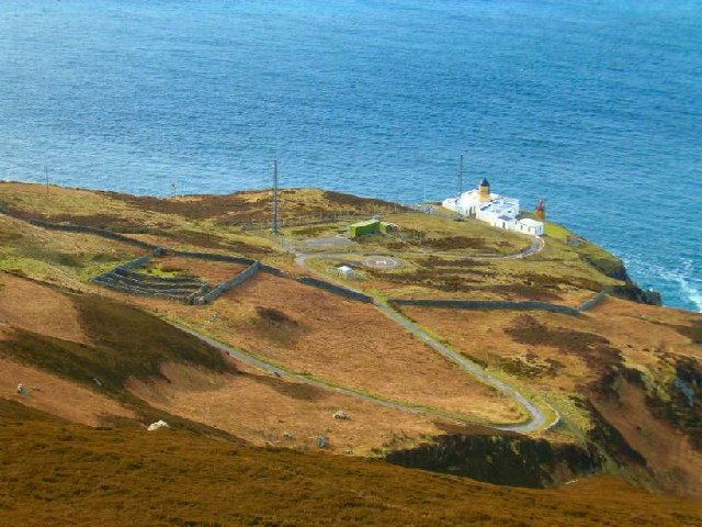
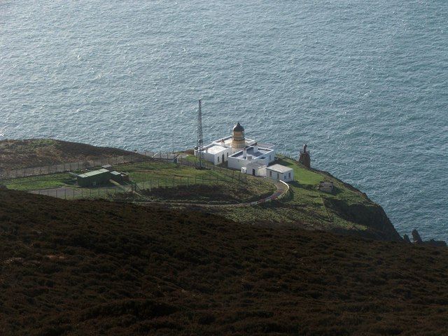
Lighthouse
Mull of Kintyre Lighthouse 
Mull of Kintyre Lighthouse Location tip of Kintyre peninsula Coordinates 55°18.626′N 5°48.208′W / 55.310433°N 5.803467°W Year first constructed 1788 Automated 1996 Construction White tower Height 12 metres (39 ft) Focal height 91 metres (299 ft) Range 24 nautical miles Characteristic Gp Fl.(2) W 20sec The Mull of Kintyre Lighthouse was the second lighthouse commissioned in Scotland by the Commissioners of the Northern Lights. It was designed and built by Thomas Smith and completed in 1788.[4] Smith had previously designed the light at Kinnaird Head, but Mull of Kintyre was a far more substantial project, in a far more remote location.
The lighthouse was rebuilt in the 1820s. The light was fixed until 1906, when it was converted to flashing, and its power increased from 8,000 to 281,000 candela.[4] It was converted to electrical power in 1976, automated in 1996 and is now monitored from Edinburgh.
The former keeper's cottages are now run as holiday cottages by the National Trust for Scotland.[5]
Trivia
The Mull of Kintyre is used as a reference in the Mull of Kintyre test, an unofficial test for the propriety of images of naked men. It is famously used by the Broadcasting Standards Commission to determine whether or not the male member may be shown on television: only penises of flaccidity similar to that of the Mull of Kintyre in relation to the mainland of Great Britain may be shown. Those in a state of greater extension are deemed to be inappropriate.[citation needed]
Footnotes
- ^ "Mull". Online Etymology Dictionary. http://www.etymonline.com/index.php?search=mull&searchmode=none. Retrieved 17 January 2011.
- ^ ""maol" in Gaelic-English Dictionary". Clan MacRae Society of Canada. http://www.clanmacrae.org/documents/gaelic-m.htm. Retrieved 17 January 2011.
- ^ "Kintyre Guide". Kintyre tourist information. http://www.kintyre.org/mullofkintyre/index.php. Retrieved 17 January 2011.
- ^ a b "Mull of Kintyre". Northern Lighthouse Board. http://www.nlb.org.uk/LighthouseLibrary/Lighthouse/Mull-of-Kintyre/. Retrieved 17 January 2011.
- ^ "Lighthouse Accommodation". National Trust for Scotland. http://www.nts.org.uk/Holidays/Specialist-properties/Lighthouses/. Retrieved 17 January 2011.
Categories:- Headlands of Scotland
- Listed lighthouses in Scotland
- Argyll and Bute
- Kintyre


Wikimedia Foundation. 2010.