- Moshannon Creek
-
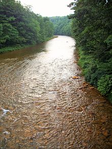 Moshannon Creek is known as the Red Moshannon for its red coloring.
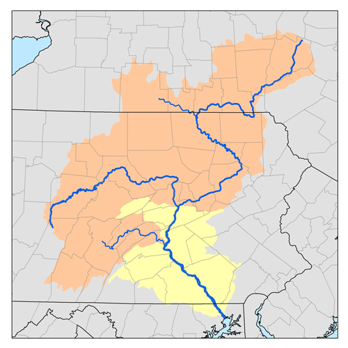
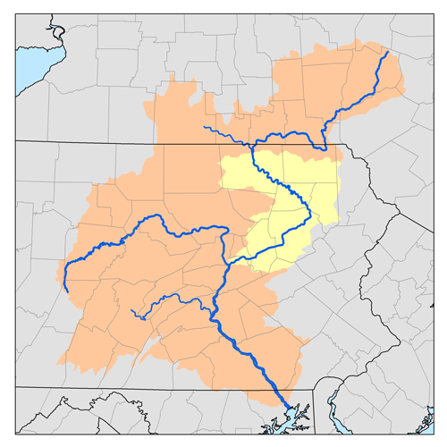
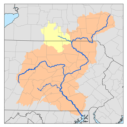
Moshannon Creek is a 57.4-mile-long (92.4 km)[1] tributary of the West Branch Susquehanna River in Centre County, Pennsylvania, in the United States. Throughout its length, it serves as the boundary between Centre and Clearfield counties.
The name "Moshannon" is said to be derived from the Native American Moss-Hanne, meaning "moose stream".[citation needed]
Moshannon Creek, commonly called the "Red Moshannon" or "Red Mo", is noted for its reddish-orange rocks, banks and water, caused by an iron compound that precipitates out of the acidic waters that seep into the stream from numerous old coal and clay mines in the basin.[citation needed] The name "Red Mo" is also used to distinguish it from the smaller tributary Black Moshannon Creek which joins the Red where PA Route 53 crosses the creek. While the acidity is a detriment to fish, wild cranberry appear to thrive in the environment.
The Red Moshannon is the site of an annual canoe and kayak race known as the Red Moshannon Downriver Race which has been held on the last Saturday in March since 1967.[2] The race course covers approximately 7 miles (11 km) from the Peale bridge near the town of Grassflat to the Rt. 53 bridge and includes several class 1 and class 2 whitewater sections. The course record is 39 minutes, 29 seconds, set in 1993 by Brad Nelson.
Moshannon Creek joins the West Branch Susquehanna River downstream of the community of Moshannon, approximately 3.4 miles (5.5 km) upstream of Karthaus.
Contents
Tributaries
- Ames Run
- Sevenmile Run
- Black Moshannon Creek
- Crawford Run
- Weber Run
- Browns Run
- Laurel Run
- Potter Run
- Tark Hill Run
- Sixmile Run
- Black Bear Run
- Sulphur Run
- Hawk Run
- Onemile Run
- Emigh Run
- Cold Stream
- Laurel Run
- Big Run
- Shimel Run
- Beaver Run
- Bear Run
- Mountain Branch
- Whiteside Run
- Roup Run
- Wilson Run
See also
References
- ^ U.S. Geological Survey. National Hydrography Dataset high-resolution flowline data. The National Map, accessed August 8, 2011
- ^ "Races". Tussey Mountain Outfitters. http://www.tusseymountainoutfitters.com/index.cfm?cfid=17352747&cftoken=ca45b7a8f8f60587-b33f2275-5056-a32a-f80569bbfa108a5e&jsessionid=84309d9b5c2b9f446bfa495d766118783f22&vid=116000. Retrieved September 2, 2011.
- Gertler, Edward. Keystone Canoeing, Seneca Press, 2004. ISBN 0-9749692-0-6
External links
- "Moshannon Creek, Pennsylvania, US", American Whitewater
Categories:- Rivers of Pennsylvania
- Tributaries of the West Branch Susquehanna River
- Geography of Centre County, Pennsylvania
- Geography of Clearfield County, Pennsylvania
- Pennsylvania geography stubs

Wikimedia Foundation. 2010.