- Wingecarribee Shire Council
Infobox Australian Place | type = lga
name = Wingecarribee Shire
state = nsw
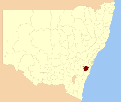
caption = Location in NSW
pop = 40,636Census 2001 AUS|id=LGA18350|name=Wingecarribee (A) (Local Government Area)|accessdate=2007-06-30|quick=on]
area = 2689
est =
seat = Moss Vale (Civic Centre, Elizabeth Street) [cite web
title=Wingecarribee Shire Council
publisher = Department of Local Government
url = http://www.dlg.nsw.gov.au/dlg/dlghome/dlg_CouncilContactDetails.asp?slacode=8350
accessdate = 2006-11-27 ]
mayor = Gordon Lewis
region = Southern Highlands
url = http://www.wsc.nsw.gov.au
stategov = Goulburn (2004 boundaries)
fedgov = Hume, Gilmore
near-nw = Goulburn
near-n = Wollondilly
near-ne = Wollondilly
near-w = Goulburn
near-e = Wollongong
near-sw = Goulburn
near-s = Shoalhaven
near-se = KiamaWingecarribee is a Local Government Area (LGA) southwest of
Sydney named after theWingecarribee River , which flows through it. It is crossed by theHume Highway and the Southern Highlands railway line.The pattern of development is one of small towns and villages. The eastern parts of the Shire are bounded by the
Illawarra escarpment andMorton National Park , with some remnant rainforest and heathland. The north of the Shire is characterised by ruggedeucalypt bushland, with gullies, gorges and sandy soils. This area forms part of the catchment forSydney 's water supply and three major storage dams (Avon, Nepean and Cordeaux). The Wollondilly andWingecarribee River s flow through the west of the Shire, through deep sandstone valleys and much of this area forms part of the catchment forWarragamba Dam . The south of the Shire is bounded by Uringalla Creek and is a sandstone plateaux dissected by deep gorges.The major towns in the Shire are Mittagong, Bowral, Moss Vale and Bundanoon. Villages include: Balmoral Village, Hill Top, Colo Vale, Yerrinbool, Robertson, Burrawang, Burradoo, Berrima, Sutton Forest, Exeter, Wingello, Welby and Penrose.
Wingecarribee Swamp is home to the remaining population of the endangered
Giant dragonfly .References
Wikimedia Foundation. 2010.