- Bowral, New South Wales
Infobox Australian Place | type = town
name = Bowral
state = New South Wales

|300px|thumb
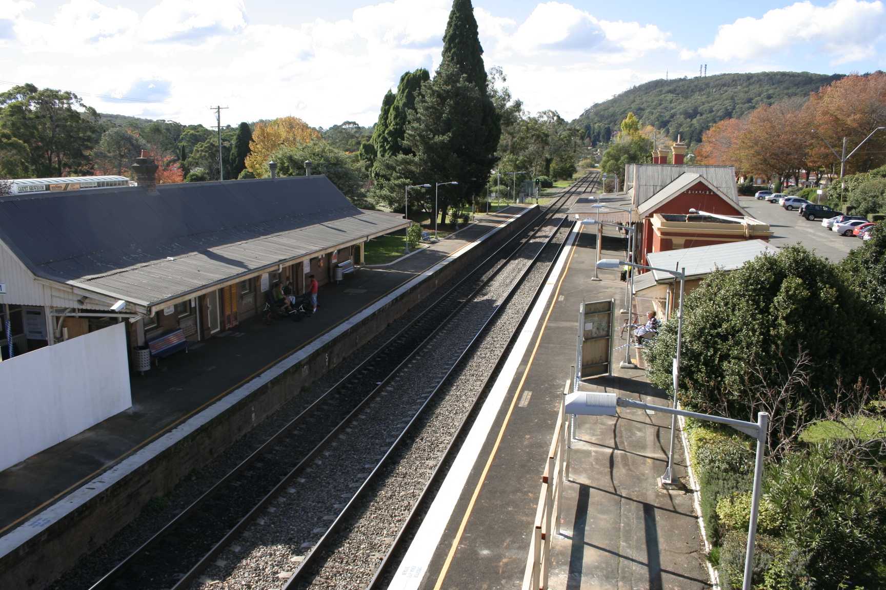
caption = Bowral Railway Station
lga = Wingecarribee Shire
postcode = 2576
est = 1861
region = Southern Highlands
pop = 10,971
pop_footnotes= (2006 census)
elevation= 662
elevation_footnotes=
maxtemp = 18.8
mintemp = 7.7
rainfall = 912.0
stategov = Goulburn
fedgov = Hume
dist1 = 136
dir1 = South West
location1=Sydney
near-n = Mittagong
near-e = East Bowral
near-s = Burradoo
near-w = BerrimaBowral is a town located in the Southern Highlands of
New South Wales ,Australia , in Wingecarribee Shire. It was previously known by the name "Bowrall".Fact|date=July 2007History
Demographics
The population of Bowral is 10,971 (Census 2006) and is growing rapidly. [ [http://www.abs.gov.au/Ausstats/abs@census.nsf/0/2ea464ee91ce51f9ca256c63002c44a5?OpenDocument AusStats : UCL112600 Bowral (Urban Centre/Locality) ] ] This is due in part to the completion of the M5 freeway from
Sydney with links toCanberra .In recent years, Bowral has become a haven for retirees and empty nesters, commonly from Sydney: 14.2% of Bowral's population is aged 55–64 years (compared with the national average of 11.0%) and 26.5% is aged over 64 years (compared with the national average of 13.3%) (2006 Census). [ [http://www.censusdata.abs.gov.au/ABSNavigation/prenav/ProductSelect?newproducttype=QuickStats&btnSelectProduct=View+QuickStats+%3E&collection=census&period=2006&areacode=SSC16441&geography=&method=&productlabel=&producttype=&topic=&navmapdisplayed=true&javascript=true&breadcrumb=LP&topholder=0&leftholder=0¤taction=201&action=401&textversion=true| Statistics of Bowral] ] Notably, Bowral is a town that caters well for the retired demographic, with many retirement villages located only minutes walk from its central business district and hospitals.
Transportation
Bowral is about 5km drive to the
Hume Highway , which goes north to Sydney and south toCanberra , theSnowy Mountains andMelbourne . Also, historically, Bowral is one of the antique towns that is located on the historicalOld Hume Highway . In the past, Bowral served as an overnight stopover for travellers heading to the Snowy Mountains and to Melbourne and Canberra.Bowral has a rail station on
CityRail 's Southern Highlands line which underCityrail services goes toSydney and Goulburn and underCountryLink goes to Canberra and Melbourne.Bowral also has bus charters that go to Nowra, Albion Park and
Wollongong .Attractions
Bowral is perhaps the best known of the towns and villages of the Southern Highlands, and in recent years has become the commercial centre of the Wingecarribee Shire. Bowral is known for its
boutique s, antique stores, gourmet restaurants, richcoffee culture and the historic Springetts' Arcade (established in 1926).Bowral is home to the nationally famed Bradman Museum, which not only celebrates the achievements of Bowral's favourite son, Sir Donald Bradman, but also contains a wealth of world sporting information and memorabilia. Occasionally, the
Australian Cricket Team play a friendly game at the Bradman Oval, which is located adjacent to the museum.Bowral is also the setting for "Tulip Time", a Spring celebration where over 100,000 tulips and 25,000 flowers are planted in the town centre. Held every September and October, Tulip Time has become one of Australia's leading floral festivals. In Spring is also very popular with gardening enthusiasts who come to view some of the world's most beautiful formal gardens designed by landscape luminaries such as
Paul Sorensen , who designed the gardens of "Invergowrie".Bowral lies at the heart of the Southern Highlands BOOKtrail, Australia's first booktown project.
The population swells during winter, when thousands of visitors book into the local hotels and B&Bs to enjoy romantic fires and secluded winter getaways. It is home to the famous resort Craigieburn, previously a homestead dating back to the 1880s, [http://www.craigieburnresort.com.au/profile.htm] and Berida Manor and Milton Park are other famous resort dating back to the 19th century. These resorts have served as retreats for the elite
gentry of Sydney for decades. Notably, many manor houses can be seen throughout Bowral.Bowral is overshadowed by
Mount Gibraltar , which rises to 861m above sea level and has lookouts over Bowral and neighbouring villages and towns such as Mittagong, Moss Vale and the ranges near Bundanoon. Near some of the lookouts are picnic and barbecue areas. The mountain also serves as residential area and bushland reserve.Past & Present Notable Residents of Bowral
*
Arthur Upfield : author of the "Bony" detective novels, lived in Bowral until his death in 1964.
*Craig Reucassel: popular television satirist.
*Sir Donald Bradman: famous Australian batsman.
*Jimmy Barnes : singer and band member of famous Australian BandCold Chisel .
*Peter Garrett : current Minister for Environment, Heritage and the Arts and band member ofMidnight Oil .
*Richard Carleton : journalist and reporter, most notably for 60 Minutes.
*Noeline Brown : journalist, radio presenter and socialite.
*Graham Kennedy : "The King" of Australian Television.
*Ita Buttrose : journalist and businesswoman.
*Bryce Courtenay : South African novelistReferences
External links
* [http://www.wsc.nsw.gov.au/ Wingecaribee Shire Council - Administering and Based in Moss Vale]
* [http://www.thesouthernhighlands.com.au/towns/bowral Information on Bowral and its History]
* [http://www.booktown.com.au/ BookTown Australia]
*
Wikimedia Foundation. 2010.
