- Othonoi
-
Othonoi
ΟθωνοίLocation 
 Othonoi
Coordinates 39°51′N 19°22′E / 39.85°N 19.367°ECoordinates: 39°51′N 19°22′E / 39.85°N 19.367°E Location within the peripheral unit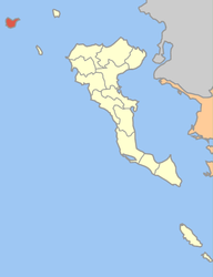
Government Country: Greece Region: Ionian Islands Regional unit: Corfu Municipality: Corfu Population statistics (as of 2001) Municipal unit - Population: 663 - Area: 10.078 km2 (4 sq mi) - Density: 66 /km2 (170 /sq mi) Other Time zone: EET/EEST (UTC+2/3) Elevation: 393 m (1289 ft) Postal: 491 00 Telephone: 26630 Auto: ΚΥ Website www.othonoi.com Othonoi (Greek: Οθωνοί, Italian: Fanò) is an island and a former community of the Ionian Islands, Greece. Since the 2011 local government reform it is part of the municipality Corfu, of which it is a municipal unit.[1] It is located northwest of Corfu. Population 663 (2001). In the 19th century the island used to be the capital of the Diapontia Islands Municipality, which consisted of the islands of Fano, Marlera and Mathrachi. Most of the island's inhabitants can trace their origins to Paxoi Island as people from Paxoi were settled in Fano beginning in the 1570s by Venice. A cave, near the Aspros Ammos (white sands) beach is traditionally believed to have been the place where Calypso kept Ulysses captive.
References
- ^ Kallikratis law Greece Ministry of Interior (Greek)
Ionian Islands Main Islands Smaller islands and islets Antikythera · Antipaxi · Arkoudi · Atokos · Drakonera · Elafonisos · Ereikoussa · Kalamos · Kastos · Kravia · Kythros · Lazaretto · Makri · Makropoula · Mathraki · Meganisi · Modia Islets · Othonoi · Oxeia · Petalas · Pistros · Pontikos · Provati · Skorpios · Sparti Lefkados · Strofades · Vidos · Vromonas ·
Municipal unit of Achilleio Agioi Deka · Agios Prokopios · Ano Garouna · Benitses · Gastouri · Kalafationes · Kamara · Kastellanoi · Kato Garouna · Kouramades · Kynopiastes · Stavros · Varypatades · VirosMunicipal unit of Agios Georgios Afionas · Agios Athanasios · Agros · Arkadades · Armenades · Chorepiskopoi · Dafni · Drosato · Kastelannoi · Kavvadades · Mesaria · Pagoi · RachtadesMunicipal unit of Corfu (city) Municipal unit of Ereikoussa Municipal unit of Esperies Municipal unit of Faiakes Agios Markos · Ano Korakiana · Kato Korakiana · Sgourades · Sokraki · Spartylas · ZygosMunicipal unit of Kassopaia Municipal unit of Korissia Municipal unit of Lefkimmi Municipal unit of Mathraki Municipal unit of Meliteieis Agios Matthaios · Ano Pavliana · Chlomatiana · Chlomos · Kato Pavliana · Moraitika · Pentati · Strongyli · VouniatadesMunicipal unit of Othonoi OthonoiMunicipal unit of Palaiokastritsa Municipal unit of Parelioi Municipal unit of Thinali Categories:- Ionian Islands geography stubs
- Populated places in Corfu (peripheral unit)
- Islands of Greece
- Ionian Islands


Wikimedia Foundation. 2010.