- Marchington
-
Coordinates: 52°52′30″N 1°48′11″W / 52.875°N 1.803°W
Marchington 
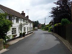
Church Lane in Marchington
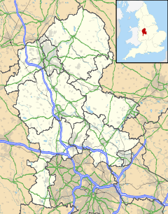
 Marchington shown within Staffordshire
Population 1,127 (Parish) OS grid reference SK132308 Parish Marchington District East Staffordshire Shire county Staffordshire Region West Midlands Country England Sovereign state United Kingdom Post town UTTOXETER Postcode district ST14 Dialling code 01283 Police Staffordshire Fire Staffordshire Ambulance West Midlands EU Parliament West Midlands UK Parliament Burton List of places: UK • England • Staffordshire Marchington is a small village in East Staffordshire, England. It lies between the towns of Burton upon Trent and Uttoxeter. Marchington has a small shop, a first school, two churches and two pubs. The population of the village was 1,127 at the 2001 census.[1]
Contents
History
One of the earliest mentions of this place is in the Domesday book where it is listed amongst the lands given to Henry de Ferrers[2] by the King. The land consisted of four and a half square leagues of woodland and meadow; 40 acres (160,000 m2) of pasture and work for more than seven ploughs. It was worth one hundred shillings.
A railway station on the Crewe to Derby Line opened in 1848 but closed in 1958.
In 1941 a USA army camp was built in Marchington. The vicarage became the headquarters and an officers’ mess was built in Silver Lane. It became a prisoner-of-war camp in 1944 when the soldiers left for the D-Day invasion of Europe. The British army was still using the camp until the 1960s but the land was finally sold in 1980.
Demographics
According to the 2001 census for the parish of Marchington was 1,127, the parish also includes Marchington Woodlands, The parish has 547 males and 580 females.[3] The area's ward (Crown) is over 97% White British with only 55 people from an ethnic minority.[4]
Geography
Geology and topography
Marchington is 270 feet (82 m) above sea level. Marchington lies adjacent to the River Dove which also marks the border between Staffordshire and Derbyshire. there is also a small brook in the village, towards the river dove there is a flood plane and there is Toot Hill to the North West and Hound Hill to the East. The National Forest also lies nearby to the south of the village.
Climate
Climate data for Staffordshire (1971–2000 averages) Month Jan Feb Mar Apr May Jun Jul Aug Sep Oct Nov Dec Year Average high °C (°F) 6.5
(43.7)6.9
(44.4)9.5
(49.1)12
(54)15.7
(60.3)18.4
(65.1)21.1
(70.0)20.8
(69.4)17.5
(63.5)13.5
(56.3)9.5
(49.1)7.5
(45.5)13.3 Average low °C (°F) 1
(34)1
(34)2.5
(36.5)3.5
(38.3)6.2
(43.2)8.9
(48.0)11.1
(52.0)10.9
(51.6)9
(48)6.4
(43.5)3.3
(37.9)1.8
(35.2)5.5 Rainfall mm (inches) 62.7
(2.469)44.4
(1.748)51.2
(2.016)48.5
(1.909)52.7
(2.075)59.3
(2.335)46.7
(1.839)57.7
(2.272)63.6
(2.504)60.5
(2.382)62
(2.44)66.8
(2.63)676
(26.61)Source: [3] Location

Uttoxeter Doveridge Sudbury 
Marchington Woodlands 
Hatton  Marchington

Abbots Bromley Newborough Draycott in the Clay Economy
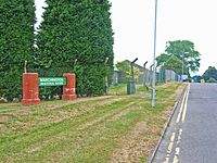
There is a large industrial estate to the south of the village with several businesses. The Industrial Estate previously housed the military's fleet of 'Green Goddess' fire tenders.[5]
Today the majority of the residents work in nearby town such as Uttoxeter and Burton-on-Trent. however some work further afield in Derby, Stoke-on-Trent and Birmingham
Governance
Marchington is the main settlement in Marchington Civil Parish which also includes Birch Cross and Marchington Woodlands
Marchington is part of the Crown ward in East Staffordshire and is represented by the Conservative Robert Hardwick. And the Dove ward in Staffordshire County council and is represented by Bob Fraser who is also Conservative.
Marchington is part of the Burton constituency and is represented by the Conservative Andrew Griffiths. In Europe it is part of the West Midlands constituency and is represented by 6 MEPs.
Transport
Marchington has 2 bus Stops and is served by route 402.
The railway between Stoke-on-Trent and Derby runs to the north of Marchington but Marchington railway station closed in 1958.
The Nearest Railway station is Uttoxeter.
The nearest airports are East Midlands 20 miles (32.2 km) and Birmingham 29 miles (46.7 km).
Culture and recreation
There is a large playing field to the east of the village.
The village is now home to three football clubs once more with the emergence of a new team for the 2011/12 season The Bulls head Marchington FC.
Marchington Keep Fat Club, is a veterans' team, with an average age in the late forties. Based in the Bulls Head,[6] the Marchington KFC[7] play weekly indoor 5-a-side games, as well as outdoor 11-a-side whenever suitable opposition can be found. The team has also enjoyed tours to York, Liverpool and Spain.
Marchington also has a village hall on the square.
Crime
During June 2011 there were 2 reported crimes in the village 1 being other crime and the other being anti-social behaviour,[8] in May 2011 there were 5 reported crimes[9] and in April there were 3.[10] The most common type of crime is anti-social behaviour.
The nearest police station is in Uttoxeter although the Neighbourhood police station is Burton upon Trent, Marchington is part Needwood Neighbourhood Neighbourhood Policing Team which has 7 Police officers and 2 pcsos.[11] The local Police force is Staffordshire Police.
Health
Marchington lies in the South Staffordshire NHS trust area. The village does not have its own doctor's surgery or pharmacy The nearest GP's surgeries can be found in Sudbury and Uttoxeter.[12] The Queens Hospital at Burton Upon Trent is the area's local hospital.[13] It has an Accident and Emergency Department. Out of hours GP services are also based at Queens Hospital, Burton.
Public Services
Waste collection services are provided by East Staffordshire Borough Council. Water services are provided by South Staffordshire Water and sewage services are provided by Severn Trent Water The Distribution Network Operator for electricity is Central Networks better known as E.ON UK.
Marchington uses the Stoke-On-Trent (ST) postcode, there was previously a small sub-post office located inside the Village shop that closed in 2009 The nearest one now is in Uttoxeter, the Postal Town is also Uttoxeter. The nearest Library is located in Uttoxeter.
The nearest police and fire stations are in Uttoxeter. Marchington is part of Staffordshire Police, Staffordshire Fire and Rescue Service and West Midlands Ambulance Service.
Education
Marchington uses the Uttoxeter Middle School system and years 5-8 attend Oldfields Hall Middle School in Uttoxeter and the areas senior school is Thomas Alleyne's High School which is also in Uttoxeter.
The areas Further education colleges are Burton College and Stafford College.
St Peters School
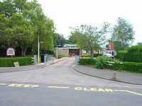
Marchington has a small Primary School called St Peters CE Primay School which is used by children up to the age of 8.
The school was originally added in the mid 1830s . The school was damaged by the RAF Fauld explosion of 1944 when 4,000 tons of stored bombs exploded at nearby Fauld. The school was declared unsafe in 1948 and later demolished. The children were taught in an army hut until a new school was built in 1964.
Religion
According to the 2001 census for the Crown ward 85% are Christian and 14% are non-religious with other making up 1%.[14]
St Peter's Church
Main article: St Peter's Church, MarchingtonSt Peter's is the local Parish Church and is a Brick Building dating from 1742 and is the only church in the parish of Marchington, St Peter.
Methodist chapel
Marchington previously had a Wesleyan Methodist chapel on Bag lane that opened in 1840 and closed in 1970, It is now in Private Residence.
St Thomas A Becket Catholic Church
The Villages Roman Catholic church on Hall road is a small stone building and is part of the Roman Catholic Archdiocese of Birmingham
Media
The local newspapers covering the area are The Uttoxeter Advertiser and The Uttoxeter Post and Times.
Marchington Receives both BBC West Midlands and BBC East Midlands plus ITV Central television. The areas BBC Local radio station is BBC Radio Derby Independent local radio includes Touch, Signal 1 and Capital East Midlands.
References
- ^ 2001 census Staffordshire
- ^ Domesday Book: A Complete Transliteration. London: Penguin, 2003. p.679 656-7 ISBN 0-14-143994-7
- ^ Population for Marchington
- ^ Ethnic Group for Crown Ward
- ^ Exploring Marchington Barracks, Former Royal Army Ordnance Corp & Vehicle Depot
- ^ Bulls Head site
- ^ Marchington FC, accessed 28 September 2010
- ^ Street-level crime and ASB in June 2011
- ^ [1]
- ^ [2]
- ^ Needwood Neighbourhood Neighbourhood Policing Team
- ^ NHS Surgeries Near Marchington
- ^ NHS find your nearest Hospital
- ^ Religion (UV15)
External links
 Media related to Marchington at Wikimedia CommonsCategories:
- Villages in Staffordshire
- East Staffordshire
Wikimedia Foundation. 2010.


