- Draycott in the Clay
-
Coordinates: 52°51′14″N 1°46′12″W / 52.854°N 1.770°W
Draycott in the Clay 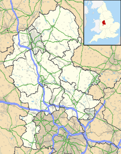
 Draycott in the Clay
Draycott in the Clay shown within StaffordshirePopulation 891 (2001) OS grid reference SK15551 Parish Draycott in the Clay District East Staffordshire Shire county Staffordshire Region West Midlands Country England Sovereign state United Kingdom Post town Burton-Upon-Trent Postcode district DE13 Dialling code 01283 Police Staffordshire Fire Staffordshire Ambulance West Midlands EU Parliament West Midlands UK Parliament Burton List of places: UK • England • Staffordshire Draycott in the Clay is a village in Staffordshire between Uttoxeter and Burton Upon Trent it has two churches a village shop/Post Office, two public houses, one school and a play area. The village is dominated by the A515 which runs through it. to the south of the village is The National Forest and to the north is a traction engine park.
The local Village website is at http://www.draycottintheclay.com/
Categories:- Villages in Staffordshire
- East Staffordshire
- Staffordshire geography stubs

Wikimedia Foundation. 2010.