Marchington River (Ontario)

Marchington River (Ontario)
Marchington River
River
Country Canada
Province Ontario
Region Northwestern Ontario
Districts Kenora, Thunder Bay
Part of Hudson Bay drainage basin
Tributaries
 - left Houghton Creek, Drive Creek, Sturgeon River, Martin Creek
 - right North River, Runway Creek
Source Kashaweogama Lake
 - elevation 390 m (1,280 ft)
 - coordinates 50°23′58″N 90°52′11″W / 50.39944°N 90.86972°W / 50.39944; -90.86972
Mouth Abram Lake
 - elevation 357 m (1,171 ft)
 - coordinates 50°05′47″N 91°48′14″W / 50.09639°N 91.80389°W / 50.09639; -91.80389
Length 118 km (73 mi)
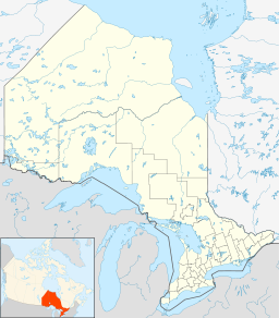
Location of the mouth of the Marchington River in Ontario

The Marchington River is a river in the Hudson Bay drainage basin located in Kenora and Thunder Bay Districts in northwestern Ontario, Canada. It travels 78 kilometres (48 mi) from its head at Kashaweogama Lake in Thunder Bay District through a series of lakes to Marchington Lake, where it meets the Sturgeon River and North River. It then continues 30 kilometres (19 mi) over the small McDougall Falls and through Botsford Lake before emptying into the English River at Abram Lake near Sioux Lookout.

Highway 516 crosses the river approximately 6.5 km (4.0 mi) north of its confluence with Marchington Lake. Highway 642 and the CN transcontinental rail line cross the river about 4 km (2.5 mi) and 2 km (1.2 mi) respectively upstream of the mouth, near Superior Junction.

Tributaries

References


Wikimedia Foundation. 2010.

Игры ⚽ Поможем решить контрольную работу

Look at other dictionaries:

  • Marchington Lake (Ontario) — Marchington Lake Location Kenora District, Ontario Coordinates 50°11′17″N 91°24′24″W …   Wikipedia

  • North River (Ontario) — For other places with the same name, see North River (disambiguation). North River may refer to one of five rivers in Ontario, Canada: North River in Kenora District, in the Hudson Bay drainage basin, which flows into Marchington Lake on the… …   Wikipedia

  • Sturgeon River (Marchington River) — Infobox River river name = Sturgeon River image size = caption = origin = Sturgeon Lake mouth = Marchington Lake basin countries = length = convert|38.5|km|mi|1 elevation = mouth elevation = convert|362|m|ft|0|abbr=on discharge = watershed = The… …   Wikipedia

  • Ontario Highway 516 — Highway 516 Route information Maintained by the Ministry of Transportation of Ontario Length: 103.8 km …   Wikipedia

  • Abram Lake (Kenora District, Ontario) — Infobox lake lake name = Abram Lake image lake = caption lake = image bathymetry = caption bathymetry= location = Kenora District, Ontario coords = coord|50|03|26|N|91|55|55|W|region:CA ON type:waterbody|display=inline,title type = inflow =… …   Wikipedia

  • Sturgeon River — may refer to: In Canada *Sturgeon River (Alberta) in Alberta *Sturgeon River (Manitoba) in northern Manitoba and Ontario *Sturgeon River (Saskatchewan) a tributary of the North Saskatchewan River which flows into it a short distance west of… …   Wikipedia

  • Drive Creek (Ontario) — Coordinates: 50°20′50″N 91°08′58″W / 50.34722°N 91.14944°W / 50.34722; 91.14944 …   Wikipedia

  • McDougall Mills, Ontario — Coordinates: 50°10′06″N 91°32′43″W / 50.16833°N 91.54528°W / 50.16833; 91.54528 …   Wikipedia

  • Kashaweogama Lake (Ontario) — Infobox lake lake name = Kashaweogama Lake image lake = caption lake = image bathymetry = caption bathymetry= location = Thunder Bay District, Ontario coords = coord|50|25|N|90|46|W|region:CA ON type:waterbody|display=inline,title type = inflow …   Wikipedia

  • List of Ontario rivers — This is the list of rivers which are situated in and flow through Ontario. The watershed list includes tributaries as well.List of rivers arranged by watershedHudson Bay watershedIn order of drainage into Hudson Bay from west to east: *Echoing… …   Wikipedia

Share the article and excerpts

Direct link
Do a right-click on the link above
and select “Copy Link”