McDougall Mills, Ontario

McDougall Mills, Ontario
McDougall Mills
Settlement
Country Canada
Province Ontario
Region Northwestern Ontario
District Kenora
Part Kenora, Unorganized
Elevation 370 m (1,214 ft)
Coordinates 50°10′06″N 91°32′43″W / 50.16833°N 91.54528°W / 50.16833; -91.54528
Timezone Central Time Zone (UTC-6)
 - summer (DST) Central Time Zone (UTC-5)
Postal code FSA P0T
Area code 807
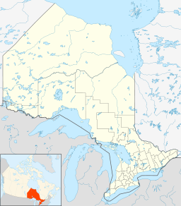
Location of McDougall Mills in Ontario

McDougall Mills is an unincorporated place on the Marchington River between Botsford Lake and the McDougall Falls downstream and Marchington Lake upstream in Unorganized Kenora District in northwestern Ontario, Canada.[1]

It lies on the Canadian National Railway transcontinental main line,[2] between Rosnel to the west and Ghost River to the east, and is passed but not served by Via Rail transcontinental Canadian trains.

References


Wikimedia Foundation. 2010.

Игры ⚽ Поможем решить контрольную работу

Look at other dictionaries:

  • Ontario general election, 1987 — 1985 ← September 10, 1987 → 1990 …   Wikipedia

  • Ontario Highway 400 — Highway 400 Toronto–Barrie Highway …   Wikipedia

  • Ontario New Democratic Party candidates, 2007 Ontario provincial election — The New Democratic Party of Ontario is one of three major political parties in Ontario, Canada which ran in the 2007 Ontario provincial election. It has served as a third party in the Legislative Assembly of Ontario since 1995, having previously… …   Wikipedia

  • Ontario general election, 1985 — Diagram of the 1985 election results in the Provincial Legislature The Ontario general election of 1985 was held on May 2, 1985, to elect members of the 33rd Legislative Assembly of the Province of Ontario, Canada. This election ended 42 years of …   Wikipedia

  • Ontario general election, 2007 (results) — Main article: Ontario general election, 2007 The Ontario general election, 2007 took place on Wednesday, October 10, 2007. The list of candidates was finalized by Elections Ontario on September 19, 2007. Contents 1 Candidates by party 2… …   Wikipedia

  • Marchington Lake (Ontario) — Marchington Lake Location Kenora District, Ontario Coordinates 50°11′17″N 91°24′24″W …   Wikipedia

  • List of census subdivisions in Ontario — The following is a list of census subdivisions in the Canadian province of Ontario. NOTOC A B C D E F G H I J K L M N O P Q R S T U V W X Y Z*Key **C = City **R = First Nations Reserve **S E = Indian Settlement **T = Town **TP = Township **UNO =… …   Wikipedia

  • List of communities in Ontario — Communities in the province of Ontario, Canada Note: this is an incomplete list of communities, not necessarily organized municipalities. For organized municipalities see list of municipalities in Ontario and for census subdivisions see list of… …   Wikipedia

  • Parry Sound District, Ontario — Infobox Settlement official name = Parry Sound District other name = native name = nickname = settlement type = District motto = imagesize = image caption = flag size = image seal size = image shield = shield size = city logo = citylogo size =… …   Wikipedia

  • List of municipalities in Ontario — There are currently 444 municipalities in the province of Ontario.[1][2] In Ontario the term municipality refers to various forms of local government (including cities, counties, regional municipalities, towns, townships, villages, and… …   Wikipedia

Share the article and excerpts

Direct link
Do a right-click on the link above
and select “Copy Link”