- Florida State Road 414
-
State Road 414

Route information Maintained by FDOT Length: 6.526 mi[1] (10.503 km) Major junctions West end: 
 US 441 / SR 500 near Lockhart
 SR 434 near Altamonte Springs

 I-4 / SR 400 in Maitland
East end: 

 US 17 / US 92 / SR 600 in Maitland
Highway system Florida State and County Roads
Interstate • US • SR (Pre-1945) • Toll • County←  SR 410
SR 415  →
→←  SR 426
426A SR 427  →
→State Road 414 (SR 414), named Maitland Boulevard, is a state highway in the U.S. state of Florida.
Contents
Route description
Free Section
The free section is built to expressway standards, with no driveway access, at-grade intersections at minor roads, and interchanges at major roads. The road was once numbered State Road 426A. From east to west, the road begins and travels through Maitland, Florida, briefly travels through Seminole County, Florida and the city of Altamonte Springs before ending at U.S. Highway 441 in Lockhart, Florida in Orange County, Florida. The road previously ended here prior to the opening of the toll road section further west.
Toll Road Section
An extension to the west has been built around the south side of Apopka and back to U.S. Highway 441 (SR 500) via State Road 429. Originally known as the Apopka Bypass, this project is now the John Land Apopka Expressway or Maitland Boulevard Extension, a tollway owned and operated by the Orlando-Orange County Expressway Authority. It was named after Apopka mayor John Land in December 2005.[2]
Phase 1 of the toll road section runs from U.S. Highway 441 west to State Road 429 (Western Beltway) south of Apopka. Ground broke on the project on January 19, 2007 at the southeast corner of SR 414 and US 441. Construction ran way ahead of schedule and the roadway from Exit 4 to Exit 8 was opened on February 14, 2009 for vehicles with SunPass and E-Pass transponders. Exit 6 was not included in the early opening. The entire road opened for all vehicles on May 15, 2009. On signage, the eastbound control city is Maitland and the westbound control city is Apopka.
Some of the additions and modifications in Phase 1 include:
- The entire toll road is elevated.
- The intersection of SR 414 and US 441 was shifted slightly southward and turned into a grade-separated half-folded diamond interchange. SR 414 passes over US 441. The 7-11 at the southeast corner of the interchange was demolished to accomplish this.
- The Florida Central Railroad bridge over US 441 just to the north of the intersection with State Road 414 was demolished during June 2007. Railroad tracks that had continued east to Forest City, Florida were removed. This location is the site of westbound exit and entrance ramps with US 441.
- Apopka Blvd. (CR 424) was broken where SR 414 passes through. Before construction, Apopka Blvd. ran parallel to US 441 to its west, but 20 feet (6.1 m) above US 441's grade. The north side was diverted to end at US 441 at SR 414's new westbound off ramps, with a cul-de-sac sticking out briefly to the south. The south side simply ends in a cul-de-sac.
- SR 414 is six lanes, three in each direction over the entire currently constructed distance.
- A SPUI interchange was constructed at Hiawassee Road, with SR 414 passing to the south of the recently opened Wekiva High School (Orange County Public Schools). SR 414 is four lanes, two in each direction, from this point to the west.
- A westbound off-ramp to, and an eastbound on-ramp from Keene Road has been built.
- Coral Hills Road, a side-street to the west of Clarcona Road (CR 435), was closed where SR 414 passes through and ends in cul-de-sacs on both sides. This is the location of the only mainline toll plaza in Phase 1 of SR 414.
- The mainline toll is $1.00 and was not impacted by recent Orlando-Orange County Expressway Authority toll increases.
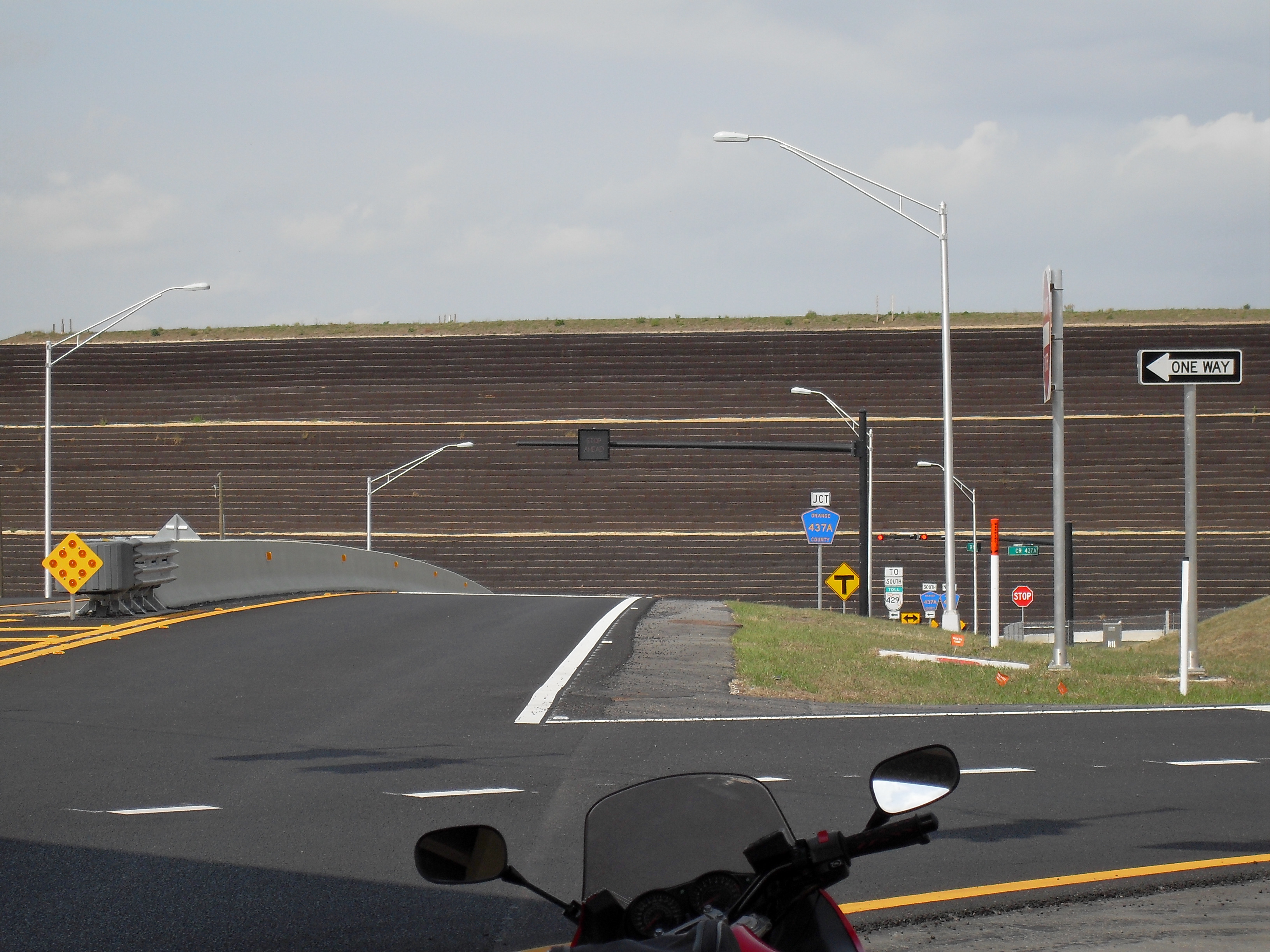
- Continuing west, State Road 414 currently ends at the interchange at SR 429. There is a direct ramp to northbound State Road 429. Traffic desiring to go southbound on State Road 429 must exit onto Orange County Road 437A (Ocoee-Apopka Road) and travel one-quarter mile to the State Road 429 on-ramp. Southbound traffic on State Road 429 desiring to travel eastbound on State Road 414 has a direct ramp however northbound traffic on State Road 429 desiring to travel eastbound on State Road 414 must also exit onto CR 437A.
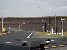 This wall is at the hill on SR 414 westbound before Ocoee-Apopka Road
Phase 2
Construction on Phase 2 began with earth movement during June 2010 at the current western terminus. Once completed, the Phase 2 section will be concurrently signed as both SR 414 and SR 429 and will continue west and then north to a SPUI interchange a quarter mile north of Plymouth-Sorrento Road at U.S. Route 441. A surface road will be built at that location to connect between US 441 and Plymouth-Sorrento Road. This new road will pass over the right-of-way of SR 414/429, which will be further extended to the north in the future. What was SR 429 north of the current SR 414 junction will be resigned as State Road 451.
Plans for further extension, eventually to meet Interstate 4 in Sanford, are part of a corridor known as the Wekiva Parkway.
Exit list
County Location Mile # Destinations Notes 4  SR 429 (Western Expressway) – Apopka, Tampa / Ocoee-Apopka Road
westbound exit direct to SR 429 northbound; eastbound entrance direct from SR 429 southbound. Other traffic must use Ocoee-Apopka Road. Mainline Toll Plaza ($1.00 cars) 6 Keene Road westbound exit and eastbound entrance only; ramp toll $.50 8 Hiawassee Road westbound exit and eastbound entrance ramp toll $.25 9 Orange Blossom TrailRose Avenue / Bear Lake Road Eastern terminus References
- ^ FDOT GIS data
- ^ New expressway to be named after Apopka Mayor John Land, December 8, 2005
External links
Expressways in Greater Orlando Orlando-Orange County Expressway Authority
SR 408 · SR 414 · SR 417 · SR 429 · SR 451 · SR 528 · Goldenrod Road Extension · SR 529† · Xpress 400†
† = planned, never builtFlorida's Turnpike Enterprise
Florida's Turnpike · SR 417 · SR 429 · SR 528Other agencies
Interstate 4 · Osceola Parkway · SR 407Categories:- State highways in Florida
- State Roads in Orange County, Florida
- Expressways in Orange County, Florida
- State Roads in Seminole County, Florida


Wikimedia Foundation. 2010.