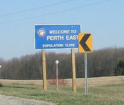
- Perth East, Ontario
-
Perth East — Township — Coordinates: 43°28′N 80°57′W / 43.467°N 80.95°WCoordinates: 43°28′N 80°57′W / 43.467°N 80.95°W Country  Canada
Province  Ontario
County Perth Settled Formed January 1, 1998 Government - Mayor Ian Forrest - Federal riding Perth—Wellington - Prov. riding Perth—Wellington Area[1] - Land 715.07 km2 (276.1 sq mi) Population (2006)[1] - Total 12,041 - Density 16.8/km2 (43.5/sq mi) Time zone EST (UTC-5) - Summer (DST) EDT (UTC-4) Postal Code N0K Area code(s) 519 and 226 Website www.pertheast.on.ca The Township of Perth East is municipality located in Perth County, Ontario, Canada and situated north of Stratford.
Milverton is the major community of the township, where the municipal administration is based. The mayor is Ian Forrest, who was elected in November, 2006.
Perth East was created in 1998 after the Ontario government imposed amalgamation on many local governments throughout the province. The village of Milverton was combined with the surrounding former townships of Ellice, Mornington, North Easthope and South Easthope.
The population in 2006 was 12,041 in an area of 715.07 km².
Contents
Settlements
- Amulree
- Brocksden
- Brunner
- Burns
- Carthage
- Dorking
- Fernbank
- Gads Hill
- Hesson
- Kinkora
- Kuhryville
- Mennonite Corner
- Millbank
- Milverton
- Moserville
- Newton
- Peffers
- Poole
- Ratzburg
- Rostock
- Sebastopol
- Topping
- Tralee
- Wartburg
Demographics
Population trend:[2]
- Population in 2006: 12,041 (2001 to 2006 population change: -0.6 %)
- Population in 2001: 12,218 (or 12,119 when adjusted for 2006 boundaries)
- Population in 1996: 12,089
Private dwellings occupied by usual residents: 3885 (total dwellings: 4004)
References
- ^ a b "Perth East community profile". 2006 Census data. Statistics Canada. http://www12.statcan.gc.ca/census-recensement/2006/dp-pd/prof/92-591/details/page.cfm?Lang=E&Geo1=CSD&Code1=3531030&Geo2=PR&Code2=35&Data=Count&SearchText=Perth%20East&SearchType=Begins&SearchPR=01&B1=All&Custom=. Retrieved 2011-01-31.
- ^ Statistics Canada: 1996, 2001, 2006 census
- "Topographic Map sheets 40P6, 40P7, 40P10 & 40P11". Atlas of Canada. Natural Resources Canada. 2006-02-06. http://atlas.nrcan.gc.ca/site/english/maps/topo/map/. Retrieved 2008-12-21.
- "Map/Directions". Township of Perth East. http://www.pertheast.on.ca/Templates/workingfiledirections.html. Retrieved 2008-12-21.
External links

North Perth Mapleton 
West Perth 
Wellesley
Wilmot Perth East

Perth South, Stratford, Zorra East Zorra-Tavistock Independent North Perth Atwood • Britton • Donegal • Gowanstown • Kurtzville • Listowel • Monkton • Newry • Teviotdale • Trowbridge • WallacePerth East Amulree • Brunner • Dorking • Milverton • Millbank • Newton • Gads Hill • Poole • Rostock • Shakespeare • WartburgPerth South West Perth Roads Perth County RoadsCategories:- Municipalities in Perth County, Ontario
- Township municipalities in Ontario
- Western Ontario geography stubs
Wikimedia Foundation. 2010.


