- North Carolina Highway 6
-
"NC 6" redirects here. NC 6 may also refer to North Carolina's 6th congressional district.
NC 6
Route information Maintained by NCDOT Length: 8.20 mi[2] (13.20 km) Existed: 1959[1] – 2005[1] Major junctions West end: 
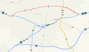
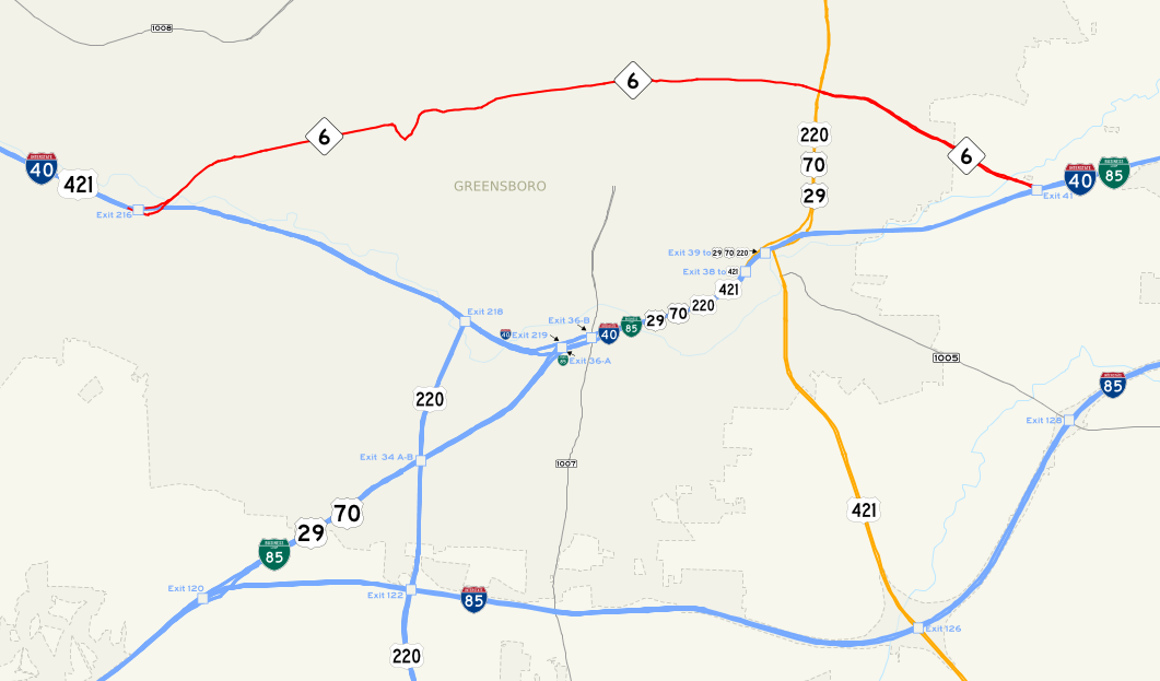
 I-40 / US 421 in west Greensboro

 US 29 / US 70 / US 220 southeast of downtown Greensboro
East end:  I-40/Bus I-85 in east Greensboro, NC
Location Counties: Guilford Highway system ←  NC 5
NC 5NC 7  →
→NC 6 was an eight-mile (13 km) North Carolina state highway. It ran entirely in Guilford County and served primarily to connect I-40 and Business I-85 commuters in Greensboro. It was decommissioned in 2005.
Contents
Route description
The western terminus of NC 6 was at I-40 in west Greensboro. From there, NC 6 traveled at 45 mph (72 km/h) as Patterson Street to Patterson's only traffic signal at Holden Road and then at 35 mph (56 km/h) to Patterson's end at the Greensboro Coliseum. NC 6 then turned left and followed High Point Road onto Lee Street. NC 6 had an important intersection with O'Henry Boulevard (US 29/US 70/US 220) where it picked up a lot of traffic between the US Highways and I-40 east of Greensboro, its eastern terminus.
History
- 1934: NC 6 is commissioned as a short road located southwest of Lake Mattamuskeet in Hyde County.
- 1944: NC 6 is decommissioned and not replaced.
- 1947: A new NC 6 cuts off the corner between NC 49 and U.S. Route 52 in Stanly County. It replaced NC 49A.
- 1953: NC 8 is extended, moving NC 6.
- 1959: After moving to its current location, a couple of timely shifts allowed NC 6 to follow its current route.
- 2000s: Recent changes have slightly altered the path of NC 6 around the I-40 interchange and the Greensboro Coliseum.[1]
- 2005: NC 6 decommissioned permanently, signs not taken down till around May 2009.[1] As of October 2010, Google Maps still shows NC 6.[2]
Major intersections
The entire route is in Greensboro, Guilford County.
Mile Destinations Notes 0.00 I-40 / US 421Western terminus of NC 6 6.20 US 29 / US 70 / US 2208.20 I-40 / I-85 Bus.Eastern terminus of NC 6 1.000 mi = 1.609 km; 1.000 km = 0.621 mi See also
- Greensboro Bypass
- Death Valley (North Carolina)
References
- ^ a b c d NCRoads Annex - NC 6
- ^ a b Google Maps. Overview Map of Former North Carolina Route 6 (Map). http://maps.google.com/maps?f=d&source=s_d&saddr=Exit+216&daddr=Patterson+St+to:E+Lee+St+to:36.05185,-79.734786&hl=en&geocode=FT4OJgIdXEc9-w%3BFZgwJgIdiuc9-w%3BFeNIJgIdS9g--w%3B&mra=mi&mrcr=2&mrsp=3&sz=15&sll=36.051215,-79.735894&sspn=0.015509,0.027595&ie=UTF8&ll=36.051285,-79.735894&spn=0.015371,0.027595&t=p&z=15. Retrieved 2010-01-27.
External links
Categories:- State highways in North Carolina

Wikimedia Foundation. 2010.